TopoQuest Logo
Do you find TopoQuest useful?
Help keep TopoQuest running and adding new maps/features by donating!
Bitcoin:  19c7KJd3qBynnjoSw5npx9KScwjBe4ifkT
Litecoin:  LXs6TkuXGGXo1vDsWCkWVdjQX94eUKd6ui
Home View Maps Find Maps Find Places Resources & Links


Pennington Gap, Virginia Topographic Map

USGS Map Title: Pennington Gap, VA
USGS Map MRC: 36083G1
DRG (GeoTIFF) Download: o36083g1.tif


Neighboring USGS Topographic Map Quads:


  Nolansburg, KY  
36083H2
 

  Louellen, KY  
36083H1
 

  Benham, KY  
36082H8
 

  Evarts, KY  
36083G2
 

  Pennington Gap, VA  
36083G1
 

  Keokee, VA  
36082G8
 

  Hubbard Springs, VA  
36083F2
 

  Ben Hur, VA  
36083F1
 

  Stickleyville, VA  
36082F8


Map MRC Location:

N37°
W84°
N37°
W83°
H8 H7 H6 H5 H4 H3 H2 H1
G8 G7 G6 G5 G4 G3 G2 G1
F8 F7 F6 F5 F4 F3 F2 F1
E8 E7 E6 E5 E4 E3 E2 E1
D8 D7 D6 D5 D4 D3 D2 D1
C8 C7 C6 C5 C4 C3 C2 C1
B8 B7 B6 B5 B4 B3 B2 B1
A8 A7 A6 A5 A4 A3 A2 A1
N36°
W84°
N36°
W83°

Pennington Gap, VA USGS 1:24K Topographic Map Preview:
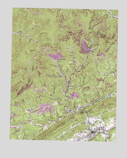
Pennington Gap, VA USGS Topographic Map
Click on map above to begin viewing in our Map Viewer.

This topographic map contains these locations and features:
Feature Name Type Latitude Longitude GNIS ID View Map
Baileys TraceLocaleN36.8034°W83.0566°1481399View Map
Baker CemeteryCemeteryN36.7942°W83.0927°1481405View Map
Beech Hill ChurchChurchN36.7540°W83.0277°1481594View Map
Belcher ChapelChurchN36.7676°W83.0396°1481603View Map
Belgium BranchStreamN36.7631°W83.0849°1481607View Map
Belgium School (historical)SchoolN36.7626°W83.0854°1496492View Map
BenedictPopulated PlaceN36.8431°W83.0299°1496800View Map
Benedict BranchStreamN36.8354°W83.0313°1496493View Map
Bergen BranchStreamN36.7651°W83.1104°1481642View Map
Big BranchStreamN36.7926°W83.0741°1481698View Map
Big BranchStreamN36.8009°W83.0582°1481699View Map
Bills CreekStreamN36.8506°W83.1168°487312View Map
Bobs BranchStreamN36.7781°W83.0493°1481897View Map
Bondurant (historical)Populated PlaceN36.8193°W83.0449°1496494View Map
Bonny BluePopulated PlaceN36.8270°W83.0682°1481930View Map
Bowman HollowValleyN36.7623°W83.1105°1481955View Map
Bubby BranchStreamN36.7956°W83.0813°1496496View Map
Burhart ChapelChurchN36.8154°W83.0027°1482169View Map
Cane CreekStreamN36.7595°W83.0135°1482301View Map
Childs GapGapN36.8674°W83.0578°2565663View Map
Cloud BranchStreamN36.8443°W83.0932°489698View Map
Cooper HollowValleyN36.7929°W83.0743°1482698View Map
Crusenberry HollowValleyN36.7686°W83.0739°1482865View Map
DarbyvillePopulated PlaceN36.8304°W83.0524°1496870View Map
Deirth HollowValleyN36.8042°W83.0383°1482974View Map
DizneyPopulated PlaceN36.8529°W83.1166°490935View Map
Dizney Post Office (historical)Post OfficeN36.8480°W83.1049°2565605View Map
DominionPopulated PlaceN36.8109°W83.0713°1496875View Map
Dry BranchStreamN36.7573°W83.0091°1483108View Map
Ely CreekStreamN36.7687°W83.0996°1483296View Map
Fawn BranchStreamN36.8118°W83.0618°1483386View Map
First Baptist ChurchChurchN36.7595°W83.0260°1496513View Map
First Christian ChurchChurchN36.7565°W83.0313°1496514View Map
First Methodist ChurchChurchN36.7593°W83.0254°1496516View Map
Gin CreekStreamN36.8173°W83.0485°1483645View Map
Hanging RockPillarN36.8443°W83.0129°1483924View Map
Holmes MillPopulated PlaceN36.8684°W83.0024°508269View Map
Holmes Mill (historical)LocaleN36.8678°W83.0024°2565675View Map
Hoover RockPillarN36.7854°W83.0091°1484207View Map
Imperial (historical)Populated PlaceN36.8418°W83.0207°1496528View Map
John Paces Store (historical)LocaleN36.8490°W83.1068°2565692View Map
Lady BranchStreamN36.7709°W83.0666°1484641View Map
Lee (historical)Populated PlaceN36.8256°W83.0721°1496537View Map
Lee County Rescue Squad Pennington Gap UnitBuildingN36.7602°W83.0302°2086176View Map
Leeman FieldParkN36.7690°W83.0285°1496543View Map
Leona Mines (historical)Populated PlaceN36.8384°W83.0241°1496544View Map
Lick BranchStreamN36.7895°W83.0702°1484802View Map
Little Black MountainSummitN36.8409°W83.0749°496627View Map
Lone MountainSummitN36.8198°W83.0354°1496996View Map
ManessPopulated PlaceN36.7823°W83.0577°1497004View Map
MayflowerPopulated PlaceN36.8298°W83.0807°1497011View Map
Meadow BranchStreamN36.7890°W83.0574°1485325View Map
Meadow ForkStreamN36.8123°W83.0038°1485338View Map
Meadow Fork ChurchChurchN36.8140°W83.0096°1485339View Map
Meadow Fork School (historical)SchoolN36.8148°W83.0054°1496549View Map
Middleton DamDamN36.7584°W83.1166°1490246View Map
Middleton LakeReservoirN36.7585°W83.1165°1490247View Map
Miller CoveValleyN36.8341°W83.0338°1485466View Map
MonarchPopulated PlaceN36.8354°W83.0310°1497021View Map
Myers CemeteryCemeteryN36.7529°W83.0488°1485784View Map
Napier CemeteryCemeteryN36.7634°W83.1185°1485789View Map
Negro Head RockPillarN36.7768°W83.0346°1485818View Map
Panther BranchStreamN36.7679°W83.0732°1486049View Map
Parsons CemeteryCemeteryN36.7676°W83.0020°1486074View Map
Penn LeePopulated PlaceN36.7898°W83.0566°1497084View Map
Pennington CemeteryCemeteryN36.7673°W83.0993°1486134View Map
Pennington CemeteryCemeteryN36.7720°W83.0346°1486135View Map
Pennington GapGapN36.7776°W83.0332°1486136View Map
Pennington GapPopulated PlaceN36.7584°W83.0271°1486137View Map
Pennington Gap Police DepartmentBuildingN36.7590°W83.0282°2767050View Map
Pennington Gap Post OfficePost OfficeN36.7573°W83.0291°2766487View Map
Pennington Gap Volunteer Fire Department Station 1BuildingN36.7588°W83.0244°2086178View Map
Pennington Middle SchoolSchoolN36.7632°W83.0162°1496554View Map
Pennington StationLocaleN36.7579°W83.0263°1496555View Map
Pine Grove ChurchChurchN36.7773°W83.1013°1486210View Map
Pine Grove School (historical)SchoolN36.7765°W83.1007°1496556View Map
Pine Knob Lookout TowerTowerN36.7709°W83.0502°1491216View Map
PocketPopulated PlaceN36.7815°W83.0427°1497099View Map
Poor ValleyBasinN36.7712°W83.0321°1486341View Map
Potts BranchStreamN36.8204°W83.0682°1486388View Map
Puckett CreekStreamN36.7815°W83.0577°1486437View Map
Puckett School (historical)SchoolN36.7995°W83.0818°1496560View Map
River Bend Shopping CenterLocaleN36.7634°W83.0149°1496562View Map
Rockhouse CreekStreamN36.8698°W83.0068°502189View Map
Rocklick BranchStreamN36.7904°W83.0191°1486719View Map
Rocklick ChurchChurchN36.7873°W83.0260°1486720View Map
Rocklick School (historical)SchoolN36.7870°W83.0271°1496564View Map
Rocky Station District (historical)CivilN36.7637°W83.0127°1927476View Map
Saint CharlesPopulated PlaceN36.8018°W83.0574°1497128View Map
Saint Charles Elementary SchoolSchoolN36.8039°W83.0574°1496567View Map
Saint Charles Post OfficePost OfficeN36.8052°W83.0568°2766494View Map
Saint Charles Volunteer Fire DepartmentBuildingN36.8039°W83.0579°2086180View Map
Saint Pious Catholic ChurchChurchN36.7515°W83.0443°1496568View Map
Sandick BranchStreamN36.7848°W83.0318°1486930View Map
Short Store (historical)LocaleN36.8678°W83.0013°2565810View Map
Stone BranchStreamN36.7543°W83.1068°1487593View Map
Stone CreekStreamN36.7770°W83.0560°1487597View Map
Stone CreekPopulated PlaceN36.7765°W83.0568°1497165View Map
Straight CreekStreamN36.7770°W83.0513°1487652View Map
Stretchneck BranchStreamN36.8509°W83.1138°504580View Map
Summers CreekStreamN36.8143°W83.0060°1487728View Map
The PocketAreaN36.8070°W83.0554°1496559View Map
Town of Pennington GapCivilN36.7595°W83.0295°2391356View Map
Town of Saint CharlesCivilN36.8051°W83.0574°2391423View Map
Turner CemeteryCemeteryN36.7726°W83.0238°1488037View Map
Turner CreekStreamN36.8495°W83.1071°505662View Map
Turners SidingPopulated PlaceN36.8179°W83.0488°1497184View Map
Whiteoak BranchStreamN36.8456°W83.1013°506661View Map
Wolf BranchStreamN36.7681°W83.0746°1488434View Map
Wolf Harbor BranchStreamN36.7937°W83.0096°1488447View Map
WSWV-AM (Pennington Gap)TowerN36.7568°W83.0152°1502529View Map

Note: Coordinates in the location and feature list above are referenced to NAD83 datum.


Copyright (C) 2008-2024 Ryan Niemi / Sunset Dynamics ... All Rights Reserved