TopoQuest Logo
Do you find TopoQuest useful?
Help keep TopoQuest running and adding new maps/features by donating!
Bitcoin:  19c7KJd3qBynnjoSw5npx9KScwjBe4ifkT
Litecoin:  LXs6TkuXGGXo1vDsWCkWVdjQX94eUKd6ui
Home View Maps Find Maps Find Places Resources & Links


Keokee, Virginia Topographic Map

USGS Map Title: Keokee, VA
USGS Map MRC: 36082G8
DRG (GeoTIFF) Download: o36082g8.tif


Neighboring USGS Topographic Map Quads:


  Louellen, KY  
36083H1
 

  Benham, KY  
36082H8
 

  Appalachia, VA  
36082H7
 

  Pennington Gap, VA  
36083G1
 

  Keokee, VA  
36082G8
 

  Big Stone Gap, VA  
36082G7
 

  Ben Hur, VA  
36083F1
 

  Stickleyville, VA  
36082F8
 

  Duffield, VA  
36082F7


Map MRC Location:

N37°
W83°
N37°
W82°
H8 H7 H6 H5 H4 H3 H2 H1
G8 G7 G6 G5 G4 G3 G2 G1
F8 F7 F6 F5 F4 F3 F2 F1
E8 E7 E6 E5 E4 E3 E2 E1
D8 D7 D6 D5 D4 D3 D2 D1
C8 C7 C6 C5 C4 C3 C2 C1
B8 B7 B6 B5 B4 B3 B2 B1
A8 A7 A6 A5 A4 A3 A2 A1
N36°
W83°
N36°
W82°

Keokee, VA USGS 1:24K Topographic Map Preview:
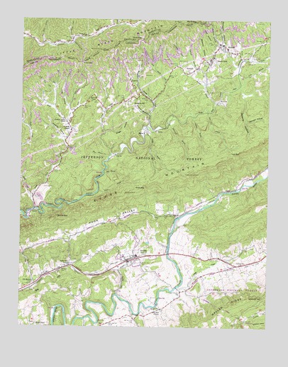
Keokee, VA USGS Topographic Map
Click on map above to begin viewing in our Map Viewer.

This topographic map contains these locations and features:
Feature Name Type Latitude Longitude GNIS ID View Map
Allen HollowValleyN36.8374°W82.9753°1481286View Map
Anderson CemeteryCemeteryN36.8067°W82.9888°1481309View Map
Baker CemeteryCemeteryN36.7790°W82.8929°1481404View Map
Bear BranchStreamN36.8187°W82.9554°1481505View Map
Big HillSummitN36.7659°W82.9863°1495267View Map
Big Stone Gap 6GapN36.8626°W82.9591°487278View Map
Boggs HollowValleyN36.8293°W82.9577°1481905View Map
Buckles (historical)Populated PlaceN36.8159°W82.9574°1496498View Map
BundyPopulated PlaceN36.8298°W82.9310°1495334View Map
Bundy CreekStreamN36.8315°W82.9366°1482165View Map
Calvary ChurchChurchN36.7762°W82.8860°1482234View Map
CalvinPopulated PlaceN36.8520°W82.9416°1495343View Map
Camp CreekStreamN36.7662°W82.9196°1482254View Map
Carroll HollowValleyN36.8538°W82.9075°1482337View Map
Cave Springs CampgroundLocaleN36.8020°W82.9221°1488800View Map
Clear Spring BranchStreamN36.7634°W82.9504°1482567View Map
Colliers CoveValleyN36.8557°W82.9195°1482651View Map
Cox CreekStreamN36.8201°W82.9543°1482774View Map
Craborchard CreekStreamN36.8484°W82.8891°1482788View Map
Craft HollowValleyN36.8619°W82.9026°1482798View Map
Dalton GapGapN36.7943°W82.9774°1482902View Map
Darnell TownPopulated PlaceN36.8645°W82.8999°1495454View Map
Darty GapGapN36.8676°W82.9374°490602View Map
De Busk FordCrossingN36.7604°W82.9452°1496502View Map
DelvalePopulated PlaceN36.8198°W82.9521°1495464View Map
District 4CivilN36.7519°W82.9076°1927244View Map
District 5CivilN36.8128°W82.9985°1927265View Map
Dry School (historical)SchoolN36.7679°W82.9921°1496505View Map
DrydenPopulated PlaceN36.7776°W82.9416°1483150View Map
Dryden Census Designated PlaceCensusN36.7764°W82.9433°2389417View Map
Dryden Elementary SchoolSchoolN36.7790°W82.9411°1496506View Map
Dryden Post OfficePost OfficeN36.7797°W82.9190°2766453View Map
Dryden Volunteer Fire DepartmentBuildingN36.7780°W82.9419°2086172View Map
Eden CemeteryCemeteryN36.8576°W82.9199°1483237View Map
ElyPopulated PlaceN36.7693°W82.9896°1496510View Map
Ely CemeteryCemeteryN36.7612°W82.9329°1483294View Map
Ely CreekStreamN36.7670°W82.9921°1483295View Map
Ely Memorial ChurchChurchN36.7679°W82.9921°1483297View Map
Flanary BranchStreamN36.8359°W82.9129°1483432View Map
Garrison HollowValleyN36.8342°W82.8865°1483594View Map
Green Hill ChurchChurchN36.7559°W82.9285°1483801View Map
Green Hill School (historical)SchoolN36.7570°W82.9279°1496521View Map
Haupts BranchStreamN36.8708°W82.9609°2565650View Map
Heads CreekStreamN36.8676°W82.9729°493976View Map
Holmes HollowValleyN36.8368°W82.9355°1484164View Map
Holmes House (historical)LocaleN36.8683°W82.9739°2565674View Map
Holmes School (historical)SchoolN36.8415°W82.9485°1496522View Map
Hoover ChapelChurchN36.8429°W82.9618°1484204View Map
Huff CreekStreamN36.8726°W82.9524°494734View Map
Hughes CemeteryCemeteryN36.7670°W82.9971°1484269View Map
Jack Bailey BranchStreamN36.8668°W82.9946°2565685View Map
Johnsons Mill (historical)Populated PlaceN36.8331°W82.9257°1496531View Map
Jones CreekStreamN36.8026°W82.9943°1484497View Map
Jordon BranchStreamN36.8418°W82.9021°1484514View Map
KeokeePopulated PlaceN36.8590°W82.9041°1495785View Map
Keokee Census Designated PlaceCensusN36.8622°W82.9162°2389998View Map
Keokee Elementary SchoolSchoolN36.8653°W82.8988°1496535View Map
Keokee Post OfficePost OfficeN36.8651°W82.8981°2766466View Map
Keokee Volunteer Fire RescueBuildingN36.8633°W82.8959°2086174View Map
Keokee Volunteer Rescue SquadBuildingN36.8633°W82.8959°2086175View Map
Laurel BranchStreamN36.8051°W82.9604°1484672View Map
Lick BranchStreamN36.8256°W82.9788°1496545View Map
Little Bundy CreekStreamN36.8415°W82.9335°1484875View Map
Lovelady GapGapN36.7626°W82.8766°1485098View Map
Low GapGapN36.8206°W82.8932°1485106View Map
Low Gap BranchStreamN36.8381°W82.9054°1485110View Map
Lower Trace BranchStreamN36.8656°W82.9735°497302View Map
Marcum BranchStreamN36.8682°W82.9658°2565750View Map
Marcum HollowValleyN36.8657°W82.9006°1485185View Map
McConnell BranchStreamN36.8331°W82.9266°1485267View Map
McConnell HollowValleyN36.8660°W82.8985°1485272View Map
Meadow BranchStreamN36.8490°W82.9074°1485326View Map
Med Short BranchStreamN36.8654°W82.9893°498017View Map
Mill Branch (historical)Populated PlaceN36.8123°W82.9579°1496550View Map
Mohawk (historical)Populated PlaceN36.8495°W82.8888°1496552View Map
Mohawk School (historical)SchoolN36.8556°W82.8768°1496553View Map
Moore BranchStreamN36.8593°W82.8888°1485534View Map
Morris GapGapN36.8743°W82.9107°498620View Map
Mud CreekStreamN36.8329°W82.9768°1485715View Map
NewtownPopulated PlaceN36.8415°W82.9010°1496005View Map
Olinger Lookout TowerTowerN36.8118°W82.9171°1491210View Map
Parsons HollowValleyN36.8260°W82.9779°1486076View Map
Payne BranchStreamN36.8270°W82.9377°1486097View Map
Peters CemeteryCemeteryN36.7531°W82.8860°1486161View Map
Poor Valley CreekStreamN36.7948°W82.9199°1486344View Map
PughsPopulated PlaceN36.7512°W82.9916°1496119View Map
PurcellPopulated PlaceN36.7962°W82.9949°1496120View Map
RawhidePopulated PlaceN36.8556°W82.9110°1496130View Map
Reeds CreekStreamN36.7979°W82.9929°1486561View Map
Right Fork Jones CreekStreamN36.8368°W82.9749°1496561View Map
Right Fork Mud CreekStreamN36.8393°W82.9832°1486611View Map
Robbins (historical)Populated PlaceN36.8037°W82.9624°1496563View Map
Robbins ChapelChurchN36.8298°W82.9749°1486666View Map
Robbins Chapel SchoolSchoolN36.8343°W82.9788°1486667View Map
Roberts HollowValleyN36.8449°W82.8875°1486676View Map
Scott GapGapN36.8065°W82.9418°1486978View Map
Shepherd HillPopulated PlaceN36.8431°W82.9443°1496216View Map
SigmaPopulated PlaceN36.8301°W82.9366°1496225View Map
Stallard FordCrossingN36.7798°W82.9252°1496573View Map
Stone Mountain WildernessReserveN36.8193°W82.9224°2767384View Map
Trace GapGapN36.8579°W82.9685°505449View Map
Valley View ChurchChurchN36.7756°W82.9743°1488098View Map
Wells BranchStreamN36.8484°W82.8896°1488225View Map
Whisman HollowValleyN36.8568°W82.9054°1488277View Map
Willis ChapelChurchN36.7506°W82.9910°1488401View Map
Yokum Station District (historical)CivilN36.8059°W82.8913°1927578View Map

Note: Coordinates in the location and feature list above are referenced to NAD83 datum.


Copyright (C) 2008-2024 Ryan Niemi / Sunset Dynamics ... All Rights Reserved