TopoQuest Logo
Do you find TopoQuest useful?
Help keep TopoQuest running and adding new maps/features by donating!
Bitcoin:  19c7KJd3qBynnjoSw5npx9KScwjBe4ifkT
Litecoin:  LXs6TkuXGGXo1vDsWCkWVdjQX94eUKd6ui
Home View Maps Find Maps Find Places Resources & Links


Peoria, Kansas Topographic Map

USGS Map Title: Peoria, KS
USGS Map MRC: 38095E2
DRG (GeoTIFF) Download: o38095e2.tif


Neighboring USGS Topographic Map Quads:


  Ottawa North, KS  
38095F3
 

  Le Loup, KS  
38095F2
 

  Wellsville, KS  
38095F1
 

  Ottawa South, KS  
38095E3
 

  Peoria, KS  
38095E2
 

  Rantoul, KS  
38095E1
 

  Richmond, KS  
38095D3
 

  Garnett NW, KS  
38095D2
 

  Lane, KS  
38095D1


Map MRC Location:

N39°
W96°
N39°
W95°
H8 H7 H6 H5 H4 H3 H2 H1
G8 G7 G6 G5 G4 G3 G2 G1
F8 F7 F6 F5 F4 F3 F2 F1
E8 E7 E6 E5 E4 E3 E2 E1
D8 D7 D6 D5 D4 D3 D2 D1
C8 C7 C6 C5 C4 C3 C2 C1
B8 B7 B6 B5 B4 B3 B2 B1
A8 A7 A6 A5 A4 A3 A2 A1
N38°
W96°
N38°
W95°

Peoria, KS USGS 1:24K Topographic Map Preview:
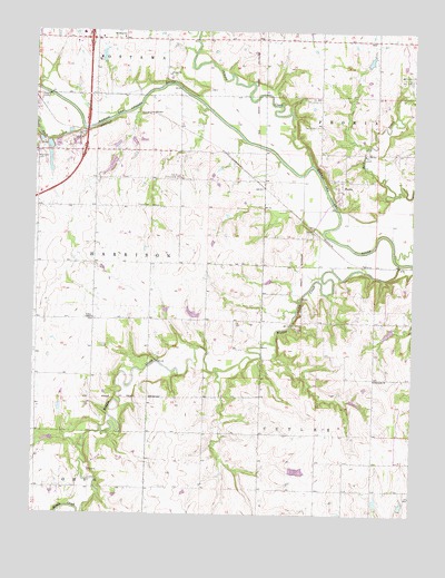
Peoria, KS USGS Topographic Map
Click on map above to begin viewing in our Map Viewer.

This topographic map contains these locations and features:
Feature Name Type Latitude Longitude GNIS ID View Map
Community Revival Center ChurchChurchN38.5830°W95.2486°2689809View Map
Cross Pointe Community ChurchChurchN38.5971°W95.2323°2688639View Map
Elm Grove Community HallBuildingN38.5870°W95.2025°479684View Map
Fouts CemeteryCemeteryN38.5798°W95.2168°479683View Map
Franklin County Convention and Visitors BureauBuildingN38.6237°W95.2417°2692642View Map
Harrod AirportAirportN38.5614°W95.2103°2675719View Map
Hawkins School (historical)SchoolN38.6236°W95.2216°479676View Map
Highland Farm AirportAirportN38.5430°W95.1557°2651040View Map
ImesPopulated PlaceN38.5736°W95.1583°484945View Map
Kingdom Hall of Jehovah's WitnessesChurchN38.6237°W95.2274°2688725View Map
Larimore (historical)LocaleN38.5833°W95.1655°481926View Map
Lincoln - Ottawa - Harrison Fire DistrictBuildingN38.5501°W95.2310°2695534View Map
Mears ParkParkN38.6058°W95.1608°479677View Map
Middle CreekStreamN38.5650°W95.1297°479673View Map
Ottawa CreekStreamN38.5906°W95.1591°479356View Map
PeoriaPopulated PlaceN38.5847°W95.1489°479682View Map
Peoria (historical)LocaleN38.5847°W95.1461°481972View Map
Peoria CemeteryCemeteryN38.6005°W95.1571°479685View Map
Rock CreekStreamN38.5995°W95.2344°479678View Map
Ruhamah Baptist ChurchChurchN38.5352°W95.1374°479680View Map
Township of CutlerCivilN38.5180°W95.1327°479687View Map
Township of HarrisonCivilN38.5652°W95.2180°479679View Map
Union Chapel United Methodist ChurchChurchN38.5501°W95.2310°479681View Map

Note: Coordinates in the location and feature list above are referenced to NAD83 datum.


Copyright (C) 2008-2025 Ryan Niemi / Sunset Dynamics ... All Rights Reserved