TopoQuest Logo
Do you find TopoQuest useful?
Help keep TopoQuest running and adding new maps/features by donating!
Bitcoin:  19c7KJd3qBynnjoSw5npx9KScwjBe4ifkT
Litecoin:  LXs6TkuXGGXo1vDsWCkWVdjQX94eUKd6ui
Home View Maps Find Maps Find Places Resources & Links


Richmond, Kansas Topographic Map

USGS Map Title: Richmond, KS
USGS Map MRC: 38095D3
DRG (GeoTIFF) Download: o38095d3.tif


Neighboring USGS Topographic Map Quads:


  Pomona, KS  
38095E4
 

  Ottawa South, KS  
38095E3
 

  Peoria, KS  
38095E2
 

  Williamsburg, KS  
38095D4
 

  Richmond, KS  
38095D3
 

  Garnett NW, KS  
38095D2
 

  Harris, KS  
38095C4
 

  Garnett West, KS  
38095C3
 

  Garnett East, KS  
38095C2


Map MRC Location:

N39°
W96°
N39°
W95°
H8 H7 H6 H5 H4 H3 H2 H1
G8 G7 G6 G5 G4 G3 G2 G1
F8 F7 F6 F5 F4 F3 F2 F1
E8 E7 E6 E5 E4 E3 E2 E1
D8 D7 D6 D5 D4 D3 D2 D1
C8 C7 C6 C5 C4 C3 C2 C1
B8 B7 B6 B5 B4 B3 B2 B1
A8 A7 A6 A5 A4 A3 A2 A1
N38°
W96°
N38°
W95°

Richmond, KS USGS 1:24K Topographic Map Preview:
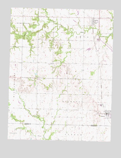
Richmond, KS USGS Topographic Map
Click on map above to begin viewing in our Map Viewer.

This topographic map contains these locations and features:
Feature Name Type Latitude Longitude GNIS ID View Map
Beachner Grain Elevator Number 13LocaleN38.4007°W95.2563°2695120View Map
Central Community HallBuildingN38.4481°W95.3230°477585View Map
City of PrincetonCivilN38.4877°W95.2706°2396282View Map
City of RichmondCivilN38.4013°W95.2535°2396369View Map
Middletown (historical)LocaleN38.4917°W95.3608°482497View Map
Mount Olivet ChurchChurchN38.4481°W95.3608°477584View Map
Ohio Township Fire DepartmentBuildingN38.4883°W95.2664°2111678View Map
Old Channel Sac CreekChannelN38.3792°W95.3314°477582View Map
Payne CreekStreamN38.4875°W95.3239°479643View Map
PrincetonPopulated PlaceN38.4889°W95.2753°477586View Map
Princeton Christian ChurchChurchN38.4909°W95.2760°2689838View Map
Princeton Mobile Home ParkPopulated PlaceN38.4887°W95.2700°2694143View Map
Princeton Municipal Water Treatment FacilityLocaleN38.4820°W95.2793°2691889View Map
Princeton Post OfficePost OfficeN38.4885°W95.2751°2693930View Map
Princeton United Methodist ChurchChurchN38.4880°W95.2720°2689530View Map
RichmondPopulated PlaceN38.4028°W95.2539°484355View Map
Richmond Consolidated Fire District 1BuildingN38.4014°W95.2544°2111777View Map
Richmond Consolidated Fire District 2BuildingN38.4001°W95.2552°2111778View Map
Richmond Police DepartmentBuildingN38.4014°W95.2554°2504175View Map
Richmond Post OfficePost OfficeN38.4014°W95.2554°2693944View Map
Richmond Public LibraryBuildingN38.4014°W95.2559°2694671View Map
Richmond United Methodist ChurchChurchN38.4019°W95.2542°2690232View Map
Richmond Wastewater PlantLocaleN38.4098°W95.2623°2691930View Map
Township of OhioCivilN38.4778°W95.2828°479686View Map
Township of RichmondCivilN38.4149°W95.2589°477588View Map

Note: Coordinates in the location and feature list above are referenced to NAD83 datum.


Copyright (C) 2008-2025 Ryan Niemi / Sunset Dynamics ... All Rights Reserved