TopoQuest Logo
Do you find TopoQuest useful?
Help keep TopoQuest running and adding new maps/features by donating!
Bitcoin:  19c7KJd3qBynnjoSw5npx9KScwjBe4ifkT
Litecoin:  LXs6TkuXGGXo1vDsWCkWVdjQX94eUKd6ui
Home View Maps Find Maps Find Places Resources & Links


Perry, Florida Topographic Map

USGS Map Title: Perry, FL
USGS Map MRC: 30083A5
DRG (GeoTIFF) Download: o30083a5.tif


Neighboring USGS Topographic Map Quads:


  Secotan, FL  
30083B6
 

  Boyd, FL  
30083B5
 

  Day NW, FL  
30083B4
 

  Hampton Springs, FL  
30083A6
 

  Perry, FL  
30083A5
 

  Fenholloway, FL  
30083A4
 

  Okefenokee Slough, FL  
29083H6
 

  Warrior Swamp, FL  
29083H5
 

  Salem, FL  
29083H4


Map MRC Location:

N31°
W84°
N31°
W83°
H8 H7 H6 H5 H4 H3 H2 H1
G8 G7 G6 G5 G4 G3 G2 G1
F8 F7 F6 F5 F4 F3 F2 F1
E8 E7 E6 E5 E4 E3 E2 E1
D8 D7 D6 D5 D4 D3 D2 D1
C8 C7 C6 C5 C4 C3 C2 C1
B8 B7 B6 B5 B4 B3 B2 B1
A8 A7 A6 A5 A4 A3 A2 A1
N30°
W84°
N30°
W83°

Perry, FL USGS 1:24K Topographic Map Preview:
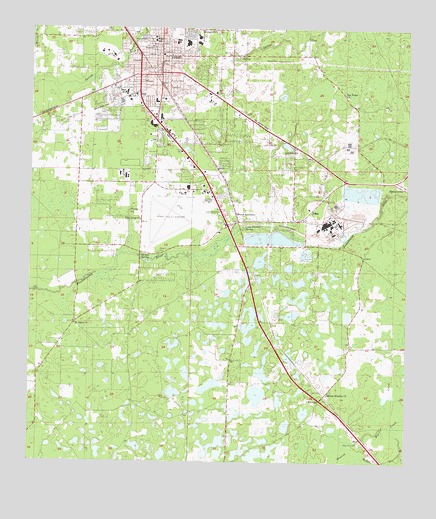
Perry, FL USGS Topographic Map
Click on map above to begin viewing in our Map Viewer.

This topographic map contains these locations and features:
Feature Name Type Latitude Longitude GNIS ID View Map
Antioch Baptist ChurchChurchN30.1074°W83.5883°2451854View Map
Atlantic Camp Ground SpringSpringN30.0677°W83.5535°304967View Map
Bucell JunctionPopulated PlaceN30.0697°W83.5557°295159View Map
Calvary Baptist ChurchChurchN30.0849°W83.6102°2451856View Map
Carlton CemeteryCemeteryN30.0608°W83.5821°280042View Map
Carlton SpringSpringN30.0583°W83.5871°280045View Map
Catholic Church of the Immaculate Conception Parish CenterChurchN30.0868°W83.5702°2451857View Map
Church of God of ProphecyChurchN30.1119°W83.5864°2451859View Map
City of PerryCivilN30.1092°W83.5820°2404505View Map
City of Perry Wastewater Treatment FacilityLocaleN30.1127°W83.5978°2451842View Map
Doctors Memorial HospitalHospitalN30.1202°W83.5932°298956View Map
Everetts Mobile Home ParkPopulated PlaceN30.0759°W83.5682°2451850View Map
Faulkner CemeteryCemeteryN30.1160°W83.5432°282396View Map
Fenholloway StationBuildingN30.0799°W83.5029°300838View Map
First Presbyterian ChurchChurchN30.1007°W83.5601°2451860View Map
First United Methodist ChurchChurchN30.1193°W83.5823°2451861View Map
FoleyPopulated PlaceN30.0694°W83.5307°282642View Map
Foley JunctionBuildingN30.0824°W83.5199°302710View Map
Foley StationBuildingN30.0894°W83.5321°300839View Map
Forest Capital Museum State ParkParkN30.0863°W83.5454°300840View Map
Kinsey CemeteryCemeteryN30.1163°W83.5438°285136View Map
Lakeside ChurchChurchN30.0897°W83.5354°285304View Map
Mount Zion Missionary Baptist ChurchChurchN30.1173°W83.5732°2451863View Map
New Home Baptist ChurchChurchN30.1116°W83.5787°2451864View Map
New Hope CemeteryCemeteryN30.0058°W83.5149°287623View Map
PerryPopulated PlaceN30.1174°W83.5818°288724View Map
Perry Army Air Field (historical)MilitaryN30.0694°W83.5803°2093984View Map
Perry Elementary SchoolSchoolN30.1210°W83.5765°299410View Map
Perry Fire DepartmentBuildingN30.1158°W83.5819°2644147View Map
Perry PlazaLocaleN30.0999°W83.5835°295912View Map
Perry Police DepartmentBuildingN30.1159°W83.5815°2333108View Map
Perry Police DepartmentBuildingN30.1161°W83.5814°2333145View Map
Perry Post OfficePost OfficeN30.1048°W83.5810°2451846View Map
Perry Primary SchoolSchoolN30.1225°W83.5699°299413View Map
Perry SquareLocaleN30.0988°W83.5832°295911View Map
Perry-Foley AirportAirportN30.0773°W83.5748°309825View Map
Pimple CreekStreamN30.1152°W83.5943°288818View Map
Pine Level ChurchChurchN30.0697°W83.5882°288899View Map
Pineview Memorial GardensCemeteryN30.1238°W83.5763°299036View Map
PinlandPopulated PlaceN30.0180°W83.5279°295546View Map
Purity ChurchChurchN30.0727°W83.5918°289386View Map
Restoration Faith Center ChurchChurchN30.1110°W83.5910°2451865View Map
Saint Johns ChurchChurchN30.0397°W83.6099°290221View Map
Saint Peter Primitive Baptist ChurchChurchN30.1052°W83.5870°2451866View Map
San Carlos Golf CourseLocaleN30.0523°W83.6121°2451845View Map
San Pedro ChurchChurchN30.1063°W83.5210°290497View Map
Spring Hill CemeteryCemeteryN30.1180°W83.5574°291537View Map
Spring Warrior ChurchChurchN30.0197°W83.5254°291568View Map
Springhill ChurchChurchN30.1244°W83.5688°291581View Map
Stewart Memorial African Methodist Episcopal ChurchChurchN30.1110°W83.5910°2451868View Map
Taylor CountyCivilN30.0196°W83.6190°295728View Map
Taylor County Area Education CenterSchoolN30.0974°W83.5846°299409View Map
Taylor County Fire and RescueBuildingN30.0775°W83.5751°2644199View Map
Taylor County Historical SocietyBuildingN30.1181°W83.5814°2451843View Map
Taylor County Junior High SchoolSchoolN30.1191°W83.5713°299412View Map
Taylor County Public LibraryBuildingN30.1190°W83.5816°299035View Map
Taylor County Sheriff's OfficeBuildingN30.1103°W83.5738°2756076View Map
Taylor County Sheriff's OfficeBuildingN30.1175°W83.5817°2333141View Map
Taylor Square Shopping CenterLocaleN30.1030°W83.5901°295913View Map
Triumph ChurchChurchN30.1117°W83.5919°2451869View Map
Wesleyan ChurchChurchN30.1107°W83.5809°2451870View Map
West District Fire AuthorityBuildingN30.1173°W83.6168°2644581View Map
Westgate Mobile Home ParkPopulated PlaceN30.1033°W83.5882°2451851View Map
WGKR-AM (Perry)TowerN30.1119°W83.5674°308846View Map
Wilcox CemeteryCemeteryN30.1213°W83.5874°293279View Map
WNFK-FM (Perry)TowerN30.1119°W83.5674°309104View Map
WPRY-AM (Perry)TowerN30.1119°W83.5674°308849View Map

Note: Coordinates in the location and feature list above are referenced to NAD83 datum.


Copyright (C) 2008-2024 Ryan Niemi / Sunset Dynamics ... All Rights Reserved