TopoQuest Logo
Do you find TopoQuest useful?
Help keep TopoQuest running and adding new maps/features by donating!
Bitcoin:  19c7KJd3qBynnjoSw5npx9KScwjBe4ifkT
Litecoin:  LXs6TkuXGGXo1vDsWCkWVdjQX94eUKd6ui
Home View Maps Find Maps Find Places Resources & Links


Warrior Swamp, Florida Topographic Map

USGS Map Title: Warrior Swamp, FL
USGS Map MRC: 29083H5
DRG (GeoTIFF) Download: o29083h5.tif


Neighboring USGS Topographic Map Quads:


  Hampton Springs, FL  
30083A6
 

  Perry, FL  
30083A5
 

  Fenholloway, FL  
30083A4
 

  Okefenokee Slough, FL  
29083H6
 

  Warrior Swamp, FL  
29083H5
 

  Salem, FL  
29083H4


  Keaton Beach, FL  
29083G5
 

  Salem SW, FL  
29083G4


Map MRC Location:

N30°
W84°
N30°
W83°
H8 H7 H6 H5 H4 H3 H2 H1
G8 G7 G6 G5 G4 G3 G2 G1
F8 F7 F6 F5 F4 F3 F2 F1
E8 E7 E6 E5 E4 E3 E2 E1
D8 D7 D6 D5 D4 D3 D2 D1
C8 C7 C6 C5 C4 C3 C2 C1
B8 B7 B6 B5 B4 B3 B2 B1
A8 A7 A6 A5 A4 A3 A2 A1
N29°
W84°
N29°
W83°

Warrior Swamp, FL USGS 1:24K Topographic Map Preview:
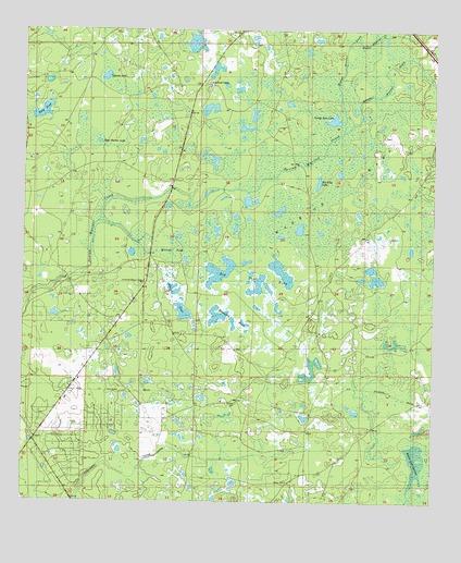
Warrior Swamp, FL USGS Topographic Map
Click on map above to begin viewing in our Map Viewer.

This topographic map contains these locations and features:
Feature Name Type Latitude Longitude GNIS ID View Map
Adams PondLakeN29.9285°W83.5775°277684View Map
Athena Warrior CreekStreamN29.9730°W83.5276°277978View Map
Bear Harbor LakeLakeN29.9706°W83.6021°278319View Map
Big Lilly LakeLakeN29.9600°W83.5350°278705View Map
Big Trail PondSwampN29.9347°W83.5576°278763View Map
Bird PondLakeN29.9784°W83.6192°278833View Map
Clearwater CreekStreamN29.8752°W83.6101°280547View Map
Cypress LakeLakeN29.9877°W83.6003°281224View Map
Ezell AirportAirportN29.9070°W83.6072°309548View Map
George Ann LakeLakeN29.9765°W83.5307°283025View Map
Huxford CampLocaleN29.9855°W83.5688°284441View Map
Huxford Lookout TowerTowerN29.9330°W83.5879°284442View Map
Little Saint John ChurchChurchN29.9841°W83.5690°300844View Map
Melvina PondLakeN29.9420°W83.5791°286698View Map
Middle Warrior CreekStreamN29.9974°W83.5238°286818View Map
Perry South DivisionCivilN29.8957°W83.5440°1935896View Map
Rosemary PondSwampN29.9233°W83.5604°289973View Map
Sandhill CemeteryCemeteryN29.9013°W83.5593°290606View Map
Sealey CemeteryCemeteryN29.8802°W83.5438°290795View Map
Taylor County Fire and Rescue Station 6BuildingN29.8821°W83.6148°2644358View Map
Warrior SwampSwampN29.9751°W83.5285°292898View Map
Weaver Warrior CreekStreamN29.9733°W83.5276°292969View Map
White Oak SwampLakeN29.8864°W83.5047°293217View Map

Note: Coordinates in the location and feature list above are referenced to NAD83 datum.


Copyright (C) 2008-2024 Ryan Niemi / Sunset Dynamics ... All Rights Reserved