TopoQuest Logo
Do you find TopoQuest useful?
Help keep TopoQuest running and adding new maps/features by donating!
Bitcoin:  19c7KJd3qBynnjoSw5npx9KScwjBe4ifkT
Litecoin:  LXs6TkuXGGXo1vDsWCkWVdjQX94eUKd6ui
Home View Maps Find Maps Find Places Resources & Links


Perth, Kansas Topographic Map

USGS Map Title: Perth, KS
USGS Map MRC: 37097B5
DRG (GeoTIFF) Download: o37097b5.tif


Neighboring USGS Topographic Map Quads:


  Milan, KS  
37097C6
 

  Mayfield, KS  
37097C5
 

  Wellington, KS  
37097C4
 

  Caldwell NW, KS  
37097B6
 

  Perth, KS  
37097B5
 

  Rome, KS  
37097B4
 

  Doster, KS  
37097A6
 

  Caldwell, KS  
37097A5
 

  South Haven, KS  
37097A4


Map MRC Location:

N38°
W98°
N38°
W97°
H8 H7 H6 H5 H4 H3 H2 H1
G8 G7 G6 G5 G4 G3 G2 G1
F8 F7 F6 F5 F4 F3 F2 F1
E8 E7 E6 E5 E4 E3 E2 E1
D8 D7 D6 D5 D4 D3 D2 D1
C8 C7 C6 C5 C4 C3 C2 C1
B8 B7 B6 B5 B4 B3 B2 B1
A8 A7 A6 A5 A4 A3 A2 A1
N37°
W98°
N37°
W97°

Perth, KS USGS 1:24K Topographic Map Preview:
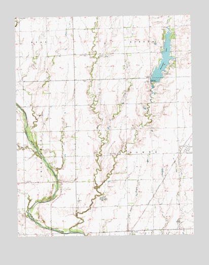
Perth, KS USGS Topographic Map
Click on map above to begin viewing in our Map Viewer.

This topographic map contains these locations and features:
Feature Name Type Latitude Longitude GNIS ID View Map
Bethany CemeteryCemeteryN37.1721°W97.5008°470304View Map
Camp Loga VistaLocaleN37.2128°W97.5306°470302View Map
Chikaskia (historical)LocaleN37.1689°W97.6101°482643View Map
Chikaskia CemeteryCemeteryN37.2134°W97.5749°470301View Map
Chikaskia CemeteryCemeteryN37.1561°W97.6190°470308View Map
CorbinPopulated PlaceN37.1264°W97.5439°470307View Map
East Prairie CreekStreamN37.1514°W97.5856°470312View Map
Jordan CreekStreamN37.1725°W97.6101°470309View Map
Long CreekStreamN37.1778°W97.5637°470303View Map
Orie (historical)LocaleN37.2000°W97.6003°482644View Map
PerthPopulated PlaceN37.1747°W97.5053°470305View Map
Prairie CreekStreamN37.1275°W97.5887°470311View Map
Sacred Heart CemeteryCemeteryN37.1714°W97.5601°470306View Map
Sumner County Fire District 5 CaldwellBuildingN37.1254°W97.5441°2111917View Map
Township of DownsCivilN37.1701°W97.5293°470320View Map
Union Chapel CemeteryCemeteryN37.2279°W97.5743°470300View Map
Wellington City DamDamN37.2117°W97.5287°479971View Map
Wellington City ParkParkN37.2111°W97.5275°481126View Map
Wellington LakeReservoirN37.2183°W97.5227°479972View Map
West Prairie CreekStreamN37.1522°W97.5687°470310View Map
Wood CemeteryCemeteryN37.2494°W97.6225°470299View Map

Note: Coordinates in the location and feature list above are referenced to NAD83 datum.


Copyright (C) 2008-2025 Ryan Niemi / Sunset Dynamics ... All Rights Reserved