TopoQuest Logo
Do you find TopoQuest useful?
Help keep TopoQuest running and adding new maps/features by donating!
Bitcoin:  19c7KJd3qBynnjoSw5npx9KScwjBe4ifkT
Litecoin:  LXs6TkuXGGXo1vDsWCkWVdjQX94eUKd6ui
Home View Maps Find Maps Find Places Resources & Links


Caldwell, Kansas Topographic Map

USGS Map Title: Caldwell, KS
USGS Map MRC: 37097A5
DRG (GeoTIFF) Download: o37097a5.tif


Neighboring USGS Topographic Map Quads:


  Caldwell NW, KS  
37097B6
 

  Perth, KS  
37097B5
 

  Rome, KS  
37097B4
 

  Doster, KS  
37097A6
 

  Caldwell, KS  
37097A5
 

  South Haven, KS  
37097A4
 

  Renfrow, OK  
36097H6
 

  Medford NE, OK  
36097H5
 

  Blackwell NW, OK  
36097H4


Map MRC Location:

N38°
W98°
N38°
W97°
H8 H7 H6 H5 H4 H3 H2 H1
G8 G7 G6 G5 G4 G3 G2 G1
F8 F7 F6 F5 F4 F3 F2 F1
E8 E7 E6 E5 E4 E3 E2 E1
D8 D7 D6 D5 D4 D3 D2 D1
C8 C7 C6 C5 C4 C3 C2 C1
B8 B7 B6 B5 B4 B3 B2 B1
A8 A7 A6 A5 A4 A3 A2 A1
N37°
W98°
N37°
W97°

Caldwell, KS USGS 1:24K Topographic Map Preview:
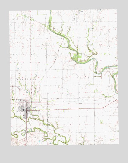
Caldwell, KS USGS Topographic Map
Click on map above to begin viewing in our Map Viewer.

This topographic map contains these locations and features:
Feature Name Type Latitude Longitude GNIS ID View Map
Alton CemeteryCemeteryN37.0041°W97.5279°470091View Map
Assembly of God ChurchChurchN37.0377°W97.6079°2689295View Map
Border Queen MuseumBuildingN37.0320°W97.6158°2694292View Map
CaldwellPopulated PlaceN37.0322°W97.6070°470089View Map
Caldwell CemeteryCemeteryN37.0541°W97.6149°470088View Map
Caldwell Elementary SchoolSchoolN37.0326°W97.6104°2497363View Map
Caldwell Fire DepartmentBuildingN37.0328°W97.6077°2111165View Map
Caldwell High SchoolSchoolN37.0336°W97.6103°2497469View Map
Caldwell Middle / High SchoolSchoolN37.0332°W97.6104°2497331View Map
Caldwell Municipal AirportAirportN37.0347°W97.5855°470090View Map
Caldwell Police DepartmentBuildingN37.0327°W97.6078°2503843View Map
Caldwell Post OfficePost OfficeN37.0330°W97.6066°2693650View Map
Caldwell Public LibraryBuildingN37.0307°W97.6065°2694635View Map
Caldwell United Methodist ChurchChurchN37.0328°W97.6087°2689933View Map
Central Christian ChurchChurchN37.0349°W97.6079°2689651View Map
Cherokee Strip CenterBuildingN37.0327°W97.6067°2694298View Map
City of CaldwellCivilN37.0350°W97.6087°485550View Map
Cobin United Methodist ChurchChurchN37.1244°W97.5434°2689380View Map
Corzine CemeteryCemeteryN37.0925°W97.5293°470087View Map
First Baptist ChurchChurchN37.0344°W97.6086°2689652View Map
First Church of GodChurchN37.0257°W97.6074°2689653View Map
First Presbyterian ChurchChurchN37.0320°W97.6101°2689654View Map
Rodgers BranchStreamN37.0856°W97.5467°470114View Map
Saint Martin's Catholic ChurchChurchN37.0380°W97.6065°2689655View Map
Soveriegn Grace Baptist ChurchChurchN37.0370°W97.6066°2689656View Map
Spring CreekStreamN37.0770°W97.5348°470113View Map
Sumner County FairgroundsLocaleN37.0304°W97.6118°2692803View Map
Sumner County HospitalHospitalN37.0262°W97.6102°2499154View Map
Township of FallsCivilN37.0631°W97.5281°470086View Map

Note: Coordinates in the location and feature list above are referenced to NAD83 datum.


Copyright (C) 2008-2025 Ryan Niemi / Sunset Dynamics ... All Rights Reserved