TopoQuest Logo
Do you find TopoQuest useful?
Help keep TopoQuest running and adding new maps/features by donating!
Bitcoin:  19c7KJd3qBynnjoSw5npx9KScwjBe4ifkT
Litecoin:  LXs6TkuXGGXo1vDsWCkWVdjQX94eUKd6ui
Home View Maps Find Maps Find Places Resources & Links


Bertha Hill, Idaho Topographic Map

USGS Map Title: Bertha Hill, ID
USGS Map MRC: 46115G7
DRG (GeoTIFF) Download: o46115g7.tif


Neighboring USGS Topographic Map Quads:


  Pinchot Butte, ID  
46115H8
 

  Little Goat Mountains, ID  
46115H7
 

  Buzzard Roost, ID  
46115H6
 

  Township Butte, ID  
46115G8
 

  Bertha Hill, ID  
46115G7
 

  Thompson Point, ID  
46115G6
 

  John Lewis Mountain, ID  
46115F8
 

  Headquarters, ID  
46115F7
 

  Browns Rock, ID  
46115F6


Map MRC Location:

N47°
W116°
N47°
W115°
H8 H7 H6 H5 H4 H3 H2 H1
G8 G7 G6 G5 G4 G3 G2 G1
F8 F7 F6 F5 F4 F3 F2 F1
E8 E7 E6 E5 E4 E3 E2 E1
D8 D7 D6 D5 D4 D3 D2 D1
C8 C7 C6 C5 C4 C3 C2 C1
B8 B7 B6 B5 B4 B3 B2 B1
A8 A7 A6 A5 A4 A3 A2 A1
N46°
W116°
N46°
W115°

Bertha Hill, ID USGS 1:24K Topographic Map Preview:
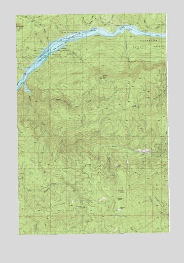
Bertha Hill, ID USGS Topographic Map
Click on map above to begin viewing in our Map Viewer.

This topographic map contains these locations and features:
Feature Name Type Latitude Longitude GNIS ID View Map
Ahlvers CreekStreamN46.7591°W115.7521°376485View Map
Benton ButteSummitN46.8385°W115.8035°377380View Map
Benton CreekStreamN46.8377°W115.8699°377381View Map
Bertha HillSummitN46.7641°W115.7924°377411View Map
Black Bear SaddleGapN46.7744°W115.7871°395110View Map
Boehls ButteSummitN46.8680°W115.8746°396156View Map
Carson CabinLocaleN46.8577°W115.8427°378957View Map
Cougar RockSummitN46.7882°W115.7932°395261View Map
Crampton CreekStreamN46.8646°W115.7829°395272View Map
Croty CreekStreamN46.8544°W115.8632°395573View Map
Joes CreekStreamN46.8563°W115.8521°395531View Map
Larkins CabinLocaleN46.8616°W115.8299°384440View Map
Larkins CreekStreamN46.8646°W115.8307°395607View Map
Larson Bar Landing AreaLocaleN46.8610°W115.8443°395596View Map
Larson CabinLocaleN46.8580°W115.8418°395608View Map
Long Bar CreekStreamN46.8674°W115.8032°395644View Map
Loop CreekStreamN46.8632°W115.8354°395651View Map
Lovell SaddleGapN46.8221°W115.7754°395657View Map
North Fork Benton CreekStreamN46.8307°W115.8646°387651View Map
Rooney CreekStreamN46.8682°W115.8140°395014View Map
Spires CreekStreamN46.8630°W115.7654°391115View Map
Thrasher CreekStreamN46.8624°W115.7615°392070View Map
Thunder CreekStreamN46.8007°W115.8035°392111View Map
Thunder SpringSpringN46.7700°W115.7929°392115View Map
Township SaddleGapN46.7657°W115.8218°399319View Map
West Fork Long Bar CreekStreamN46.8685°W115.8032°399636View Map
West Fork Rooney CreekStreamN46.8682°W115.8140°399637View Map
Whiskey CreekStreamN46.8599°W115.8482°399646View Map

Note: Coordinates in the location and feature list above are referenced to NAD83 datum.


Copyright (C) 2008-2025 Ryan Niemi / Sunset Dynamics ... All Rights Reserved