TopoQuest Logo
Do you find TopoQuest useful?
Help keep TopoQuest running and adding new maps/features by donating!
Bitcoin:  19c7KJd3qBynnjoSw5npx9KScwjBe4ifkT
Litecoin:  LXs6TkuXGGXo1vDsWCkWVdjQX94eUKd6ui
Home View Maps Find Maps Find Places Resources & Links


Berthoud Pass, Colorado Topographic Map

USGS Map Title: Berthoud Pass, CO
USGS Map MRC: 39105G7
DRG (GeoTIFF) Download: o39105g7.tif


Neighboring USGS Topographic Map Quads:


  Bottle Pass, CO  
39105H8
 

  Fraser, CO  
39105H7
 

  East Portal, CO  
39105H6
 

  Byers Peak, CO  
39105G8
 

  Berthoud Pass, CO  
39105G7
 

  Empire, CO  
39105G6
 

  Loveland Pass, CO  
39105F8
 

  Grays Peak, CO  
39105F7
 

  Georgetown, CO  
39105F6


Map MRC Location:

N40°
W106°
N40°
W105°
H8 H7 H6 H5 H4 H3 H2 H1
G8 G7 G6 G5 G4 G3 G2 G1
F8 F7 F6 F5 F4 F3 F2 F1
E8 E7 E6 E5 E4 E3 E2 E1
D8 D7 D6 D5 D4 D3 D2 D1
C8 C7 C6 C5 C4 C3 C2 C1
B8 B7 B6 B5 B4 B3 B2 B1
A8 A7 A6 A5 A4 A3 A2 A1
N39°
W106°
N39°
W105°

Berthoud Pass, CO USGS 1:24K Topographic Map Preview:
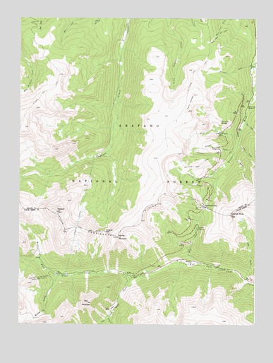
Berthoud Pass, CO USGS Topographic Map
Click on map above to begin viewing in our Map Viewer.

This topographic map contains these locations and features:
Feature Name Type Latitude Longitude GNIS ID View Map
Archibell MineMineN39.7964°W105.7861°1685252View Map
Barton MineMineN39.7753°W105.7886°1685253View Map
Bellview Hudson TunnelMineN39.7589°W105.7733°181361View Map
Berthoud FallsPopulated PlaceN39.7708°W105.8086°197798View Map
Berthoud PassGapN39.7983°W105.7778°181335View Map
Berthoud Pass DitchCanalN39.8108°W105.7897°181332View Map
Berthoud Pass HeliportAirportN39.7936°W105.7645°204384View Map
Berthoud Pass Ski AreaLocaleN39.7994°W105.7800°197796View Map
Big Bend Picnic GroundsLocaleN39.7714°W105.8178°181327View Map
Big Esther MineMineN39.7575°W105.8645°1685254View Map
Blue CreekStreamN39.7680°W105.7547°181337View Map
Blue LakeLakeN39.7929°W105.7573°197795View Map
Butler GulchValleyN39.7700°W105.8538°181308View Map
Clear Creek Picnic AreaLocaleN39.7739°W105.7714°197799View Map
Colorado Mines PeakSummitN39.7958°W105.7645°181336View Map
Current CreekStreamN39.8122°W105.7703°181338View Map
Daughters of the American Revolution CampgroundLocaleN39.8286°W105.7681°181318View Map
Doctor MineMineN39.7736°W105.8022°1685255View Map
Eva CreekStreamN39.8336°W105.7567°181321View Map
First CreekStreamN39.8283°W105.7589°181330View Map
First Creek Ski CabinLocaleN39.8328°W105.7686°181329View Map
Flora CreekStreamN39.8247°W105.7595°181320View Map
Floral Park CampgroundLocaleN39.7894°W105.7806°181328View Map
Fraser River Diversion DamDamN39.8617°W105.7500°181390View Map
Henderson HeliportAirportN39.7680°W105.8486°204383View Map
Henderson MineMineN39.7686°W105.8517°197794View Map
Henderson Mine HeliportAirportN39.7692°W105.8517°204264View Map
Hoop CreekStreamN39.7753°W105.7828°181339View Map
Jean MineMineN39.7544°W105.8736°1685256View Map
Jefferson Lake DamDamN39.8283°W105.8639°198842View Map
Jim Lode MineMineN39.7578°W105.8295°1685257View Map
John L Frannie MineMineN39.7764°W105.7595°1685258View Map
Jury MineMineN39.7622°W105.8231°1685259View Map
Mary Jane Ski AreaLocaleN39.8680°W105.7711°197787View Map
Mary Jane Ski TrailTrailN39.8725°W105.7658°202780View Map
Mizpah CampgroundLocaleN39.7744°W105.7931°197800View Map
Mount Nystrom TrailTrailN39.8042°W105.8003°202821View Map
Parsenn CreekStreamN39.8569°W105.7511°181342View Map
Red MountainSummitN39.7588°W105.8387°181324View Map
Robbers Roost CampgroundLocaleN39.8336°W105.7561°197797View Map
Robert CreekStreamN39.8197°W105.7617°181333View Map
Ruby CreekStreamN39.7536°W105.8272°181322View Map
Scotia MineMineN39.7758°W105.8297°1685260View Map
Scott MineMineN39.7597°W105.7595°1685261View Map
Second CreekStreamN39.8230°W105.7600°181331View Map
Second Creek CampgroundLocaleN39.8222°W105.7697°181317View Map
Sevenmile Ski TrailTrailN39.8158°W105.7681°181334View Map
Spruce Lodge CampgroundLocaleN39.8392°W105.7528°181344View Map
Stanley MountainSummitN39.7856°W105.8228°181326View Map
Twin ConesSummitN39.8373°W105.7862°181343View Map
Urad MineMineN39.7564°W105.8272°181319View Map
Vasquez PassGapN39.7878°W105.8292°181325View Map
Vasquez PeakSummitN39.7961°W105.8550°181341View Map
Vasquez Peak WildernessReserveN39.8200°W105.8434°2035333View Map
Vasquez TunnelTunnelN39.7919°W105.8436°181340View Map
Woods CreekStreamN39.7689°W105.8164°181323View Map
Wyoming MineMineN39.7611°W105.8231°1685400View Map

Note: Coordinates in the location and feature list above are referenced to NAD83 datum.


Copyright (C) 2008-2024 Ryan Niemi / Sunset Dynamics ... All Rights Reserved