TopoQuest Logo
Do you find TopoQuest useful?
Help keep TopoQuest running and adding new maps/features by donating!
Bitcoin:  19c7KJd3qBynnjoSw5npx9KScwjBe4ifkT
Litecoin:  LXs6TkuXGGXo1vDsWCkWVdjQX94eUKd6ui
Home View Maps Find Maps Find Places Resources & Links


Byers Peak, Colorado Topographic Map

USGS Map Title: Byers Peak, CO
USGS Map MRC: 39105G8
DRG (GeoTIFF) Download: o39105g8.tif


Neighboring USGS Topographic Map Quads:


  Sylvan Reservoir, CO  
39106H1
 

  Bottle Pass, CO  
39105H8
 

  Fraser, CO  
39105H7
 

  Ute Peak, CO  
39106G1
 

  Byers Peak, CO  
39105G8
 

  Berthoud Pass, CO  
39105G7
 

  Dillon, CO  
39106F1
 

  Loveland Pass, CO  
39105F8
 

  Grays Peak, CO  
39105F7


Map MRC Location:

N40°
W106°
N40°
W105°
H8 H7 H6 H5 H4 H3 H2 H1
G8 G7 G6 G5 G4 G3 G2 G1
F8 F7 F6 F5 F4 F3 F2 F1
E8 E7 E6 E5 E4 E3 E2 E1
D8 D7 D6 D5 D4 D3 D2 D1
C8 C7 C6 C5 C4 C3 C2 C1
B8 B7 B6 B5 B4 B3 B2 B1
A8 A7 A6 A5 A4 A3 A2 A1
N39°
W106°
N39°
W105°

Byers Peak, CO USGS 1:24K Topographic Map Preview:
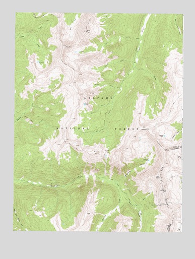
Byers Peak, CO USGS Topographic Map
Click on map above to begin viewing in our Map Viewer.

This topographic map contains these locations and features:
Feature Name Type Latitude Longitude GNIS ID View Map
Arapaho National ForestForestN39.8009°W105.9527°169575View Map
August P Gumlick TunnelTunnelN39.7672°W105.8781°202822View Map
Bills PeakSummitN39.8558°W105.9622°181300View Map
Bobtail CreekStreamN39.7786°W105.9236°181310View Map
Bobtail MineMineN39.7608°W105.9058°181314View Map
Byers PeakSummitN39.8644°W105.9472°181301View Map
Byers Peak TrailTrailN39.8269°W105.9531°202819View Map
Byers Peak WildernessReserveN39.8522°W105.9762°2035076View Map
Darling Creek TrailTrailN39.8153°W105.9917°202818View Map
Fraser Experimental ForestParkN39.8472°W105.9117°196713View Map
Gordon CreekStreamN39.8325°W105.9214°181293View Map
Horseshoe LakeLakeN39.8467°W105.9828°181299View Map
Iron CreekStreamN39.8619°W105.9061°181303View Map
Jones CreekStreamN39.7655°W105.9108°181312View Map
Jones PassGapN39.7736°W105.8892°181313View Map
Kinney Creek TrailTrailN39.8661°W105.9839°181298View Map
Lunch CreekStreamN39.8480°W105.9100°181302View Map
McQueary CreekStreamN39.7786°W105.9236°181309View Map
McQueary LakeLakeN39.7912°W105.8998°181315View Map
Mine CreekStreamN39.8247°W105.9270°181294View Map
Mount NystromSummitN39.8089°W105.9020°181292View Map
Range CreekStreamN39.8450°W105.9108°181316View Map
Saint Louis LakeLakeN39.8227°W105.9479°181295View Map
Saint Louis PassGapN39.7961°W105.9308°181296View Map
Saint Louis PeakSummitN39.7950°W105.9386°181297View Map
Saint Louis TrailTrailN39.8080°W105.9131°202820View Map
Steelman CreekStreamN39.7792°W105.9258°181311View Map
Vasquez LakeLakeN39.8051°W105.8887°181291View Map

Note: Coordinates in the location and feature list above are referenced to NAD83 datum.


Copyright (C) 2008-2025 Ryan Niemi / Sunset Dynamics ... All Rights Reserved