TopoQuest Logo
Do you find TopoQuest useful?
Help keep TopoQuest running and adding new maps/features by donating!
Bitcoin:  19c7KJd3qBynnjoSw5npx9KScwjBe4ifkT
Litecoin:  LXs6TkuXGGXo1vDsWCkWVdjQX94eUKd6ui
Home View Maps Find Maps Find Places Resources & Links


Physic Creek, Montana Topographic Map

USGS Map Title: Physic Creek, MT
USGS Map MRC: 46105G6
DRG (GeoTIFF) Download: o46105g6.tif


Neighboring USGS Topographic Map Quads:


  Little Sheep Mountain, MT  
46105H7
 

  South Fork Reservoir, MT  
46105H6
 

  McCloud, MT  
46105H5
 

  Morehouse Creek, MT  
46105G7
 

  Physic Creek, MT  
46105G6
 

  McClure Reservoir, MT  
46105G5
 

  Coal Bank Spring, MT  
46105F7
 

  Kinsey NW, MT  
46105F6
 

  Kinsey NE, MT  
46105F5


Map MRC Location:

N47°
W106°
N47°
W105°
H8 H7 H6 H5 H4 H3 H2 H1
G8 G7 G6 G5 G4 G3 G2 G1
F8 F7 F6 F5 F4 F3 F2 F1
E8 E7 E6 E5 E4 E3 E2 E1
D8 D7 D6 D5 D4 D3 D2 D1
C8 C7 C6 C5 C4 C3 C2 C1
B8 B7 B6 B5 B4 B3 B2 B1
A8 A7 A6 A5 A4 A3 A2 A1
N46°
W106°
N46°
W105°

Physic Creek, MT USGS 1:24K Topographic Map Preview:
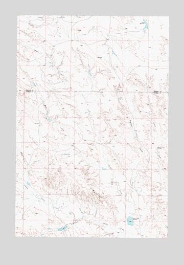
Physic Creek, MT USGS Topographic Map
Click on map above to begin viewing in our Map Viewer.

This topographic map contains these locations and features:
Feature Name Type Latitude Longitude GNIS ID View Map
13N47E23BDDA01 WellWellN46.8694°W105.7386°818965View Map
13N47E24BACA01 WellWellN46.8719°W105.7197°818974View Map
13N47E26DAAC01 WellWellN46.8528°W105.7286°818807View Map
13N47E26DAAD01 WellWellN46.8522°W105.7283°818801View Map
13N48E20CDDC01 WellWellN46.8614°W105.6767°818883View Map
13N48E28DACC01 WellWellN46.8506°W105.6467°818775View Map
13N48E29CBCA01 WellWellN46.8514°W105.6822°818787View Map
13N48E33BBCA01 WellWellN46.8445°W105.6467°818727View Map
Fallon SpringSpringN46.8286°W105.6658°771303View Map
Grant ReservoirReservoirN46.8710°W105.6445°771924View Map
Grant Reservoir DamDamN46.8717°W105.6456°797358View Map
Harmes Reservoir DamDamN46.8417°W105.6739°797357View Map
Haughan Number 2 DamDamN46.8083°W105.6872°796656View Map
Haughian Number 15 DamDamN46.8067°W105.6522°796940View Map
Haughian Number 16 DamDamN46.7900°W105.6739°796941View Map
Hunter Creek SpringSpringN46.8008°W105.6342°772631View Map
Ingersol ButteSummitN46.7764°W105.6875°772703View Map
Milwaukee CouleeValleyN46.7700°W105.6561°774259View Map
Physic CreekStreamN46.7533°W105.6578°775202View Map
Physic Creek DamDamN46.7583°W105.6572°795194View Map
Physic Creek ReservoirReservoirN46.7595°W105.6564°775203View Map
Reed Number 4 DamDamN46.7800°W105.7406°796939View Map
Reed Number 5 DamDamN46.7567°W105.7089°796938View Map
Rundel School (historical)SchoolN46.8425°W105.6583°1715728View Map
Sadie CreekStreamN46.7769°W105.7406°776072View Map
Swede DamDamN46.7969°W105.7103°777360View Map
West Fork Physic CreekStreamN46.7889°W105.6733°778263View Map

Note: Coordinates in the location and feature list above are referenced to NAD83 datum.


Copyright (C) 2008-2025 Ryan Niemi / Sunset Dynamics ... All Rights Reserved