TopoQuest Logo
Do you find TopoQuest useful?
Help keep TopoQuest running and adding new maps/features by donating!
Bitcoin:  19c7KJd3qBynnjoSw5npx9KScwjBe4ifkT
Litecoin:  LXs6TkuXGGXo1vDsWCkWVdjQX94eUKd6ui
Home View Maps Find Maps Find Places Resources & Links


Pierce Peak, New Mexico Topographic Map

USGS Map Title: Pierce Peak, NM
USGS Map MRC: 31108D3
DRG (GeoTIFF) Download: o31108d3.tif


Neighboring USGS Topographic Map Quads:


  U Bar Ridge, NM  
31108E4
 

  Sheridan Canyon, NM  
31108E3
 

  Cabin Wells, NM  
31108E2
 

  Sentinel Butte, NM  
31108D4
 

  Pierce Peak, NM  
31108D3
 

  Campbell Well, NM  
31108D2
 

  Eagle Mountain, NM  
31108C4
 

  Dog Mountains, NM  
31108C3
 

  Corner Well, NM  
31108C2


Map MRC Location:

N32°
W109°
N32°
W108°
H8 H7 H6 H5 H4 H3 H2 H1
G8 G7 G6 G5 G4 G3 G2 G1
F8 F7 F6 F5 F4 F3 F2 F1
E8 E7 E6 E5 E4 E3 E2 E1
D8 D7 D6 D5 D4 D3 D2 D1
C8 C7 C6 C5 C4 C3 C2 C1
B8 B7 B6 B5 B4 B3 B2 B1
A8 A7 A6 A5 A4 A3 A2 A1
N31°
W109°
N31°
W108°

Pierce Peak, NM USGS 1:24K Topographic Map Preview:
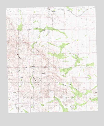
Pierce Peak, NM USGS Topographic Map
Click on map above to begin viewing in our Map Viewer.

This topographic map contains these locations and features:
Feature Name Type Latitude Longitude GNIS ID View Map
Alamo Hueco MountainsRangeN31.4326°W108.3511°920554View Map
Conejo WellsWellN31.4376°W108.2789°890443View Map
Cottonwood SpringSpringN31.4209°W108.3286°887925View Map
Cottonwood TankReservoirN31.4079°W108.2892°900899View Map
Emory CanyonValleyN31.4590°W108.2789°888869View Map
Hat Top MountainSummitN31.3979°W108.2553°889819View Map
Horse Canyon TanksReservoirN31.4298°W108.3409°900904View Map
Lion TankReservoirN31.4753°W108.3336°901177View Map
Little Hat Top TankReservoirN31.4955°W108.3114°901131View Map
Little Top Hat ButteSummitN31.4982°W108.3167°899726View Map
Lower Bull TankReservoirN31.3996°W108.3649°900820View Map
McFarlandsPopulated PlaceN31.4721°W108.3259°898571View Map
McFarlands TankReservoirN31.4721°W108.3243°900702View Map
Meno Adams RanchLocaleN31.4726°W108.3070°915936View Map
Mono Adams RanchLocaleN31.4726°W108.3073°892161View Map
Petersons WellWellN31.4521°W108.3050°893217View Map
PiercePopulated PlaceN31.4562°W108.3403°899846View Map
Pierce PeakSummitN31.4484°W108.3350°893259View Map
Pierce RanchLocaleN31.4893°W108.2748°893260View Map
Pierce TankReservoirN31.4952°W108.2883°900732View Map
Stone CabinLocaleN31.4051°W108.2898°895364View Map
Sycamore CanyonValleyN31.3968°W108.2789°895465View Map
Sycamore WellWellN31.3898°W108.3078°895470View Map
The Thicket SpringSpringN31.4201°W108.3414°898187View Map
Upper Bull TankReservoirN31.4175°W108.3580°900819View Map

Note: Coordinates in the location and feature list above are referenced to NAD83 datum.


Copyright (C) 2008-2025 Ryan Niemi / Sunset Dynamics ... All Rights Reserved