TopoQuest Logo
Do you find TopoQuest useful?
Help keep TopoQuest running and adding new maps/features by donating!
Bitcoin:  19c7KJd3qBynnjoSw5npx9KScwjBe4ifkT
Litecoin:  LXs6TkuXGGXo1vDsWCkWVdjQX94eUKd6ui
Home View Maps Find Maps Find Places Resources & Links


Sheridan Canyon, New Mexico Topographic Map

USGS Map Title: Sheridan Canyon, NM
USGS Map MRC: 31108E3
DRG (GeoTIFF) Download: o31108e3.tif


Neighboring USGS Topographic Map Quads:


  Big Hatchet Peak, NM  
31108F4
 

  Hatchet Ranch, NM  
31108F3
 

  Double Wells, NM  
31108F2
 

  U Bar Ridge, NM  
31108E4
 

  Sheridan Canyon, NM  
31108E3
 

  Cabin Wells, NM  
31108E2
 

  Sentinel Butte, NM  
31108D4
 

  Pierce Peak, NM  
31108D3
 

  Campbell Well, NM  
31108D2


Map MRC Location:

N32°
W109°
N32°
W108°
H8 H7 H6 H5 H4 H3 H2 H1
G8 G7 G6 G5 G4 G3 G2 G1
F8 F7 F6 F5 F4 F3 F2 F1
E8 E7 E6 E5 E4 E3 E2 E1
D8 D7 D6 D5 D4 D3 D2 D1
C8 C7 C6 C5 C4 C3 C2 C1
B8 B7 B6 B5 B4 B3 B2 B1
A8 A7 A6 A5 A4 A3 A2 A1
N31°
W109°
N31°
W108°

Sheridan Canyon, NM USGS 1:24K Topographic Map Preview:
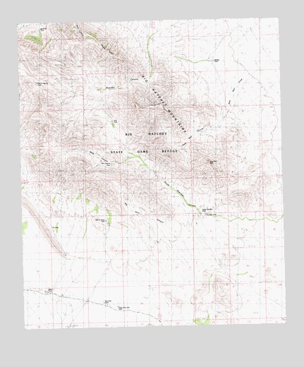
Sheridan Canyon, NM USGS Topographic Map
Click on map above to begin viewing in our Map Viewer.

This topographic map contains these locations and features:
Feature Name Type Latitude Longitude GNIS ID View Map
Big Hatchet MountainsRangeN31.6154°W108.3637°920562View Map
Big Horn CanyonValleyN31.5401°W108.3045°900838View Map
Buckhorn TankReservoirN31.6222°W108.3648°900836View Map
Bugle RidgeRidgeN31.6132°W108.3325°900837View Map
Carbonate GroupMineN31.5959°W108.3339°915514View Map
Double TankReservoirN31.6083°W108.2822°901210View Map
Gilbert TankReservoirN31.5151°W108.3643°900939View Map
Hale TankReservoirN31.5843°W108.3316°900919View Map
Hell to Finish TankReservoirN31.5432°W108.3345°901160View Map
Hell to Get to TankReservoirN31.6001°W108.3667°901150View Map
Lead QueenMineN31.5668°W108.3284°915393View Map
Mine CanyonValleyN31.5701°W108.3206°900850View Map
Mine Canyon TankReservoirN31.5669°W108.3321°900710View Map
New Well CanyonValleyN31.5870°W108.2767°900851View Map
New Well DrawArroyoN31.6032°W108.2645°901209View Map
New Well PeakSummitN31.5670°W108.2864°900721View Map
Pit TankReservoirN31.5416°W108.3613°900737View Map
Red Lake TankReservoirN31.5157°W108.3375°901171View Map
Sheridan TankReservoirN31.5401°W108.2875°900806View Map
Sheridan WellsLocaleN31.5973°W108.3373°929050View Map
Upper Red Lake TankReservoirN31.5085°W108.3306°901170View Map
Upper Sheridan TankReservoirN31.5459°W108.2901°900805View Map

Note: Coordinates in the location and feature list above are referenced to NAD83 datum.


Copyright (C) 2008-2025 Ryan Niemi / Sunset Dynamics ... All Rights Reserved