TopoQuest Logo
Do you find TopoQuest useful?
Help keep TopoQuest running and adding new maps/features by donating!
Bitcoin:  19c7KJd3qBynnjoSw5npx9KScwjBe4ifkT
Litecoin:  LXs6TkuXGGXo1vDsWCkWVdjQX94eUKd6ui
Home View Maps Find Maps Find Places Resources & Links


Pigeon Point, California Topographic Map

USGS Map Title: Pigeon Point, CA
USGS Map MRC: 37122B4
DRG (GeoTIFF) Download: o37122b4.tif


Neighboring USGS Topographic Map Quads:


  San Gregorio, CA  
37122C4
 

  La Honda, CA  
37122C3


  Pigeon Point, CA  
37122B4
 

  Franklin Point, CA  
37122B3


  Point Ano Nuevo, CA  
37122A3


Map MRC Location:

N38°
W123°
N38°
W122°
H8 H7 H6 H5 H4 H3 H2 H1
G8 G7 G6 G5 G4 G3 G2 G1
F8 F7 F6 F5 F4 F3 F2 F1
E8 E7 E6 E5 E4 E3 E2 E1
D8 D7 D6 D5 D4 D3 D2 D1
C8 C7 C6 C5 C4 C3 C2 C1
B8 B7 B6 B5 B4 B3 B2 B1
A8 A7 A6 A5 A4 A3 A2 A1
N37°
W123°
N37°
W122°

Pigeon Point, CA USGS 1:24K Topographic Map Preview:
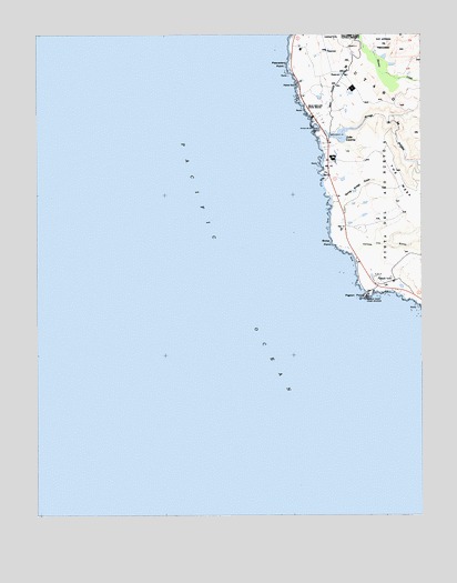
Pigeon Point, CA USGS Topographic Map
Click on map above to begin viewing in our Map Viewer.

This topographic map contains these locations and features:
Feature Name Type Latitude Longitude GNIS ID View Map
Arroyo De Los FrijolesStreamN37.2249°W122.4078°218391View Map
Arroyo De Los Frijoles BeachBeachN37.2258°W122.4094°218397View Map
Bean Hollow State BeachParkN37.2327°W122.4150°1723270View Map
Bolsa PointCapeN37.1961°W122.4053°219618View Map
Department of Forestry and Fire Protection Station 59 Pescadero Fire StationBuildingN37.2496°W122.3968°2624233View Map
Lake LucerneReservoirN37.2243°W122.4065°227815View Map
Lake Lucerne 602 DamDamN37.2233°W122.4061°1663963View Map
Pebble BeachBeachN37.2369°W122.4164°230452View Map
Pescadero High Power Homing StationLocaleN37.2349°W122.4005°1654375View Map
Pescadero PointCapeN37.2419°W122.4197°230552View Map
Pigeon PointCapeN37.1819°W122.3947°230645View Map
Pigeon Point Light StationLocaleN37.1819°W122.3936°1654379View Map
Pigeon Point Light Station State Historic ParkParkN37.1819°W122.3939°2124355View Map
Spring Bridge GulchValleyN37.2061°W122.4016°235229View Map
The MesaFlatN37.2116°W122.3836°236193View Map
Yankee Jim GulchValleyN37.1933°W122.3972°238228View Map

Note: Coordinates in the location and feature list above are referenced to NAD83 datum.


Copyright (C) 2008-2025 Ryan Niemi / Sunset Dynamics ... All Rights Reserved