TopoQuest Logo
Do you find TopoQuest useful?
Help keep TopoQuest running and adding new maps/features by donating!
Bitcoin:  19c7KJd3qBynnjoSw5npx9KScwjBe4ifkT
Litecoin:  LXs6TkuXGGXo1vDsWCkWVdjQX94eUKd6ui
Home View Maps Find Maps Find Places Resources & Links


San Gregorio, California Topographic Map

USGS Map Title: San Gregorio, CA
USGS Map MRC: 37122C4
DRG (GeoTIFF) Download: o37122c4.tif


Neighboring USGS Topographic Map Quads:


  Half Moon Bay, CA  
37122D4
 

  Woodside, CA  
37122D3


  San Gregorio, CA  
37122C4
 

  La Honda, CA  
37122C3


  Pigeon Point, CA  
37122B4
 

  Franklin Point, CA  
37122B3


Map MRC Location:

N38°
W123°
N38°
W122°
H8 H7 H6 H5 H4 H3 H2 H1
G8 G7 G6 G5 G4 G3 G2 G1
F8 F7 F6 F5 F4 F3 F2 F1
E8 E7 E6 E5 E4 E3 E2 E1
D8 D7 D6 D5 D4 D3 D2 D1
C8 C7 C6 C5 C4 C3 C2 C1
B8 B7 B6 B5 B4 B3 B2 B1
A8 A7 A6 A5 A4 A3 A2 A1
N37°
W123°
N37°
W122°

San Gregorio, CA USGS 1:24K Topographic Map Preview:
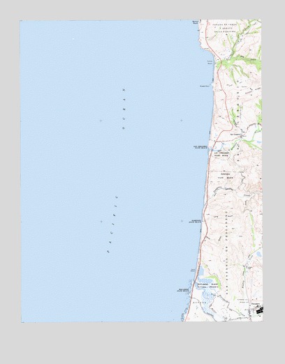
San Gregorio, CA USGS Topographic Map
Click on map above to begin viewing in our Map Viewer.

This topographic map contains these locations and features:
Feature Name Type Latitude Longitude GNIS ID View Map
Bradley CreekStreamN37.2533°W122.3886°219762View Map
Butano CreekStreamN37.2669°W122.4119°220266View Map
Chandler GulchValleyN37.2833°W122.3778°220906View Map
Dairy GulchValleyN37.2869°W122.4078°221978View Map
Dry CreekStreamN37.3588°W122.3916°222617View Map
First Congregational Church of PescaderoChurchN37.2544°W122.3833°1786325View Map
Gordons Landing (historical)LocaleN37.3586°W122.4003°1786330View Map
Half Moon Bay DivisionCivilN37.3408°W122.3787°1935317View Map
Long GulchValleyN37.2913°W122.4069°227559View Map
Martins BeachPopulated PlaceN37.3749°W122.4080°1659070View Map
Mount Hope CemeteryCemeteryN37.2580°W122.3828°229151View Map
Mussel RockIslandN37.3474°W122.4022°229378View Map
PescaderoPopulated PlaceN37.2549°W122.3814°1659375View Map
Pescadero BeachBeachN37.2622°W122.4133°230548View Map
Pescadero CreekStreamN37.2638°W122.4072°234452View Map
Pescadero Elementary SchoolSchoolN37.2563°W122.3786°1786342View Map
Pescadero Marsh Natural PreserveParkN37.2611°W122.4041°1723283View Map
Pescadero Marsh Natural PreserveReserveN37.2619°W122.4040°2741292View Map
Pescadero Post OfficePost OfficeN37.2513°W122.3827°1786343View Map
Pescadero State BeachParkN37.2638°W122.4297°1723284View Map
Pomponio BeachBeachN37.2922°W122.4072°230912View Map
Pomponio CreekStreamN37.2980°W122.4058°230913View Map
Pomponio State BeachParkN37.2930°W122.4075°1723286View Map
Round HillSummitN37.2608°W122.4000°1659551View Map
Saint Anthony CemeteryCemeteryN37.2588°W122.3830°232135View Map
San Antonio or PescaderoCivilN37.2783°W122.3939°234622View Map
San GregorioPopulated PlaceN37.3272°W122.3866°1659577View Map
San Gregorio BeachBeachN37.3230°W122.4033°232402View Map
San Gregorio CreekStreamN37.3209°W122.4033°232403View Map
San Gregorio Post OfficePost OfficeN37.3270°W122.3868°1786348View Map
San Gregorio State BeachParkN37.3233°W122.4036°1723289View Map
San Mateo Coast State Beaches (historical)ParkN37.2966°W122.4061°234637View Map
Sand BeachBeachN37.2713°W122.4105°232490View Map
Shaw GulchValleyN37.2797°W122.3772°232886View Map
Tahana GulchValleyN37.2841°W122.3780°235972View Map
Tunitas BeachBeachN37.3577°W122.4000°236623View Map
Tunitas CreekStreamN37.3566°W122.3997°236624View Map

Note: Coordinates in the location and feature list above are referenced to NAD83 datum.


Copyright (C) 2008-2025 Ryan Niemi / Sunset Dynamics ... All Rights Reserved