TopoQuest Logo
Do you find TopoQuest useful?
Help keep TopoQuest running and adding new maps/features by donating!
Bitcoin:  19c7KJd3qBynnjoSw5npx9KScwjBe4ifkT
Litecoin:  LXs6TkuXGGXo1vDsWCkWVdjQX94eUKd6ui
Home View Maps Find Maps Find Places Resources & Links


Pike Lake NW, Wisconsin Topographic Map

USGS Map Title: Pike Lake NW, WI
USGS Map MRC: 45090H2
DRG (GeoTIFF) Download: o45090h2.tif


Neighboring USGS Topographic Map Quads:


  Hay Creek Flowage, WI  
46090A3
 

  Turtle-Flambeau Flowage, WI  
46090A2
 

  Wilson Lake, WI  
46090A1
 

  Blockhouse Lake, WI  
45090H3
 

  Pike Lake NW, WI  
45090H2
 

  Pike Lake, WI  
45090H1
 

  Gates Lake, WI  
45090G3
 

  Pike Lake SW, WI  
45090G2
 

  Pike Lake SE, WI  
45090G1


Map MRC Location:

N46°
W91°
N46°
W90°
H8 H7 H6 H5 H4 H3 H2 H1
G8 G7 G6 G5 G4 G3 G2 G1
F8 F7 F6 F5 F4 F3 F2 F1
E8 E7 E6 E5 E4 E3 E2 E1
D8 D7 D6 D5 D4 D3 D2 D1
C8 C7 C6 C5 C4 C3 C2 C1
B8 B7 B6 B5 B4 B3 B2 B1
A8 A7 A6 A5 A4 A3 A2 A1
N45°
W91°
N45°
W90°

Pike Lake NW, WI USGS 1:24K Topographic Map Preview:
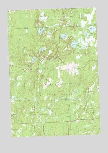
Pike Lake NW, WI USGS Topographic Map
Click on map above to begin viewing in our Map Viewer.

This topographic map contains these locations and features:
Feature Name Type Latitude Longitude GNIS ID View Map
Beaver CreekStreamN45.9877°W90.1960°1578732View Map
Byhre CreekStreamN45.9202°W90.1563°1578905View Map
Byhre LakeLakeN45.9311°W90.1503°2497013View Map
Camp C CreekStreamN45.9152°W90.2479°1578916View Map
Camp Four SpringsLakeN45.9512°W90.1881°1578923View Map
Camp Nine SpringsSpringN45.9552°W90.2482°1578930View Map
Cedar RapidsRapidsN45.9119°W90.2252°1578973View Map
Clover CreekStreamN45.9011°W90.1977°1579020View Map
Elevenmile CreekStreamN45.9005°W90.2085°1579198View Map
Island LakeLakeN45.9514°W90.2154°1579518View Map
Kabol LakeLakeN45.9786°W90.2038°1579563View Map
Little Cedar RapidsRapidsN45.9119°W90.2349°1579670View Map
Marty LakeLakeN45.9922°W90.1472°1581159View Map
Nettie B LakeLakeN45.9611°W90.1445°1580000View Map
Newman CreekStreamN45.9141°W90.2143°1580004View Map
Newman LakeLakeN45.9644°W90.1575°1580005View Map
Newman Lake Recreation AreaLocaleN45.9624°W90.1546°1580859View Map
Newman SpringsLakeN45.9497°W90.2019°1580006View Map
Newman Springs Ski TrailTrailN45.9469°W90.1960°1580860View Map
Patterson LakeLakeN45.9727°W90.1724°1580098View Map
Penny LakeLakeN45.9444°W90.2094°1580107View Map
Quimette LakeLakeN45.9767°W90.1928°1581843View Map
Riley CreekStreamN45.9094°W90.1421°1580260View Map
Riley Creek Forest Service StationLocaleN45.8972°W90.1365°1581844View Map
Robert Sells 3WR814 DamDamN45.8883°W90.2168°1792563View Map
Robert Sells Flowage 1ReservoirN45.8869°W90.2163°1792564View Map
Shady Knoll School (historical)SchoolN45.9397°W90.1671°1833554View Map
Smith RapidsRapidsN45.9105°W90.1724°1580436View Map
Smith River CampgroundLocaleN45.9116°W90.1724°1580861View Map
South Fork Fire Tower (historical)TowerN45.9408°W90.1382°1833555View Map
South LakeLakeN45.9603°W90.2036°1580463View Map
Springstead AirportAirportN45.9877°W90.1635°1582143View Map
Thompson LakeLakeN45.9787°W90.1318°1580604View Map
Whitcomb LakeLakeN45.9738°W90.1393°1580771View Map

Note: Coordinates in the location and feature list above are referenced to NAD83 datum.


Copyright (C) 2008-2025 Ryan Niemi / Sunset Dynamics ... All Rights Reserved