TopoQuest Logo
Do you find TopoQuest useful?
Help keep TopoQuest running and adding new maps/features by donating!
Bitcoin:  19c7KJd3qBynnjoSw5npx9KScwjBe4ifkT
Litecoin:  LXs6TkuXGGXo1vDsWCkWVdjQX94eUKd6ui
Home View Maps Find Maps Find Places Resources & Links


Pilot Cone, Nevada Topographic Map

USGS Map Title: Pilot Cone, NV
USGS Map MRC: 38118H4
DRG (GeoTIFF) Download: o38118h4.tif


Neighboring USGS Topographic Map Quads:


  Red Ridge, NV  
39118A5
 

  Rawhide, NV  
39118A4
 

  Big Kasock Mountain, NV  
39118A3
 

  Hu-Pwi Wash, NV  
38118H5
 

  Pilot Cone, NV  
38118H4
 

  Murphys Well, NV  
38118H3
 

  Ghost Dance Ridge, NV  
38118G5
 

  Copper Mountain, NV  
38118G4
 

  Poinsettia Spring, NV  
38118G3


Map MRC Location:

N39°
W119°
N39°
W118°
H8 H7 H6 H5 H4 H3 H2 H1
G8 G7 G6 G5 G4 G3 G2 G1
F8 F7 F6 F5 F4 F3 F2 F1
E8 E7 E6 E5 E4 E3 E2 E1
D8 D7 D6 D5 D4 D3 D2 D1
C8 C7 C6 C5 C4 C3 C2 C1
B8 B7 B6 B5 B4 B3 B2 B1
A8 A7 A6 A5 A4 A3 A2 A1
N38°
W119°
N38°
W118°

Pilot Cone, NV USGS 1:24K Topographic Map Preview:
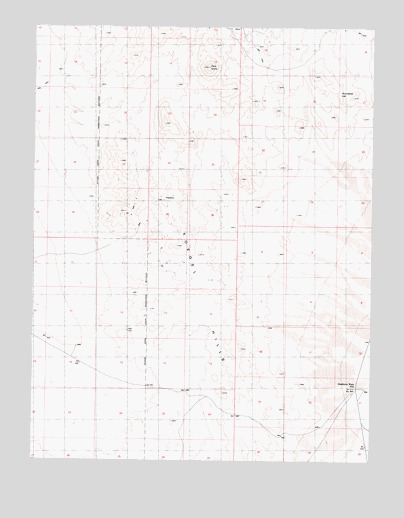
Pilot Cone, NV USGS Topographic Map
Click on map above to begin viewing in our Map Viewer.

This topographic map contains these locations and features:
Feature Name Type Latitude Longitude GNIS ID View Map
Basalt PeakSummitN38.9860°W118.3976°847933View Map
Deadhorse WellWellN38.8960°W118.3818°856541View Map
Deadhorse WellsLocaleN38.8963°W118.3796°848529View Map
Gundaker HillSummitN38.9810°W118.3876°854476View Map
Gundaker Reservoir (historical)ReservoirN38.9810°W118.3876°863803View Map
Koegel HillsRangeN38.9244°W118.4387°849710View Map
Pilot ConeSummitN38.9885°W118.4349°842811View Map
Rawhide HillsRangeN38.9777°W118.4357°848149View Map
Walker River DivisionCivilN38.8844°W118.4851°1937482View Map

Note: Coordinates in the location and feature list above are referenced to NAD83 datum.


Copyright (C) 2008-2025 Ryan Niemi / Sunset Dynamics ... All Rights Reserved