TopoQuest Logo
Do you find TopoQuest useful?
Help keep TopoQuest running and adding new maps/features by donating!
Bitcoin:  19c7KJd3qBynnjoSw5npx9KScwjBe4ifkT
Litecoin:  LXs6TkuXGGXo1vDsWCkWVdjQX94eUKd6ui
Home View Maps Find Maps Find Places Resources & Links


Rawhide, Nevada Topographic Map

USGS Map Title: Rawhide, NV
USGS Map MRC: 39118A4
DRG (GeoTIFF) Download: o39118a4.tif


Neighboring USGS Topographic Map Quads:


  Diamond Field Jack Wash, NV  
39118B5
 

  Fourmile Canyon, NV  
39118B4
 

  Chukar Canyon, NV  
39118B3
 

  Red Ridge, NV  
39118A5
 

  Rawhide, NV  
39118A4
 

  Big Kasock Mountain, NV  
39118A3
 

  Hu-Pwi Wash, NV  
38118H5
 

  Pilot Cone, NV  
38118H4
 

  Murphys Well, NV  
38118H3


Map MRC Location:

N40°
W119°
N40°
W118°
H8 H7 H6 H5 H4 H3 H2 H1
G8 G7 G6 G5 G4 G3 G2 G1
F8 F7 F6 F5 F4 F3 F2 F1
E8 E7 E6 E5 E4 E3 E2 E1
D8 D7 D6 D5 D4 D3 D2 D1
C8 C7 C6 C5 C4 C3 C2 C1
B8 B7 B6 B5 B4 B3 B2 B1
A8 A7 A6 A5 A4 A3 A2 A1
N39°
W119°
N39°
W118°

Rawhide, NV USGS 1:24K Topographic Map Preview:
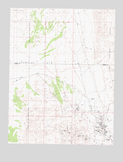
Rawhide, NV USGS Topographic Map
Click on map above to begin viewing in our Map Viewer.

This topographic map contains these locations and features:
Feature Name Type Latitude Longitude GNIS ID View Map
Balloon HillSummitN39.0199°W118.3868°854355View Map
Bethania MineMineN39.0208°W118.3940°853713View Map
Black Eagle HillSummitN39.0091°W118.4204°854368View Map
Black Eagle MineMineN39.0208°W118.3940°853714View Map
Buckskin MountainSummitN39.0077°W118.4187°850661View Map
Bullskin Mountain MineMineN39.0208°W118.3940°853711View Map
Chicago MountainSummitN39.0052°W118.4104°850662View Map
Crazy HillSummitN39.0083°W118.3801°850666View Map
Flynn MineMineN39.0208°W118.3940°853719View Map
Gold Reef MineMineN39.0208°W118.3940°853717View Map
Grutt HillSummitN39.0194°W118.3912°850663View Map
Grutt MinesMineN39.0194°W118.3912°852513View Map
Hooligan HillSummitN39.0130°W118.3949°854760View Map
Mascot MineMineN39.0208°W118.3940°853710View Map
Morning Star MineMineN39.0208°W118.3940°853707View Map
Murray HillSummitN39.0127°W118.3854°850665View Map
National MillLocaleN39.0055°W118.3801°850689View Map
National Mill Reservoir (historical)ReservoirN39.0055°W118.3801°863804View Map
Nevada New MinesMineN39.0208°W118.3940°853720View Map
Poor Boy MineMineN39.0208°W118.3940°853715View Map
RawhidePopulated PlaceN39.0166°W118.3912°856114View Map
Rawhide CemeteryCemeteryN39.0424°W118.4029°850658View Map
Rawhide MineMineN39.0208°W118.3940°853706View Map
Rawhide Post Office (historical)Post OfficeN39.0166°W118.3912°864888View Map
Rawhide Victor MineMineN39.0208°W118.3940°853708View Map
Regent (historical)LocaleN39.0335°W118.4187°850659View Map
Royal MineMineN39.0208°W118.3940°853718View Map
Scheeline MinesMineN39.0252°W118.3926°852523View Map
Seminole Regent MineMineN39.0208°W118.3940°853709View Map
Silver Zone MineMineN39.0208°W118.3940°853712View Map
Squaw PeakSummitN39.0110°W118.4296°850660View Map
Stingaree GulchValleyN39.0163°W118.3901°850664View Map
Wash Vein MineMineN39.0208°W118.3940°853716View Map

Note: Coordinates in the location and feature list above are referenced to NAD83 datum.


Copyright (C) 2008-2025 Ryan Niemi / Sunset Dynamics ... All Rights Reserved