TopoQuest Logo
Do you find TopoQuest useful?
Help keep TopoQuest running and adding new maps/features by donating!
Bitcoin:  19c7KJd3qBynnjoSw5npx9KScwjBe4ifkT
Litecoin:  LXs6TkuXGGXo1vDsWCkWVdjQX94eUKd6ui
Home View Maps Find Maps Find Places Resources & Links


Pinckney, Michigan Topographic Map

USGS Map Title: Pinckney, MI
USGS Map MRC: 42083D8
DRG (GeoTIFF) Download: o42083d8.tif


Neighboring USGS Topographic Map Quads:


  Parkers Corners, MI  
42084E1
 

  Howell, MI  
42083E8
 

  Brighton, MI  
42083E7
 

  Gregory, MI  
42084D1
 

  Pinckney, MI  
42083D8
 

  Hamburg, MI  
42083D7
 

  Chelsea, MI  
42084C1
 

  Dexter, MI  
42083C8
 

  Ann Arbor West, MI  
42083C7


Map MRC Location:

N43°
W84°
N43°
W83°
H8 H7 H6 H5 H4 H3 H2 H1
G8 G7 G6 G5 G4 G3 G2 G1
F8 F7 F6 F5 F4 F3 F2 F1
E8 E7 E6 E5 E4 E3 E2 E1
D8 D7 D6 D5 D4 D3 D2 D1
C8 C7 C6 C5 C4 C3 C2 C1
B8 B7 B6 B5 B4 B3 B2 B1
A8 A7 A6 A5 A4 A3 A2 A1
N42°
W84°
N42°
W83°

Pinckney, MI USGS 1:24K Topographic Map Preview:
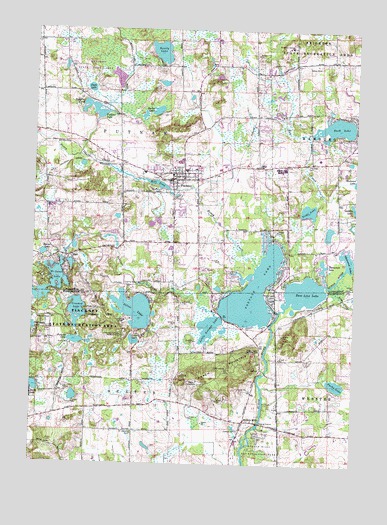
Pinckney, MI USGS Topographic Map
Click on map above to begin viewing in our Map Viewer.

This topographic map contains these locations and features:
Feature Name Type Latitude Longitude GNIS ID View Map
Arise United Methodist ChurchChurchN42.4369°W83.9356°2630483View Map
Arms CreekStreamN42.4261°W83.8847°620227View Map
Barber LakesLakeN42.4767°W83.9524°620584View Map
Base Line LakeLakeN42.4248°W83.8943°620673View Map
Beaver LakeLakeN42.4354°W83.9962°620930View Map
Bell Road Bridge Historical MarkerParkN42.4011°W83.9083°2635710View Map
Bently LakeLakeN42.4937°W83.9513°621140View Map
Birkett Post Office (historical)Post OfficeN42.4025°W83.9108°2646743View Map
Brighton CampLocaleN42.4956°W83.9008°621988View Map
Christian House of PrayerChurchN42.4250°W83.9061°2630885View Map
Community Congregational ChurchChurchN42.4589°W83.9458°2630487View Map
Country Elementary SchoolSchoolN42.4633°W83.8894°2630892View Map
Crooked LakeLakeN42.4187°W83.9825°624094View Map
Dexter Area Fire Department Station 2BuildingN42.3912°W83.9736°2620015View Map
DoverPopulated PlaceN42.4025°W83.9108°1617530View Map
Dover Historical MarkerParkN42.4011°W83.9083°2635711View Map
Duck LakeLakeN42.4830°W83.9785°624928View Map
Farley Hill Elementary SchoolSchoolN42.4786°W83.9139°2630891View Map
Galilean Baptist ChurchChurchN42.4231°W83.9053°2630884View Map
Good News Community ChapelChurchN42.4578°W83.9467°2630486View Map
Hay CreekStreamN42.4564°W83.8758°627969View Map
HellPopulated PlaceN42.4348°W83.9849°628065View Map
Hell Creek Ranch CampgroundLocaleN42.4417°W83.9689°2630887View Map
Hi-Land LakeLakeN42.4233°W83.9940°628179View Map
Hicks SchoolSchoolN42.4609°W83.9124°628216View Map
Honey CreekStreamN42.4325°W83.9127°628522View Map
Hudson CemeteryCemeteryN42.3850°W83.9191°628763View Map
Hudson MillsPopulated PlaceN42.3873°W83.9169°1617632View Map
Hudson Mills Historical MarkerParkN42.3867°W83.9107°2635733View Map
Immanuel Baptist ChurchChurchN42.4697°W83.9875°2630886View Map
Little Portage LakeLakeN42.4145°W83.9310°630740View Map
Livingston Christian SchoolSchoolN42.4594°W83.9411°2630913View Map
Losee LakeLakeN42.4104°W83.9604°631071View Map
Mill PondLakeN42.4555°W83.9519°632334View Map
Parks LakeLakeN42.3982°W83.8815°634406View Map
Pathfinder SchoolSchoolN42.4603°W83.9052°634897View Map
Peach MountainSummitN42.4028°W83.9247°634515View Map
Peoples Church of PinckneyChurchN42.4581°W83.9511°2630485View Map
Pickerel LakeLakeN42.4102°W83.9831°634778View Map
PinckneyPopulated PlaceN42.4567°W83.9463°634896View Map
Pinckney CemeteryCemeteryN42.4578°W83.9533°2631048View Map
Pinckney Community High SchoolSchoolN42.4500°W83.9317°2630912View Map
Pinckney Community LibraryBuildingN42.4533°W83.9483°2630911View Map
Pinckney Elementary SchoolSchoolN42.4589°W83.9575°2630910View Map
Pinckney Police DepartmentBuildingN42.4557°W83.9465°2630908View Map
Pinckney Post OfficePost OfficeN42.4600°W83.9278°2630903View Map
Pinckney State Recreation AreaParkN42.4261°W83.9708°634898View Map
Pinckney Station (historical)LocaleN42.4608°W83.9442°2630893View Map
Placeway CemeteryCemeteryN42.4622°W83.8930°635066View Map
Portage LakeLakeN42.4251°W83.9140°635279View Map
Portage RiverStreamN42.4178°W83.9291°635290View Map
Public Square ParkParkN42.4564°W83.9456°2630894View Map
Putnam LakeLakeN42.4767°W83.9769°635529View Map
Putnam Township Fire DepartmentBuildingN42.4647°W83.9721°2630909View Map
Roepcke PondLakeN42.4767°W83.9769°636110View Map
Rush LakeLakeN42.4723°W83.8828°636390View Map
Rush Lake Hills Golf ClubLocaleN42.4792°W83.8778°2630907View Map
Saint Josephs CemeteryCemeteryN42.3839°W83.9605°636802View Map
Saint Mary Catholic ChurchChurchN42.4444°W83.9344°2630906View Map
Saint Mary Catholic SchoolSchoolN42.4444°W83.9344°2630905View Map
Saint Marys CemeteryCemeteryN42.4536°W83.9499°636880View Map
Shalom Lutheran ChurchChurchN42.4603°W83.9117°2630488View Map
Silver LakeLakeN42.4193°W83.9606°637939View Map
Tamarack LakeLakeN42.4329°W83.8871°1614562View Map
Timber Trace Golf ClubLocaleN42.4681°W83.9722°2630904View Map
Tioga LakeLakeN42.4484°W83.8932°1614879View Map
Township of DexterCivilN42.3824°W83.9593°1626184View Map
Township of PutnamCivilN42.4671°W83.9674°1626946View Map
Village of PinckneyCivilN42.4543°W83.9455°2399675View Map
Whispering Pines Golf CourseLocaleN42.4589°W83.8986°2630902View Map
WUOM-FM (Ann Arbor)TowerN42.4067°W83.9149°1625653View Map

Note: Coordinates in the location and feature list above are referenced to NAD83 datum.


Copyright (C) 2008-2024 Ryan Niemi / Sunset Dynamics ... All Rights Reserved