TopoQuest Logo
Do you find TopoQuest useful?
Help keep TopoQuest running and adding new maps/features by donating!
Bitcoin:  19c7KJd3qBynnjoSw5npx9KScwjBe4ifkT
Litecoin:  LXs6TkuXGGXo1vDsWCkWVdjQX94eUKd6ui
Home View Maps Find Maps Find Places Resources & Links


Pine Creek, Wyoming Topographic Map

USGS Map Title: Pine Creek, WY
USGS Map MRC: 43110B7
DRG (GeoTIFF) Download: o43110b7.tif


Neighboring USGS Topographic Map Quads:


  Observation Peak, WY  
43110C8
 

  Munger Mountain, WY  
43110C7
 

  Camp Davis, WY  
43110C6
 

  Ferry Peak, WY  
43110B8
 

  Pine Creek, WY  
43110B7
 

  Bailey Lake, WY  
43110B6
 

  Stewart Peak, WY  
43110A8
 

  Deer Creek, WY  
43110A7
 

  Pickle Pass, WY  
43110A6


Map MRC Location:

N44°
W111°
N44°
W110°
H8 H7 H6 H5 H4 H3 H2 H1
G8 G7 G6 G5 G4 G3 G2 G1
F8 F7 F6 F5 F4 F3 F2 F1
E8 E7 E6 E5 E4 E3 E2 E1
D8 D7 D6 D5 D4 D3 D2 D1
C8 C7 C6 C5 C4 C3 C2 C1
B8 B7 B6 B5 B4 B3 B2 B1
A8 A7 A6 A5 A4 A3 A2 A1
N43°
W111°
N43°
W110°

Pine Creek, WY USGS 1:24K Topographic Map Preview:
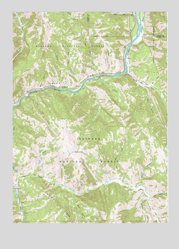
Pine Creek, WY USGS Topographic Map
Click on map above to begin viewing in our Map Viewer.

This topographic map contains these locations and features:
Feature Name Type Latitude Longitude GNIS ID View Map
Aspen HollowValleyN43.1430°W110.8258°1597825View Map
Bailey CreekStreamN43.2138°W110.7827°1597869View Map
Bull HollowValleyN43.1410°W110.7649°1598492View Map
Cabin CreekStreamN43.2485°W110.7771°1598555View Map
Cow Camp CreekStreamN43.1508°W110.7949°1598959View Map
Davis ClaimMineN43.2375°W110.7672°1726498View Map
Dry WashValleyN43.2058°W110.7641°1599385View Map
East Elbow CampgroundLocaleN43.2144°W110.7855°1608760View Map
East Table CreekStreamN43.2108°W110.8094°1599521View Map
East Table Creek CampgroundLocaleN43.2116°W110.8074°1599522View Map
Elbow Campground (historical)LocaleN43.2135°W110.7880°1599554View Map
Elk MountainSummitN43.1671°W110.8252°1599590View Map
Fire Box CreekStreamN43.1502°W110.7908°1599706View Map
Iron Rim CreekStreamN43.2002°W110.8621°1600535View Map
Keyser CreekStreamN43.2041°W110.8521°1600708View Map
Lake GulchValleyN43.2105°W110.8052°1600800View Map
Little Greys RiverStreamN43.1463°W110.8735°1600984View Map
Martin CreekStreamN43.2444°W110.7713°1601271View Map
McCain CreekStreamN43.1396°W110.7649°1601295View Map
Pine BarBarN43.2091°W110.8144°1602145View Map
Pine Bar DiggingsMineN43.2306°W110.8153°1726499View Map
Pine CreekStreamN43.2069°W110.8177°1602148View Map
Pole CanyonValleyN43.2127°W110.7974°1602240View Map
Roos CreekStreamN43.1941°W110.8741°1602625View Map
Skull CreekStreamN43.1530°W110.8694°1602947View Map
Squirrel CreekStreamN43.1458°W110.8335°1603319View Map
Station CreekStreamN43.2049°W110.8371°1603348View Map
Station Creek CampgroundLocaleN43.2044°W110.8344°1603349View Map
Trail CreekStreamN43.1538°W110.8608°1603726View Map
West Bailey CreekStreamN43.2066°W110.7716°1604032View Map
West Table CreekStreamN43.2063°W110.8194°1604101View Map
West Table Creek Boat RampLocaleN43.2066°W110.8199°1608761View Map
Whiskey CreekStreamN43.1463°W110.7766°1604126View Map

Note: Coordinates in the location and feature list above are referenced to NAD83 datum.


Copyright (C) 2008-2025 Ryan Niemi / Sunset Dynamics ... All Rights Reserved