TopoQuest Logo
Do you find TopoQuest useful?
Help keep TopoQuest running and adding new maps/features by donating!
Bitcoin:  19c7KJd3qBynnjoSw5npx9KScwjBe4ifkT
Litecoin:  LXs6TkuXGGXo1vDsWCkWVdjQX94eUKd6ui
Home View Maps Find Maps Find Places Resources & Links


Piquett Creek, Montana Topographic Map

USGS Map Title: Piquett Creek, MT
USGS Map MRC: 45114G2
DRG (GeoTIFF) Download: o45114g2.tif


Neighboring USGS Topographic Map Quads:


  Trapper Peak, MT  
45114H3
 

  Burnt Ridge, MT  
45114H2
 

  Robbins Gulch, MT  
45114H1
 

  Boulder Peak, MT  
45114G3
 

  Piquett Creek, MT  
45114G2
 

  Medicine Hot Springs, MT  
45114G1
 

  Painted Rocks Lake, MT  
45114F3
 

  Piquett Mountain, MT  
45114F2
 

  Overwhich Falls, MT  
45114F1


Map MRC Location:

N46°
W115°
N46°
W114°
H8 H7 H6 H5 H4 H3 H2 H1
G8 G7 G6 G5 G4 G3 G2 G1
F8 F7 F6 F5 F4 F3 F2 F1
E8 E7 E6 E5 E4 E3 E2 E1
D8 D7 D6 D5 D4 D3 D2 D1
C8 C7 C6 C5 C4 C3 C2 C1
B8 B7 B6 B5 B4 B3 B2 B1
A8 A7 A6 A5 A4 A3 A2 A1
N45°
W115°
N45°
W114°

Piquett Creek, MT USGS 1:24K Topographic Map Preview:
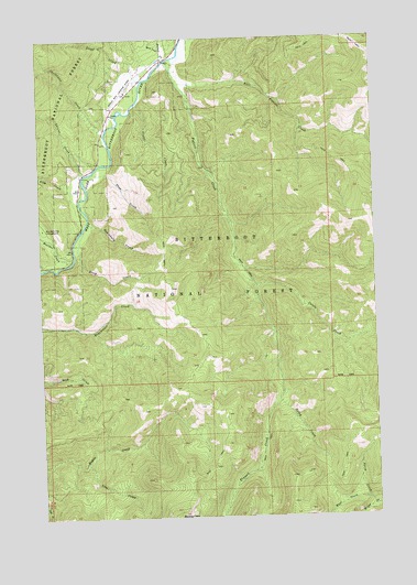
Piquett Creek, MT USGS Topographic Map
Click on map above to begin viewing in our Map Viewer.

This topographic map contains these locations and features:
Feature Name Type Latitude Longitude GNIS ID View Map
Applebury CreekStreamN45.8271°W114.2329°779105View Map
Baker CreekStreamN45.8694°W114.2018°779267View Map
Billings Memorial CampgroundLocaleN45.8194°W114.2481°1803023View Map
Boulder CreekStreamN45.8169°W114.2390°780260View Map
Boulder Creek CampgroundLocaleN45.8258°W114.2495°780266View Map
Britts CreekStreamN45.8152°W114.1754°793871View Map
Buck Creek SaddleGapN45.7783°W114.2187°799082View Map
Castle CreekStreamN45.8102°W114.1706°781020View Map
Christisen CreekStreamN45.8513°W114.2251°781254View Map
East Piquett CreekStreamN45.8633°W114.1984°782946View Map
House CreekStreamN45.8724°W114.2043°785098View Map
Lavene CreekStreamN45.8399°W114.2340°785988View Map
Line CreekStreamN45.7641°W114.2351°786177View Map
Lloyd CreekStreamN45.8644°W114.2109°786404View Map
North CreekStreamN45.7527°W114.1273°788078View Map
Notch CreekStreamN45.7802°W114.1623°788326View Map
Pine CreekStreamN45.8402°W114.2304°788876View Map
Piquett CreekStreamN45.8708°W114.1970°788955View Map
Rocky KnobSummitN45.8269°W114.1254°789734View Map
Rs West Fork LodgeLocaleN45.8666°W114.2093°1803021View Map
Steep CreekStreamN45.8255°W114.2345°791483View Map
Troy CreekStreamN45.8349°W114.2379°792412View Map
Violet CreekStreamN45.8585°W114.2134°792719View Map
West CreekStreamN45.7541°W114.1287°792964View Map
West Fork Lodge AirportAirportN45.8641°W114.2158°806391View Map
West Fork Volunteer Fire Department and Quick Response UnitBuildingN45.8605°W114.2180°2546677View Map

Note: Coordinates in the location and feature list above are referenced to NAD83 datum.


Copyright (C) 2008-2025 Ryan Niemi / Sunset Dynamics ... All Rights Reserved