TopoQuest Logo
Do you find TopoQuest useful?
Help keep TopoQuest running and adding new maps/features by donating!
Bitcoin:  19c7KJd3qBynnjoSw5npx9KScwjBe4ifkT
Litecoin:  LXs6TkuXGGXo1vDsWCkWVdjQX94eUKd6ui
Home View Maps Find Maps Find Places Resources & Links


Pitkin, Colorado Topographic Map

USGS Map Title: Pitkin, CO
USGS Map MRC: 38106E5
DRG (GeoTIFF) Download: o38106e5.tif


Neighboring USGS Topographic Map Quads:


  Crystal Creek, CO  
38106F6
 

  Fairview Peak, CO  
38106F5
 

  Cumberland Pass, CO  
38106F4
 

  Parlin, CO  
38106E6
 

  Pitkin, CO  
38106E5
 

  Whitepine, CO  
38106E4
 

  Houston Gulch, CO  
38106D6
 

  Doyleville, CO  
38106D5
 

  Sargents, CO  
38106D4


Map MRC Location:

N39°
W107°
N39°
W106°
H8 H7 H6 H5 H4 H3 H2 H1
G8 G7 G6 G5 G4 G3 G2 G1
F8 F7 F6 F5 F4 F3 F2 F1
E8 E7 E6 E5 E4 E3 E2 E1
D8 D7 D6 D5 D4 D3 D2 D1
C8 C7 C6 C5 C4 C3 C2 C1
B8 B7 B6 B5 B4 B3 B2 B1
A8 A7 A6 A5 A4 A3 A2 A1
N38°
W107°
N38°
W106°

Pitkin, CO USGS 1:24K Topographic Map Preview:
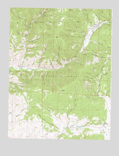
Pitkin, CO USGS Topographic Map
Click on map above to begin viewing in our Map Viewer.

This topographic map contains these locations and features:
Feature Name Type Latitude Longitude GNIS ID View Map
Armstrong CanyonValleyN38.6070°W106.5216°188973View Map
Bazooka QuarryMineN38.5358°W106.6136°1745719View Map
Bear GulchValleyN38.5966°W106.6031°189036View Map
Bluebird GulchValleyN38.5647°W106.6117°189046View Map
Box CanyonValleyN38.5115°W106.5527°189043View Map
Campbelltown (historical)Populated PlaceN38.6122°W106.5653°189069View Map
Campbird GulchValleyN38.5585°W106.5146°189085View Map
Campbird MineMineN38.5686°W106.5206°189079View Map
Carter LakeReservoirN38.6197°W106.5856°189061View Map
Carter MineMineN38.6119°W106.5953°189060View Map
Comanche CampgroundLocaleN38.5989°W106.6034°189059View Map
Comanche GulchValleyN38.6034°W106.6009°188951View Map
Copper MountainSummitN38.5708°W106.5186°189078View Map
Dutch Flats GulchValleyN38.6245°W106.5825°189066View Map
Dutch GulchValleyN38.5933°W106.6043°189062View Map
Farlee GulchValleyN38.5548°W106.5153°189087View Map
Fish Hatchery GulchValleyN38.5985°W106.5327°189071View Map
Freeman GulchValleyN38.5662°W106.5788°189051View Map
Gold CreekStreamN38.5653°W106.6128°188975View Map
Greathouse GulchValleyN38.5109°W106.5559°189042View Map
Gunsight TrailTrailN38.6083°W106.6048°203372View Map
Gurley GulchValleyN38.6117°W106.5963°189063View Map
Hot Springs Creek DamDamN38.5133°W106.5423°199612View Map
Hot Springs ReservoirReservoirN38.5122°W106.5379°189038View Map
Illinois GulchValleyN38.5687°W106.6191°189057View Map
Independence GulchValleyN38.5625°W106.5117°189083View Map
Islet MountainSummitN38.6239°W106.5528°189067View Map
Jones GulchValleyN38.6136°W106.5937°189064View Map
Kimmel GulchValleyN38.6116°W106.5080°188972View Map
Last Chance GulchValleyN38.5868°W106.6045°189058View Map
Limekiln GulchValleyN38.6114°W106.5021°188974View Map
Lincoln GulchValleyN38.5623°W106.5112°189082View Map
Line SpringSpringN38.5241°W106.6209°189041View Map
Little Katherine QuarryMineN38.5330°W106.6184°1745720View Map
Little Percent GulchValleyN38.5697°W106.5593°189055View Map
Long Bridge GulchValleyN38.5665°W106.5695°189054View Map
Lookout MountainSummitN38.5464°W106.5609°189045View Map
Lookout Mountain Area MineMineN38.5644°W106.5617°1745721View Map
Lorrain GulchValleyN38.5408°W106.5138°189044View Map
Lower Waunita Hot SpringsSpringN38.5169°W106.5156°1794707View Map
McIntyre GulchValleyN38.5669°W106.5906°196531View Map
Mingo GulchValleyN38.5521°W106.5159°189088View Map
OhioPopulated PlaceN38.5667°W106.6117°189049View Map
Ohio City CemeteryCemeteryN38.5717°W106.6197°2123879View Map
Ohio City Fire DepartmentBuildingN38.5677°W106.6107°2667360View Map
PitkinPopulated PlaceN38.6092°W106.5167°204755View Map
Pitkin CampgroundLocaleN38.6106°W106.5011°189075View Map
Pitkin CemeteryCemeteryN38.6058°W106.5283°2123882View Map
Pitkin Fire DepartmentBuildingN38.6090°W106.5187°2666922View Map
Pitkin Post OfficePost OfficeN38.6084°W106.5192°2734557View Map
Pole GulchValleyN38.5662°W106.6070°189047View Map
Powderhouse GulchValleyN38.5942°W106.5292°189402View Map
Quartz DomeSummitN38.5975°W106.5686°189070View Map
Raymond MineMineN38.6208°W106.5836°189073View Map
Red Jacket GulchValleyN38.6008°W106.5310°189072View Map
Revenue GulchValleyN38.5658°W106.5820°189050View Map
Roosevelt GulchValleyN38.5758°W106.5481°189080View Map
Roosevelt Picnic AreaLocaleN38.5797°W106.5420°189081View Map
Rosebud GulchValleyN38.5666°W106.5674°189052View Map
Schoolhouse GulchValleyN38.6106°W106.5124°189074View Map
Spring CreekStreamN38.5133°W106.5078°189039View Map
Spring GulchValleyN38.6188°W106.5856°189065View Map
Sullivan GulchValleyN38.5571°W106.5156°189086View Map
Tie GulchValleyN38.5714°W106.5564°189053View Map
Town of PitkinCivilN38.6086°W106.5165°2413138View Map
Upper Waunita Hot SpringsSpringN38.5139°W106.5086°1794708View Map
Wade GulchValleyN38.5815°W106.5399°189077View Map
Waunita Hot SpringsPopulated PlaceN38.5142°W106.5084°204754View Map
Waunita PassGapN38.5783°W106.5095°189076View Map
West MountainSummitN38.6125°W106.5434°189068View Map
Whiskey GulchValleyN38.5661°W106.5917°189048View Map
White Spar Number One MineMineN38.5514°W106.6045°1745722View Map
White Spar Number Two MineMineN38.5514°W106.6045°1745723View Map
Wiley GulchValleyN38.5407°W106.5061°189084View Map
Yellow Pine RidgeRidgeN38.5264°W106.5906°189040View Map

Note: Coordinates in the location and feature list above are referenced to NAD83 datum.


Copyright (C) 2008-2025 Ryan Niemi / Sunset Dynamics ... All Rights Reserved