TopoQuest Logo
Do you find TopoQuest useful?
Help keep TopoQuest running and adding new maps/features by donating!
Bitcoin:  19c7KJd3qBynnjoSw5npx9KScwjBe4ifkT
Litecoin:  LXs6TkuXGGXo1vDsWCkWVdjQX94eUKd6ui
Home View Maps Find Maps Find Places Resources & Links


Piute Knoll, Utah Topographic Map

USGS Map Title: Piute Knoll, UT
USGS Map MRC: 37109H1
DRG (GeoTIFF) Download: o37109h1.tif


Neighboring USGS Topographic Map Quads:


  Sop Canyon, UT  
38109A2
 

  Summit Point, UT  
38109A1
 

  Horse Range Mesa, CO  
38108A8
 

  Eastland NW, UT  
37109H2
 

  Piute Knoll, UT  
37109H1
 

  Egnar, CO  
37108H8
 

  Eastland, UT  
37109G2
 

  Northdale, CO  
37109G1
 

  Dove Creek, CO  
37108G8


Map MRC Location:

N38°
W110°
N38°
W109°
H8 H7 H6 H5 H4 H3 H2 H1
G8 G7 G6 G5 G4 G3 G2 G1
F8 F7 F6 F5 F4 F3 F2 F1
E8 E7 E6 E5 E4 E3 E2 E1
D8 D7 D6 D5 D4 D3 D2 D1
C8 C7 C6 C5 C4 C3 C2 C1
B8 B7 B6 B5 B4 B3 B2 B1
A8 A7 A6 A5 A4 A3 A2 A1
N37°
W110°
N37°
W109°

Piute Knoll, UT USGS 1:24K Topographic Map Preview:
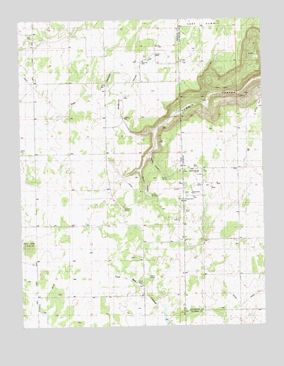
Piute Knoll, UT USGS Topographic Map
Click on map above to begin viewing in our Map Viewer.

This topographic map contains these locations and features:
Feature Name Type Latitude Longitude GNIS ID View Map
Bishop PointCliffN37.9664°W109.0004°202371View Map
Black Spider MineMineN37.9642°W109.0062°1735994View Map
Bluebird MineMineN37.9761°W109.0218°1735995View Map
Burn SchoolSchoolN37.9103°W109.0148°176269View Map
Calliham MineMineN37.9600°W109.0721°1437912View Map
Deremo Mine Number 1MineN37.9380°W109.0343°1947908View Map
Dermo Mine Number 2MineN37.9292°W109.0376°1947904View Map
East Summit SchoolSchoolN37.9200°W109.0732°1437900View Map
Eloise MineMineN37.9319°W109.0334°1735854View Map
Geisinger MineMineN37.9325°W109.0004°1734108View Map
Hazel Group MineMineN37.9867°W109.0137°1735839View Map
Ingram SpringSpringN37.8944°W109.0604°1437901View Map
Last Hope MineMineN37.9753°W109.0232°1735996View Map
Lucky Strike MineMineN37.9722°W109.0084°1735997View Map
Marie MineMineN37.9714°W109.0084°1735998View Map
Mercantile MineMineN37.9892°W109.0057°1763868View Map
Piute KnollSummitN37.9085°W109.1207°1437905View Map
Piute SpringSpringN37.8924°W109.0649°1437904View Map
Red Ant MineMineN37.9614°W109.0062°1763865View Map
Rustler CanyonValleyN37.9454°W109.0593°1437906View Map
Rustler SpringSpringN37.9357°W109.0500°1437915View Map
Sage MineMineN37.9564°W109.0521°1437916View Map
Secret CanyonValleyN37.9388°W109.0638°1437907View Map
Secret SpringsSpringN37.9276°W109.0580°1437917View Map
Silver Bell MineMineN37.9830°W109.0615°1437918View Map
Snyder MineMineN37.9267°W109.0409°1947903View Map
Snyder Reservoir Number TwoReservoirN37.8777°W109.0520°1437910View Map
Summit SpringSpringN37.9231°W109.0729°1437919View Map
Wildhorse CanyonValleyN37.9539°W109.0554°1437909View Map
Wilson MineMineN37.9858°W109.0551°1437920View Map

Note: Coordinates in the location and feature list above are referenced to NAD83 datum.


Copyright (C) 2008-2025 Ryan Niemi / Sunset Dynamics ... All Rights Reserved