TopoQuest Logo
Do you find TopoQuest useful?
Help keep TopoQuest running and adding new maps/features by donating!
Bitcoin:  19c7KJd3qBynnjoSw5npx9KScwjBe4ifkT
Litecoin:  LXs6TkuXGGXo1vDsWCkWVdjQX94eUKd6ui
Home View Maps Find Maps Find Places Resources & Links


Placerville, Colorado Topographic Map

USGS Map Title: Placerville, CO
USGS Map MRC: 38108A1
DRG (GeoTIFF) Download: o38108a1.tif


Neighboring USGS Topographic Map Quads:


  Sanborn Park, CO  
38108B2
 

  Hotchkiss Reservoir, CO  
38108B1
 

  Horsefly Peak, CO  
38107B8
 

  Gurley Canyon, CO  
38108A2
 

  Placerville, CO  
38108A1
 

  Sams, CO  
38107A8
 

  Beaver Park, CO  
37108H2
 

  Little Cone, CO  
37108H1
 

  Gray Head, CO  
37107H8


Map MRC Location:

N39°
W109°
N39°
W108°
H8 H7 H6 H5 H4 H3 H2 H1
G8 G7 G6 G5 G4 G3 G2 G1
F8 F7 F6 F5 F4 F3 F2 F1
E8 E7 E6 E5 E4 E3 E2 E1
D8 D7 D6 D5 D4 D3 D2 D1
C8 C7 C6 C5 C4 C3 C2 C1
B8 B7 B6 B5 B4 B3 B2 B1
A8 A7 A6 A5 A4 A3 A2 A1
N38°
W109°
N38°
W108°

Placerville, CO USGS 1:24K Topographic Map Preview:
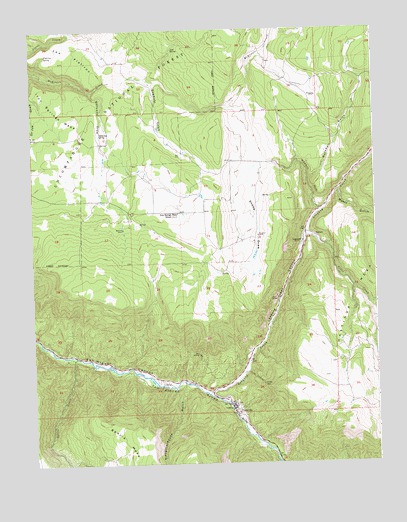
Placerville, CO USGS Topographic Map
Click on map above to begin viewing in our Map Viewer.

This topographic map contains these locations and features:
Feature Name Type Latitude Longitude GNIS ID View Map
Alder CreekStreamN38.0655°W108.0265°186239View Map
Alpha and Gamma MineMineN38.0219°W108.0342°1745508View Map
Black King MineMineN38.0250°W108.0442°1735674View Map
Black King MineMineN38.0236°W108.0495°1745509View Map
BrownLocaleN38.0653°W108.0228°186235View Map
Crescent City MineMineN38.0161°W108.0537°1745510View Map
Donegan Placer MineMineN38.0205°W108.0526°1745511View Map
Donovan Placer MineMineN38.0205°W108.0526°1745512View Map
E Bar Placer MineMineN38.0161°W108.0526°1745513View Map
East Fork Mc Kenzie CreekStreamN38.1230°W108.0370°186144View Map
Evans Claims MineMineN38.0367°W108.0792°1745514View Map
Flatiron SpringSpringN38.1180°W108.1196°186226View Map
Galloway DrawValleyN38.1074°W108.1031°186230View Map
Galloway SpringSpringN38.0952°W108.1001°186227View Map
Gold Ledge Placer MineMineN38.0169°W108.0523°1745515View Map
Grumwald MineMineN38.0161°W108.0526°1745516View Map
Guthrie PitMineN38.0161°W108.0526°1745517View Map
Gutshall GulchValleyN38.0812°W108.0248°186233View Map
Haskill HillCliffN38.0828°W108.0234°186234View Map
Idaho MineMineN38.0367°W108.1167°1745518View Map
Iron Springs MesaSummitN38.0494°W108.0992°203201View Map
Iron Springs Mesa SchoolLocaleN38.0722°W108.0723°186231View Map
Ironside MineMineN38.0161°W108.0526°1745519View Map
Laen MineMineN38.0019°W108.0317°1745520View Map
Lemon Hot SpringSpringN38.0153°W108.0537°1735249View Map
Leonard (historical)Populated PlaceN38.0639°W108.0270°186236View Map
Leopard CreekStreamN38.0200°W108.0617°186240View Map
Leopard Creek CanyonValleyN38.0199°W108.0613°186242View Map
Leopard MineMineN38.0339°W108.0417°1735672View Map
Lost SpringSpringN38.1193°W108.0732°186238View Map
Massy GulchValleyN38.0781°W108.0139°186241View Map
Omega MineMineN38.0230°W108.0417°186237View Map
PlacervillePopulated PlaceN38.0167°W108.0534°204743View Map
Placerville Fire StationBuildingN38.0188°W108.0554°2667180View Map
Placerville HeliportAirportN38.0164°W108.0512°204553View Map
Placerville Post OfficePost OfficeN38.0173°W108.0535°1795014View Map
Placerville School (historical)SchoolN38.0180°W108.0559°1795015View Map
Pocahontas MineMineN38.0169°W108.0523°1735675View Map
Pretty Blue MineMineN38.1219°W108.1223°1735676View Map
Sawdust GulchValleyN38.1108°W108.0831°186229View Map
Sheep DrawValleyN38.0852°W108.0438°186232View Map
Single Jack MineMineN38.0347°W108.0417°1735671View Map
Slaughterhouse GulchValleyN38.0229°W108.0706°176424View Map
Specie CreekStreamN38.0308°W108.1098°176423View Map
Specie Creek CanyonValleyN38.0302°W108.1106°196888View Map
The FlatironSummitN38.1117°W108.1012°186225View Map
Wave Bar MineMineN38.0217°W108.0615°1745522View Map
White Crow MineMineN38.0169°W108.0548°1735875View Map
White Spar MineMineN38.0250°W108.0442°1735673View Map
Wilson and Chambers MineMineN38.0169°W108.0523°1745523View Map

Note: Coordinates in the location and feature list above are referenced to NAD83 datum.


Copyright (C) 2008-2024 Ryan Niemi / Sunset Dynamics ... All Rights Reserved