TopoQuest Logo
Do you find TopoQuest useful?
Help keep TopoQuest running and adding new maps/features by donating!
Bitcoin:  19c7KJd3qBynnjoSw5npx9KScwjBe4ifkT
Litecoin:  LXs6TkuXGGXo1vDsWCkWVdjQX94eUKd6ui
Home View Maps Find Maps Find Places Resources & Links


Pleasant Valley, Idaho Topographic Map

USGS Map Title: Pleasant Valley, ID
USGS Map MRC: 42116E7
DRG (GeoTIFF) Download: o42116e7.tif


Neighboring USGS Topographic Map Quads:


  Cliffs, ID  
42116F8
 

  Indian Meadows, ID  
42116F7
 

  Wickiup Creek, ID  
42116F6
 

  Fairylawn, ID  
42116E8
 

  Pleasant Valley, ID  
42116E7
 

  Slack Mountain, ID  
42116E6
 

  Bedstead Ridge, ID  
42116D8
 

  Smith Creek, ID  
42116D7
 

  Castro Table, ID  
42116D6


Map MRC Location:

N43°
W117°
N43°
W116°
H8 H7 H6 H5 H4 H3 H2 H1
G8 G7 G6 G5 G4 G3 G2 G1
F8 F7 F6 F5 F4 F3 F2 F1
E8 E7 E6 E5 E4 E3 E2 E1
D8 D7 D6 D5 D4 D3 D2 D1
C8 C7 C6 C5 C4 C3 C2 C1
B8 B7 B6 B5 B4 B3 B2 B1
A8 A7 A6 A5 A4 A3 A2 A1
N42°
W117°
N42°
W116°

Pleasant Valley, ID USGS 1:24K Topographic Map Preview:
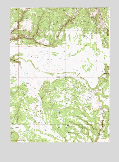
Pleasant Valley, ID USGS Topographic Map
Click on map above to begin viewing in our Map Viewer.

This topographic map contains these locations and features:
Feature Name Type Latitude Longitude GNIS ID View Map
Bills SpringSpringN42.5138°W116.8152°371546View Map
Boni SpringSpringN42.5414°W116.7743°371640View Map
Dons CreekStreamN42.6066°W116.7587°372441View Map
Dutch OvenBasinN42.5085°W116.7612°372518View Map
East Fork Pleasant Valley CreekStreamN42.5491°W116.8482°372558View Map
Indian Battleground ReservoirReservoirN42.5985°W116.7786°373212View Map
Joes Folly ReservoirReservoirN42.5238°W116.7928°373319View Map
Meadow SpringSpringN42.5327°W116.7831°373899View Map
Minks DrinkSpringN42.5149°W116.8043°373972View Map
Nickel Creek ReservoirReservoirN42.5601°W116.8123°374147View Map
Nickel Creek SpringSpringN42.5473°W116.7761°374148View Map
Nickel Creek TableSummitN42.5768°W116.7673°396960View Map
Noon CreekStreamN42.5965°W116.8724°374164View Map
North Fork Owyhee WildernessReserveN42.6160°W116.8010°2760115View Map
Pleasant ValleyValleyN42.5477°W116.8465°374445View Map
Pleasant Valley PlacePopulated PlaceN42.5404°W116.8373°397048View Map
Pleasant Valley TableSummitN42.5768°W116.8218°397049View Map
Rays ReservoirReservoirN42.5307°W116.8211°374610View Map
Sandy ReservoirReservoirN42.5088°W116.7990°374902View Map
Stoneman Creek SpringSpringN42.5631°W116.7516°375296View Map
Stoneman SpringSpringN42.6159°W116.7742°375297View Map
Swamp SpringSpringN42.6246°W116.7846°375368View Map
Teacup SpringSpringN42.5103°W116.7594°375415View Map
Teakettle SpringSpringN42.5054°W116.7608°375419View Map
Tobacco MeadowFlatN42.5985°W116.7768°375539View Map
Twin ReservoirsReservoirN42.5189°W116.8021°375638View Map
Weaner SpringSpringN42.5393°W116.7758°375774View Map
Wilson PastureFlatN42.5154°W116.8276°375952View Map

Note: Coordinates in the location and feature list above are referenced to NAD83 datum.


Copyright (C) 2008-2024 Ryan Niemi / Sunset Dynamics ... All Rights Reserved