TopoQuest Logo
Do you find TopoQuest useful?
Help keep TopoQuest running and adding new maps/features by donating!
Bitcoin:  19c7KJd3qBynnjoSw5npx9KScwjBe4ifkT
Litecoin:  LXs6TkuXGGXo1vDsWCkWVdjQX94eUKd6ui
Home View Maps Find Maps Find Places Resources & Links


Smith Creek, Idaho Topographic Map

USGS Map Title: Smith Creek, ID
USGS Map MRC: 42116D7
DRG (GeoTIFF) Download: o42116d7.tif


Neighboring USGS Topographic Map Quads:


  Fairylawn, ID  
42116E8
 

  Pleasant Valley, ID  
42116E7
 

  Slack Mountain, ID  
42116E6
 

  Bedstead Ridge, ID  
42116D8
 

  Smith Creek, ID  
42116D7
 

  Castro Table, ID  
42116D6
 

  Bull Basin Camp, ID  
42116C8
 

  Red Basin, ID  
42116C7
 

  Brace Flat, ID  
42116C6


Map MRC Location:

N43°
W117°
N43°
W116°
H8 H7 H6 H5 H4 H3 H2 H1
G8 G7 G6 G5 G4 G3 G2 G1
F8 F7 F6 F5 F4 F3 F2 F1
E8 E7 E6 E5 E4 E3 E2 E1
D8 D7 D6 D5 D4 D3 D2 D1
C8 C7 C6 C5 C4 C3 C2 C1
B8 B7 B6 B5 B4 B3 B2 B1
A8 A7 A6 A5 A4 A3 A2 A1
N42°
W117°
N42°
W116°

Smith Creek, ID USGS 1:24K Topographic Map Preview:
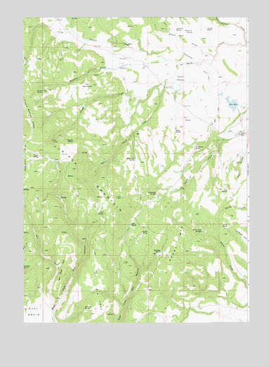
Smith Creek, ID USGS Topographic Map
Click on map above to begin viewing in our Map Viewer.

This topographic map contains these locations and features:
Feature Name Type Latitude Longitude GNIS ID View Map
Bear CreekStreamN42.3813°W116.8585°371395View Map
Bear Creek PointCliffN42.3963°W116.8548°371400View Map
Beaver Creek SpringsSpringN42.4124°W116.7761°371420View Map
Boggy SpringSpringN42.4541°W116.7905°371630View Map
Buckaroo SpringSpringN42.4949°W116.7902°371742View Map
Buckskin SpringSpringN42.4043°W116.7986°371756View Map
Castlehead SpringSpringN42.4279°W116.8018°371911View Map
Craig CampLocaleN42.3999°W116.8198°372233View Map
Davis SpringSpringN42.4147°W116.7651°372324View Map
Dug SpringSpringN42.4290°W116.7620°372506View Map
East SpringSpringN42.4153°W116.8154°372578View Map
Grasshopper TrailTrailN42.4882°W116.7907°372906View Map
Juniper MountainSummitN42.4441°W116.8537°373368View Map
Little Smith CreekStreamN42.4738°W116.7968°373670View Map
Little Thomas CreekStreamN42.4829°W116.7957°373675View Map
Moonshine SpringSpringN42.4418°W116.8133°374011View Map
Roaring SpringSpringN42.3811°W116.8414°374707View Map
Rock SpringSpringN42.4201°W116.8304°374737View Map
Rough MountainSummitN42.4043°W116.7835°398072View Map
Smith CreekStreamN42.4885°W116.7512°375080View Map
Smith MeadowFlatN42.4746°W116.7879°390695View Map
Sommerville DamDamN42.4649°W116.7593°398698View Map
Stanford SpringSpringN42.4494°W116.8474°375245View Map
Star RanchLocaleN42.4524°W116.7532°375255View Map
Star Ranch SpringSpringN42.4466°W116.7800°375256View Map
Star ReservoirReservoirN42.4644°W116.7591°398699View Map
The MonumentsAreaN42.4710°W116.8398°375468View Map
The PeteLocaleN42.4785°W116.8212°375472View Map
Thomas CreekStreamN42.4810°W116.7887°375485View Map
Thomas Creek SpringSpringN42.4699°W116.8675°375486View Map
Three SpringsSpringN42.4493°W116.8592°375506View Map
Trout SpringSpringN42.4433°W116.8663°375591View Map
Wildhorse SpringsSpringN42.3992°W116.8744°375902View Map
Wilson CreekStreamN42.4841°W116.7693°375946View Map
Wilson Creek SpringSpringN42.4940°W116.7812°375947View Map
Wonder SpringSpringN42.4121°W116.8094°375979View Map
Yarrow SpringSpringN42.4950°W116.7733°376006View Map

Note: Coordinates in the location and feature list above are referenced to NAD83 datum.


Copyright (C) 2008-2024 Ryan Niemi / Sunset Dynamics ... All Rights Reserved