TopoQuest Logo
Do you find TopoQuest useful?
Help keep TopoQuest running and adding new maps/features by donating!
Bitcoin:  19c7KJd3qBynnjoSw5npx9KScwjBe4ifkT
Litecoin:  LXs6TkuXGGXo1vDsWCkWVdjQX94eUKd6ui
Home View Maps Find Maps Find Places Resources & Links


Plentywood, Montana Topographic Map

USGS Map Title: Plentywood, MT
USGS Map MRC: 48104G5
DRG (GeoTIFF) Download: o48104g5.tif


Neighboring USGS Topographic Map Quads:


  Plentywood NW, MT  
48104H6
 

  Raymond, MT  
48104H5
 

  Dooley, MT  
48104H4
 

  Plentywood SW, MT  
48104G6
 

  Plentywood, MT  
48104G5
 

  Dooley SW, MT  
48104G4
 

  Kisler Butte, MT  
48104F6
 

  Shippe Canyon, MT  
48104F5
 

  Antelope, MT  
48104F4


Map MRC Location:

N49°
W105°
N49°
W104°
H8 H7 H6 H5 H4 H3 H2 H1
G8 G7 G6 G5 G4 G3 G2 G1
F8 F7 F6 F5 F4 F3 F2 F1
E8 E7 E6 E5 E4 E3 E2 E1
D8 D7 D6 D5 D4 D3 D2 D1
C8 C7 C6 C5 C4 C3 C2 C1
B8 B7 B6 B5 B4 B3 B2 B1
A8 A7 A6 A5 A4 A3 A2 A1
N48°
W105°
N48°
W104°

Plentywood, MT USGS 1:24K Topographic Map Preview:
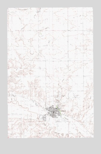
Plentywood, MT USGS Topographic Map
Click on map above to begin viewing in our Map Viewer.

This topographic map contains these locations and features:
Feature Name Type Latitude Longitude GNIS ID View Map
35N54E13DBBB01 WellWellN48.7873°W104.5908°1636542View Map
35N54E14AADC01 WellWellN48.7917°W104.6038°1636554View Map
35N55E03ABBA01 WellWellN48.8228°W104.5016°1636716View Map
35N55E19ADCA01 WellWellN48.7742°W104.5622°1636471View Map
35N55E19ADDB01 WellWellN48.7745°W104.5608°1636478View Map
35N55E19ADDB02 WellWellN48.7745°W104.5608°1636479View Map
35N55E19ADDB03 WellWellN48.7745°W104.5608°1636480View Map
35N55E19DAC_01 WellWellN48.7709°W104.5636°1636455View Map
35N55E19DAD_01 WellWellN48.7703°W104.5616°1636452View Map
35N55E20ACCA01 WellWellN48.7739°W104.5463°1636469View Map
35N55E20BAB_01 WellWellN48.7792°W104.5513°1636498View Map
35N55E20BAB_02 WellWellN48.7792°W104.5513°1636499View Map
35N55E20BBCB01 WellWellN48.7778°W104.5588°1636494View Map
35N55E20BDBC01 WellWellN48.7753°W104.5533°1636484View Map
35N55E20DCAD01 WellWellN48.7684°W104.5436°1636441View Map
35N55E20DCBA__ WellWellN48.7689°W104.5455°1636443View Map
35N55E20DCBB__ WellWellN48.7692°W104.5472°1636446View Map
35N55E21CDBB01 WellWellN48.7692°W104.5308°1636445View Map
35N55E28BBAD01 WellWellN48.7642°W104.5330°1636420View Map
35N55E28BDAD01 WellWellN48.7603°W104.5263°1636407View Map
35N55E28BDCA01 WellWellN48.7600°W104.5300°1636400View Map
35N55E28BDDD01 WellWellN48.7592°W104.5266°1636393View Map
36N47E12CA__01 WellWellN48.7995°W104.5961°1636597View Map
36N47E12CA__02 WellWellN48.7995°W104.5961°1636598View Map
36N54E36CDDB01 WellWellN48.8245°W104.5930°1636722View Map
Ag Grain IncorporatedLocaleN48.7717°W104.5566°1677590View Map
Assembly of God ChurchChurchN48.7767°W104.5661°1677414View Map
Bethel Evangelical ChurchChurchN48.7806°W104.5586°1677427View Map
Bolster Dam CampgroundsLocaleN48.7845°W104.5525°1677419View Map
Box Elder Creek DamDamN48.7717°W104.5522°796064View Map
Boxelder LakeReservoirN48.7897°W104.5506°799102View Map
Church of ChristChurchN48.7714°W104.5505°1677430View Map
City of PlentywoodCivilN48.7760°W104.5573°2411443View Map
Columbia Grain International IncorporatedLocaleN48.7598°W104.5138°1677588View Map
Daniels / Sheridan Special Education Cooperative SchoolSchoolN48.7786°W104.5550°1677543View Map
Family Chiropractic CenterHospitalN48.7750°W104.5572°1677409View Map
First Baptist Church - PlentywoodChurchN48.7753°W104.5477°1677412View Map
First Congregational United Church of ChristChurchN48.7767°W104.5566°1677426View Map
Harry DeSilva City ParkParkN48.7798°W104.5530°1677400View Map
Harrys CreekStreamN48.8564°W104.6005°772180View Map
KATQ-AM (Plentywood)TowerN48.7675°W104.5463°806599View Map
KATQ-FM (Plentywood)TowerN48.7850°W104.5338°806710View Map
Marron CreekStreamN48.7639°W104.5322°777060View Map
Marsh DamDamN48.7667°W104.5438°796666View Map
McCoy CreekStreamN48.7834°W104.6197°773982View Map
Medical ClinicHospitalN48.7795°W104.5636°1677408View Map
MercLocaleN48.7556°W104.5144°1677557View Map
Mill ParkParkN48.7734°W104.5475°1677434View Map
Pioneer Manor Retirement HomeBuildingN48.7811°W104.5600°1677428View Map
PlentywoodPopulated PlaceN48.7748°W104.5625°775295View Map
PlentywoodLocaleN48.7736°W104.5602°1677542View Map
Plentywood Can-Am RV ParkLocaleN48.7789°W104.5536°1677418View Map
Plentywood CemeteryCemeteryN48.7806°W104.5472°1677403View Map
Plentywood City Volunteer Fire DepartmentBuildingN48.7747°W104.5609°1637563View Map
Plentywood Golf ClubLocaleN48.7842°W104.5661°1677433View Map
Plentywood Lutheran ParishChurchN48.7731°W104.5555°1677424View Map
Plentywood Memorial CemeteryCemeteryN48.7870°W104.5338°1677402View Map
Plentywood Police DepartmentBuildingN48.7786°W104.5563°1637562View Map
Plentywood Post OfficePost OfficeN48.7764°W104.5571°1677544View Map
Plentywood SchoolSchoolN48.7786°W104.5550°1677537View Map
Plentywood Seventh Day Adventist ChurchChurchN48.7792°W104.5641°1677429View Map
Plentywood Vision CenterHospitalN48.7750°W104.5577°1677410View Map
Polly ParkParkN48.7698°W104.5463°1677435View Map
Raymond Park and Recreation AreaParkN48.8728°W104.5797°1677391View Map
Saint Josephs Catholic ChurchChurchN48.7767°W104.5583°1677425View Map
Sher-Wood AirportAirportN48.7884°W104.5255°806871View Map
Sheridan County Agriculture Museum and Civic CenterBuildingN48.7706°W104.5388°1677405View Map
Sheridan County CourthouseBuildingN48.7786°W104.5563°1677431View Map
Sheridan County FairgroundsLocaleN48.7695°W104.5430°1677406View Map
Sheridan County LibraryBuildingN48.7786°W104.5563°1677432View Map
Sheridan County MuseumBuildingN48.7717°W104.5416°1677404View Map
Sheridan County Sheriff's OfficeBuildingN48.7784°W104.5565°1637564View Map
Sheridan Dental ClinicHospitalN48.7764°W104.5583°1677411View Map
Sheridan Grain Company Plentywood Station (historical)LocaleN48.7723°W104.5577°1677589View Map
Sheridan Memorial HospitalHospitalN48.7792°W104.5633°1677416View Map
Sheridan Memorial Hospital AmbulanceBuildingN48.7791°W104.5627°2637921View Map
Sheridan Memorial Nursing HomeHospitalN48.7795°W104.5630°1677417View Map
Sherwood ParkParkN48.7792°W104.5652°1677436View Map
Sindt School (historical)SchoolN48.8461°W104.5700°1677392View Map
Sportsman ParkParkN48.7686°W104.5508°1677437View Map
Sunset Movie Drive-in TheatreLocaleN48.7698°W104.5325°1677413View Map
The Church of Jesus Christ of Latter Day SaintsChurchN48.7736°W104.5650°1677422View Map
Trails End Trailer CourtPopulated PlaceN48.7767°W104.5755°1677401View Map
Trinity Lutheran Church - Missouri SynodChurchN48.7775°W104.5636°1677415View Map
United Methodist ChurchChurchN48.7717°W104.5605°1677423View Map
Vivs Trailer CourtPopulated PlaceN48.7714°W104.5680°1677407View Map

Note: Coordinates in the location and feature list above are referenced to NAD83 datum.


Copyright (C) 2008-2024 Ryan Niemi / Sunset Dynamics ... All Rights Reserved