TopoQuest Logo
Do you find TopoQuest useful?
Help keep TopoQuest running and adding new maps/features by donating!
Bitcoin:  19c7KJd3qBynnjoSw5npx9KScwjBe4ifkT
Litecoin:  LXs6TkuXGGXo1vDsWCkWVdjQX94eUKd6ui
Home View Maps Find Maps Find Places Resources & Links


Beulah, Wyoming Topographic Map

USGS Map Title: Beulah, WY
USGS Map MRC: 44104E1
DRG (GeoTIFF) Download: o44104e1.tif


Neighboring USGS Topographic Map Quads:


  Aladdin, WY  
44104F2
 

  Slaughter Reservoir, SD  
44104F1
 

  Sourdough Flats, SD  
44103F8
 

  Schoolmarm Butte, WY  
44104E2
 

  Beulah, WY  
44104E1
 

  Chicken Creek, SD  
44103E8
 

  Red Canyon Creek, WY  
44104D2
 

  Tinton, SD  
44104D1
 

  Maurice, SD  
44103D8


Map MRC Location:

N45°
W105°
N45°
W104°
H8 H7 H6 H5 H4 H3 H2 H1
G8 G7 G6 G5 G4 G3 G2 G1
F8 F7 F6 F5 F4 F3 F2 F1
E8 E7 E6 E5 E4 E3 E2 E1
D8 D7 D6 D5 D4 D3 D2 D1
C8 C7 C6 C5 C4 C3 C2 C1
B8 B7 B6 B5 B4 B3 B2 B1
A8 A7 A6 A5 A4 A3 A2 A1
N44°
W105°
N44°
W104°

Beulah, WY USGS 1:24K Topographic Map Preview:
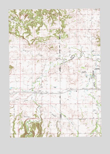
Beulah, WY USGS Topographic Map
Click on map above to begin viewing in our Map Viewer.

This topographic map contains these locations and features:
Feature Name Type Latitude Longitude GNIS ID View Map
Bear GulchValleyN44.5303°W104.0815°1261231View Map
Bear GulchValleyN44.5314°W104.0727°1585262View Map
Beaver CreekStreamN44.5133°W104.0060°1261244View Map
Beaver Creek SchoolSchoolN44.5028°W104.0158°1253819View Map
BeulahPopulated PlaceN44.5444°W104.0891°1585416View Map
Beulah CemeteryCemeteryN44.5444°W104.0758°2774534View Map
Beulah Census Designated PlaceCensusN44.5460°W104.0828°2585079View Map
Beulah Post OfficePost OfficeN44.5442°W104.0825°2767904View Map
Crow CreekStreamN44.5744°W104.0047°1261512View Map
Dry CreekStreamN44.5758°W104.0508°1599339View Map
Interchange 2CrossingN44.5462°W104.0119°2725760View Map
McNenny Fish HatcheryLocaleN44.5589°W104.0097°1256362View Map
Mill CreekStreamN44.5058°W104.0085°1262073View Map
Miller DitchCanalN44.5753°W104.0605°1591605View Map
Miller DitchCanalN44.5803°W104.0530°1256474View Map
Montana LakeLakeN44.5489°W104.0612°1591693View Map
Murray LakeReservoirN44.5604°W104.0197°1256632View Map
Redwater CreekStreamN44.5744°W104.0047°1260970View Map
Redwater CreekStreamN44.5744°W104.0047°1602470View Map
Sand CreekStreamN44.5336°W104.0899°1602711View Map
Shepherd GulchValleyN44.5289°W104.0777°1602880View Map
South Redwater CreekStreamN44.5464°W104.0944°1603196View Map
State Wildlife Management AreaParkN44.5630°W104.0222°1266501View Map
The BrakesRangeN44.6125°W104.1133°1603594View Map

Note: Coordinates in the location and feature list above are referenced to NAD83 datum.


Copyright (C) 2008-2025 Ryan Niemi / Sunset Dynamics ... All Rights Reserved