TopoQuest Logo
Do you find TopoQuest useful?
Help keep TopoQuest running and adding new maps/features by donating!
Bitcoin:  19c7KJd3qBynnjoSw5npx9KScwjBe4ifkT
Litecoin:  LXs6TkuXGGXo1vDsWCkWVdjQX94eUKd6ui
Home View Maps Find Maps Find Places Resources & Links


Poe Mountain, Wyoming Topographic Map

USGS Map Title: Poe Mountain, WY
USGS Map MRC: 41105G3
DRG (GeoTIFF) Download: o41105g3.tif


Neighboring USGS Topographic Map Quads:


  Bull Camp Peak, WY  
41105H4
 

  Moonshine Peak, WY  
41105H3
 

  Squaw Rock, WY  
41105H2
 

  Guide Rock, WY  
41105G4
 

  Poe Mountain, WY  
41105G3
 

  Natwick SW, WY  
41105G2
 

  Sheep Rock, WY  
41105F4
 

  Indian Guide, WY  
41105F3
 

  Delano Ranch, WY  
41105F2


Map MRC Location:

N42°
W106°
N42°
W105°
H8 H7 H6 H5 H4 H3 H2 H1
G8 G7 G6 G5 G4 G3 G2 G1
F8 F7 F6 F5 F4 F3 F2 F1
E8 E7 E6 E5 E4 E3 E2 E1
D8 D7 D6 D5 D4 D3 D2 D1
C8 C7 C6 C5 C4 C3 C2 C1
B8 B7 B6 B5 B4 B3 B2 B1
A8 A7 A6 A5 A4 A3 A2 A1
N41°
W106°
N41°
W105°

Poe Mountain, WY USGS 1:24K Topographic Map Preview:
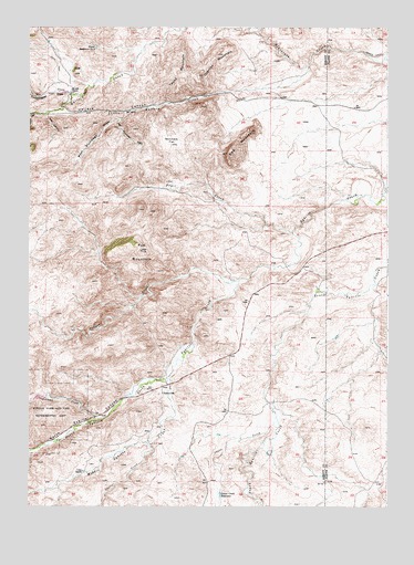
Poe Mountain, WY USGS Topographic Map
Click on map above to begin viewing in our Map Viewer.

This topographic map contains these locations and features:
Feature Name Type Latitude Longitude GNIS ID View Map
Canon CreekStreamN41.8091°W105.3019°1597083View Map
Canyon CreekStreamN41.8089°W105.3014°1584675View Map
Christiansen Number 2 DamDamN41.8100°W105.2555°1605651View Map
Christiansen Number 2 ReservoirReservoirN41.8100°W105.2555°1608839View Map
Cobar Number One MineMineN41.7750°W105.3505°1726201View Map
Cottonwood DrawValleyN41.8572°W105.3600°1587062View Map
Dover Reservoir Number 2ReservoirN41.8697°W105.3520°1605258View Map
East Plumbago DrawValleyN41.8505°W105.3422°1588121View Map
Gold HillSummitN41.8633°W105.3586°1588954View Map
Grant CreekStreamN41.7733°W105.2886°1589051View Map
Grant Creek DamDamN41.7533°W105.3089°1605652View Map
Grant Creek ReservoirReservoirN41.7532°W105.3083°1589053View Map
Halleck CanyonValleyN41.8594°W105.2866°1589257View Map
Joe CreekStreamN41.8575°W105.3600°1590124View Map
Johnson CreekStreamN41.7728°W105.3519°1590157View Map
Johnson DamDamN41.7816°W105.3739°1605783View Map
Johnson ReservoirReservoirN41.7816°W105.3739°1605784View Map
Little CreekStreamN41.7666°W105.3333°1590778View Map
Little Halleck CreekStreamN41.8647°W105.2772°1590803View Map
Lucy RanchLocaleN41.7591°W105.3558°1591113View Map
McGill RanchLocaleN41.8583°W105.3603°1591332View Map
Middle Sybille CreekStreamN41.7836°W105.3258°1591559View Map
North Sybille CanyonValleyN41.7789°W105.3400°1592288View Map
North Sybille CreekStreamN41.7828°W105.3266°1609060View Map
Overton MountainSummitN41.8622°W105.3141°1592513View Map
Poe MountainSummitN41.8166°W105.3353°1592891View Map
Post CanyonValleyN41.8514°W105.3686°1592973View Map
Red MountainSummitN41.8422°W105.3044°1593312View Map
Sommers FlatFlatN41.8447°W105.3244°1594566View Map
Sybille Volunteer Fire DepartmentBuildingN41.8595°W105.3614°2673610View Map
Tower CanyonValleyN41.8525°W105.3689°1595646View Map
Trail CreekStreamN41.8216°W105.2828°1595665View Map
West Plumbago DrawValleyN41.8525°W105.3403°1596232View Map
Yount MountainSummitN41.8644°W105.3191°1596667View Map

Note: Coordinates in the location and feature list above are referenced to NAD83 datum.


Copyright (C) 2008-2024 Ryan Niemi / Sunset Dynamics ... All Rights Reserved