TopoQuest Logo
Do you find TopoQuest useful?
Help keep TopoQuest running and adding new maps/features by donating!
Bitcoin:  19c7KJd3qBynnjoSw5npx9KScwjBe4ifkT
Litecoin:  LXs6TkuXGGXo1vDsWCkWVdjQX94eUKd6ui
Home View Maps Find Maps Find Places Resources & Links


Bull Camp Peak, Wyoming Topographic Map

USGS Map Title: Bull Camp Peak, WY
USGS Map MRC: 41105H4
DRG (GeoTIFF) Download: o41105h4.tif


Neighboring USGS Topographic Map Quads:


  Garrett, WY  
42105A5
 

  Davidson Flats, WY  
42105A4
 

  Reese Mountain, WY  
42105A3
 

  Dodge Ranch, WY  
41105H5
 

  Bull Camp Peak, WY  
41105H4
 

  Moonshine Peak, WY  
41105H3
 

  Bluegrass Wells, WY  
41105G5
 

  Guide Rock, WY  
41105G4
 

  Poe Mountain, WY  
41105G3


Map MRC Location:

N42°
W106°
N42°
W105°
H8 H7 H6 H5 H4 H3 H2 H1
G8 G7 G6 G5 G4 G3 G2 G1
F8 F7 F6 F5 F4 F3 F2 F1
E8 E7 E6 E5 E4 E3 E2 E1
D8 D7 D6 D5 D4 D3 D2 D1
C8 C7 C6 C5 C4 C3 C2 C1
B8 B7 B6 B5 B4 B3 B2 B1
A8 A7 A6 A5 A4 A3 A2 A1
N41°
W106°
N41°
W105°

Bull Camp Peak, WY USGS 1:24K Topographic Map Preview:
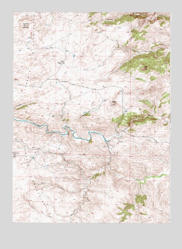
Bull Camp Peak, WY USGS Topographic Map
Click on map above to begin viewing in our Map Viewer.

This topographic map contains these locations and features:
Feature Name Type Latitude Longitude GNIS ID View Map
Bull Camp CreekStreamN41.9011°W105.4389°1586083View Map
Bull Camp PeakSummitN41.9150°W105.4989°1586084View Map
Cottonwood SpringSpringN41.9152°W105.4608°1587080View Map
Desert CreekStreamN41.8947°W105.4433°1587547View Map
Dipping Vat CreekStreamN41.9294°W105.4383°1587637View Map
Douthitt MountainSummitN41.9919°W105.4903°1587755View Map
Elmers RockSummitN41.9464°W105.4186°1588274View Map
Halleck Canyon Area MineMineN41.8789°W105.4164°1704095View Map
Halleck Canyon MineMineN41.8805°W105.3978°1704094View Map
Hay CanyonValleyN41.9994°W105.4036°1589392View Map
Kennedy RanchLocaleN41.9697°W105.4614°1590325View Map
Kennedy SchoolSchoolN41.9702°W105.4608°1590326View Map
Mill CreekStreamN41.8983°W105.3978°1591588View Map
North Fork Cherry CreekStreamN41.9764°W105.3989°1592157View Map
Preemption CreekStreamN41.9325°W105.4575°1593027View Map
Salt CreekStreamN41.9791°W105.4153°1593807View Map
School CreekStreamN41.8755°W105.4539°1593999View Map
Shellhart Fish and Stock DamDamN41.9966°W105.4672°1608092View Map
Shellhart Fish and Stock ReservoirReservoirN41.9966°W105.4672°1608093View Map
South Fork Cherry CreekStreamN41.9764°W105.3989°1594633View Map
Sugar LoafSummitN41.9675°W105.3942°1595150View Map
Tony RidgeRidgeN41.9855°W105.4053°1595635View Map
Wheatland TunnelTunnelN41.9183°W105.4230°1596279View Map

Note: Coordinates in the location and feature list above are referenced to NAD83 datum.


Copyright (C) 2008-2024 Ryan Niemi / Sunset Dynamics ... All Rights Reserved