TopoQuest Logo
Do you find TopoQuest useful?
Help keep TopoQuest running and adding new maps/features by donating!
Bitcoin:  19c7KJd3qBynnjoSw5npx9KScwjBe4ifkT
Litecoin:  LXs6TkuXGGXo1vDsWCkWVdjQX94eUKd6ui
Home View Maps Find Maps Find Places Resources & Links


Poe Mountain, Washington Topographic Map

USGS Map Title: Poe Mountain, WA
USGS Map MRC: 47121H1
DRG (GeoTIFF) Download: o47121h1.tif


Neighboring USGS Topographic Map Quads:


  Glacier Peak West, WA  
48121A2
 

  Glacier Peak East, WA  
48121A1
 

  Clark Mountain, WA  
48120A8
 

  Benchmark Mountain, WA  
47121H2
 

  Poe Mountain, WA  
47121H1
 

  Mount David, WA  
47120H8
 

  Captain Point, WA  
47121G2
 

  Labyrinth Mountain, WA  
47121G1
 

  Mount Howard, WA  
47120G8


Map MRC Location:

N48°
W122°
N48°
W121°
H8 H7 H6 H5 H4 H3 H2 H1
G8 G7 G6 G5 G4 G3 G2 G1
F8 F7 F6 F5 F4 F3 F2 F1
E8 E7 E6 E5 E4 E3 E2 E1
D8 D7 D6 D5 D4 D3 D2 D1
C8 C7 C6 C5 C4 C3 C2 C1
B8 B7 B6 B5 B4 B3 B2 B1
A8 A7 A6 A5 A4 A3 A2 A1
N47°
W122°
N47°
W121°

Poe Mountain, WA USGS 1:24K Topographic Map Preview:
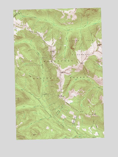
Poe Mountain, WA USGS Topographic Map
Click on map above to begin viewing in our Map Viewer.

This topographic map contains these locations and features:
Feature Name Type Latitude Longitude GNIS ID View Map
Bryant PeakSummitN47.9593°W121.0718°1517016View Map
Cady CreekStreamN47.9132°W121.0934°1517205View Map
Cady RidgeRidgeN47.9398°W121.1137°1517210View Map
Cockeye CreekStreamN47.9237°W121.0093°1517906View Map
Cougar CreekStreamN47.9237°W121.0093°1518154View Map
Fall CreekStreamN47.8959°W121.0757°1519445View Map
Fish CreekStreamN47.9054°W121.0851°1519581View Map
Fourteenmile CreekStreamN47.8954°W121.0723°1519739View Map
Indian PassGapN47.9965°W121.1212°1521193View Map
Irving PeakSummitN47.8979°W121.0159°1521255View Map
Lake CreekStreamN47.8779°W121.0337°1521842View Map
Lake Creek CampgroundLocaleN47.8757°W121.0134°1521847View Map
Little Wenatchee Ford CampgroundLocaleN47.9179°W121.0870°1522319View Map
Longfellow MountainSummitN47.9387°W121.0595°1522414View Map
Meander MeadowFlatN47.9818°W121.1234°1522981View Map
Mount JonathanSummitN47.9640°W121.0023°1521454View Map
Papoose CreekStreamN47.9787°W121.0462°1524181View Map
Pheasant CreekStreamN47.8821°W121.0418°1524380View Map
Poe MountainSummitN47.9159°W121.0618°1524527View Map
Shoofly MountainSummitN47.8796°W121.1023°1525701View Map
Thirteenmile CreekStreamN47.8840°W121.0482°1527091View Map
Twelvemile CreekStreamN47.8768°W121.0270°1527494View Map
Vine Maple CreekStreamN47.8943°W121.0712°1527715View Map
Whittier PeakSummitN47.9471°W121.0315°1528111View Map

Note: Coordinates in the location and feature list above are referenced to NAD83 datum.


Copyright (C) 2008-2024 Ryan Niemi / Sunset Dynamics ... All Rights Reserved