TopoQuest Logo
Do you find TopoQuest useful?
Help keep TopoQuest running and adding new maps/features by donating!
Bitcoin:  19c7KJd3qBynnjoSw5npx9KScwjBe4ifkT
Litecoin:  LXs6TkuXGGXo1vDsWCkWVdjQX94eUKd6ui
Home View Maps Find Maps Find Places Resources & Links


Captain Point, Washington Topographic Map

USGS Map Title: Captain Point, WA
USGS Map MRC: 47121G2
DRG (GeoTIFF) Download: o47121g2.tif


Neighboring USGS Topographic Map Quads:


  Blanca Lake, WA  
47121H3
 

  Benchmark Mountain, WA  
47121H2
 

  Poe Mountain, WA  
47121H1
 

  Evergreen Mountain, WA  
47121G3
 

  Captain Point, WA  
47121G2
 

  Labyrinth Mountain, WA  
47121G1
 

  Skykomish, WA  
47121F3
 

  Scenic, WA  
47121F2
 

  Stevens Pass, WA  
47121F1


Map MRC Location:

N48°
W122°
N48°
W121°
H8 H7 H6 H5 H4 H3 H2 H1
G8 G7 G6 G5 G4 G3 G2 G1
F8 F7 F6 F5 F4 F3 F2 F1
E8 E7 E6 E5 E4 E3 E2 E1
D8 D7 D6 D5 D4 D3 D2 D1
C8 C7 C6 C5 C4 C3 C2 C1
B8 B7 B6 B5 B4 B3 B2 B1
A8 A7 A6 A5 A4 A3 A2 A1
N47°
W122°
N47°
W121°

Captain Point, WA USGS 1:24K Topographic Map Preview:
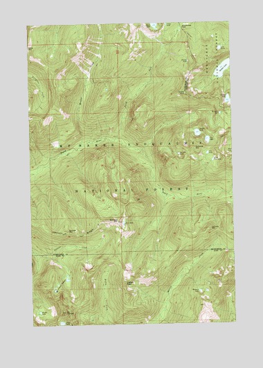
Captain Point, WA USGS Topographic Map
Click on map above to begin viewing in our Map Viewer.

This topographic map contains these locations and features:
Feature Name Type Latitude Longitude GNIS ID View Map
Bertha LakeLakeN47.7553°W121.2463°1516446View Map
Captain PointCliffN47.7668°W121.1937°1517382View Map
Cup LakeLakeN47.8263°W121.1411°1518416View Map
Delberts Ridge (not official)RidgeN47.7540°W121.1443°1529887View Map
Glasses LakeLakeN47.8426°W121.1274°1519999View Map
Grass LakeLakeN47.8744°W121.1652°1520249View Map
Grizzly LakeLakeN47.8589°W121.1524°1520369View Map
Grizzly PeakSummitN47.8459°W121.1532°1520372View Map
Grouse LakeLakeN47.8217°W121.1255°1520391View Map
Heather LakeLakeN47.8555°W121.1309°1520660View Map
Jakes LakeLakeN47.7507°W121.2329°1521320View Map
Joan LakeLakeN47.7921°W121.1939°1521385View Map
Johnson RidgeRidgeN47.7871°W121.2240°1521443View Map
Lake LouisLakeN47.8642°W121.1327°1522516View Map
Little Pete LakeLakeN47.8179°W121.1380°1522286View Map
Margaret LakeLakeN47.8371°W121.1332°1522724View Map
Meadow CreekStreamN47.8234°W121.2201°1522954View Map
Mosquito LakeLakeN47.7634°W121.1478°1523400View Map
Mount FernowSummitN47.7551°W121.2307°1523424View Map
Mount Fernow PotholesBasinN47.7668°W121.2351°1523425View Map
North Fork Rapid RiverStreamN47.8271°W121.1976°1523826View Map
Peach LakeLakeN47.8741°W121.1728°1524267View Map
Pete LakeLakeN47.8207°W121.1413°1524353View Map
Saucer LakeLakeN47.8291°W121.1473°1525448View Map
Scorpion MountainSummitN47.7921°W121.1970°1525512View Map
Scrabble LakeLakeN47.8205°W121.1591°1525526View Map
Scrabble MountainSummitN47.8226°W121.1493°1525527View Map
Sunrise MountainSummitN47.7887°W121.2284°1526763View Map
Valhalla MountainSummitN47.7893°W121.1404°1527657View Map
Wenatchee PassGapN47.8732°W121.1557°1527906View Map

Note: Coordinates in the location and feature list above are referenced to NAD83 datum.


Copyright (C) 2008-2025 Ryan Niemi / Sunset Dynamics ... All Rights Reserved