TopoQuest Logo
Do you find TopoQuest useful?
Help keep TopoQuest running and adding new maps/features by donating!
Bitcoin:  19c7KJd3qBynnjoSw5npx9KScwjBe4ifkT
Litecoin:  LXs6TkuXGGXo1vDsWCkWVdjQX94eUKd6ui
Home View Maps Find Maps Find Places Resources & Links


Point Roberts, Washington Topographic Map

USGS Map Title: Point Roberts, WA
USGS Map MRC: 48123H1
DRG (GeoTIFF) Download: o48123h1.tif


Neighboring USGS Topographic Map Quads:


  Point Roberts, WA  
48123H1


  Sucia Island, WA  
48122G8


Map MRC Location:

N49°
W124°
N49°
W123°
H8 H7 H6 H5 H4 H3 H2 H1
G8 G7 G6 G5 G4 G3 G2 G1
F8 F7 F6 F5 F4 F3 F2 F1
E8 E7 E6 E5 E4 E3 E2 E1
D8 D7 D6 D5 D4 D3 D2 D1
C8 C7 C6 C5 C4 C3 C2 C1
B8 B7 B6 B5 B4 B3 B2 B1
A8 A7 A6 A5 A4 A3 A2 A1
N48°
W124°
N48°
W123°

Point Roberts, WA USGS 1:24K Topographic Map Preview:
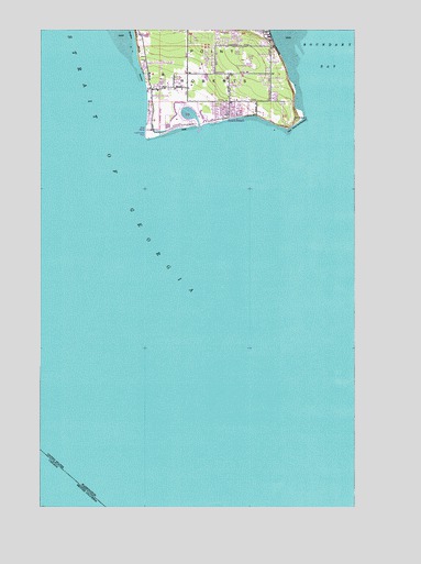
Point Roberts, WA USGS Topographic Map
Click on map above to begin viewing in our Map Viewer.

This topographic map contains these locations and features:
Feature Name Type Latitude Longitude GNIS ID View Map
Boundary BayBayN48.9932°W123.0119°1503493View Map
Boundary BluffCliffN48.9970°W123.0880°1503494View Map
Gulfaire Mobile VillaPopulated PlaceN48.9878°W123.0623°2607416View Map
Lighthouse Marine Park Boat LaunchLocaleN48.9737°W123.0848°2607958View Map
Lighthouse Marine Park CampgroundLocaleN48.9732°W123.0806°2608230View Map
Northwest GrangeLocaleN48.9834°W123.0810°1507112View Map
Point RobertsCapeN48.9915°W123.0563°1507533View Map
Point RobertsPopulated PlaceN48.9854°W123.0780°1512573View Map
Point Roberts AirparkAirportN48.9795°W123.0793°1533884View Map
Point Roberts Census Designated PlaceCensusN48.9883°W123.0577°2586745View Map
Point Roberts DivisionCivilN48.9318°W123.0572°1939598View Map
Point Roberts Golf and Country ClubLocaleN48.9964°W123.0817°2608187View Map
Point Roberts LibraryBuildingN48.9844°W123.0769°2610224View Map
Point Roberts LighthouseLocaleN48.9715°W123.0827°1507534View Map
Point Roberts Military Reservation (historical)MilitaryN48.9917°W123.0500°1531400View Map
Point Roberts Post OfficePost OfficeN48.9850°W123.0686°2607002View Map
Point Roberts Primary SchoolSchoolN48.9902°W123.0424°2518449View Map
Point Roberts Resort MarinaLocaleN48.9781°W123.0677°2610362View Map
Salish SeaSeaN48.9367°W123.0611°2573411View Map
South BeachPopulated PlaceN48.9773°W123.0505°1512671View Map
Trinity Community Lutheran ChurchChurchN48.9814°W123.0526°2609059View Map
Whatcom County Fire District 5BuildingN48.9888°W123.0438°2643678View Map

Note: Coordinates in the location and feature list above are referenced to NAD83 datum.


Copyright (C) 2008-2025 Ryan Niemi / Sunset Dynamics ... All Rights Reserved