TopoQuest Logo
Do you find TopoQuest useful?
Help keep TopoQuest running and adding new maps/features by donating!
Bitcoin:  19c7KJd3qBynnjoSw5npx9KScwjBe4ifkT
Litecoin:  LXs6TkuXGGXo1vDsWCkWVdjQX94eUKd6ui
Home View Maps Find Maps Find Places Resources & Links


Poison Point, Oregon Topographic Map

USGS Map Title: Poison Point, OR
USGS Map MRC: 45116G8
DRG (GeoTIFF) Download: o45116g8.tif


Neighboring USGS Topographic Map Quads:


  Teepee Butte, OR  
45117H1
 

  Jim Creek Butte, OR  
45116H8
 

  Wapshilla Creek, ID  
45116H7
 

  Billy Meadows, OR  
45117G1
 

  Poison Point, OR  
45116G8
 

  Deadhorse Ridge, OR  
45116G7
 

  Greenwood Butte, OR  
45117F1
 

  Zumwalt, OR  
45116F8
 

  Haas Hollow, OR  
45116F7


Map MRC Location:

N46°
W117°
N46°
W116°
H8 H7 H6 H5 H4 H3 H2 H1
G8 G7 G6 G5 G4 G3 G2 G1
F8 F7 F6 F5 F4 F3 F2 F1
E8 E7 E6 E5 E4 E3 E2 E1
D8 D7 D6 D5 D4 D3 D2 D1
C8 C7 C6 C5 C4 C3 C2 C1
B8 B7 B6 B5 B4 B3 B2 B1
A8 A7 A6 A5 A4 A3 A2 A1
N45°
W117°
N45°
W116°

Poison Point, OR USGS 1:24K Topographic Map Preview:
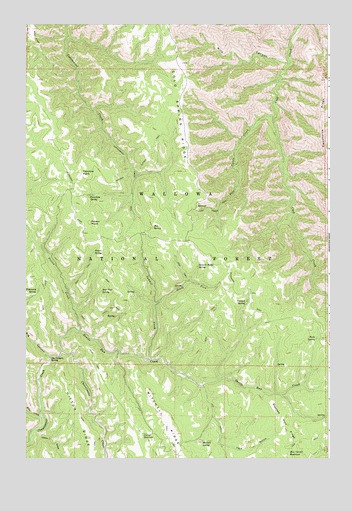
Poison Point, OR USGS Topographic Map
Click on map above to begin viewing in our Map Viewer.

This topographic map contains these locations and features:
Feature Name Type Latitude Longitude GNIS ID View Map
Bear Paw SpringSpringN45.7982°W116.9692°1137736View Map
Bear RidgeRidgeN45.8713°W116.9963°1137740View Map
Big CanyonValleyN45.7788°W116.9899°1137989View Map
Big Canyon SpringSpringN45.7791°W116.9903°1137994View Map
Billy CreekStreamN45.7615°W116.9927°1138122View Map
Box SpringSpringN45.8164°W116.9478°1138541View Map
Burn SpringSpringN45.7845°W116.8808°1138974View Map
Cook Creek TrailTrailN45.8227°W116.9201°1140055View Map
Cottonwood Creek TrailTrailN45.8288°W116.9554°1140186View Map
Crooked Pine RidgeRidgeN45.7596°W116.8921°1140471View Map
Cutout ReservoirReservoirN45.7566°W116.9530°1140575View Map
Devils Run CreekStreamN45.7804°W116.9854°1140972View Map
Fairchild PointSummitN45.8324°W116.9768°1141944View Map
Fairchild SpringSpringN45.8256°W116.9741°1141945View Map
Five Points CreekStreamN45.8479°W116.8979°1142195View Map
Hideaway SpringSpringN45.7983°W116.9957°1143555View Map
Hilton GulchValleyN45.7582°W116.9957°1143609View Map
Hilton RidgeRidgeN45.7610°W116.9779°1143610View Map
Howard Cutoff TrailTrailN45.8393°W116.9479°1143849View Map
Howard SpringSpringN45.8216°W116.9271°1851705View Map
Mitchell SpringSpringN45.7548°W116.9278°1146376View Map
Poison CreekStreamN45.7868°W116.9779°1147821View Map
Poison PointSummitN45.8179°W116.9738°1147826View Map
Poison SpringSpringN45.8094°W116.9725°1147828View Map
Rice Corral ReservoirReservoirN45.7510°W116.8923°1148413View Map
South Fork Summit CreekStreamN45.7940°W116.9468°1150026View Map
Summit CreekStreamN45.7782°W116.9496°1150612View Map
Summit Ridge SpringSpringN45.8053°W116.9296°1150637View Map
TNT GulchValleyN45.7710°W116.9268°1150807View Map
Wild CanyonValleyN45.8635°W116.8913°1152327View Map
Yandall SpringSpringN45.7945°W116.9096°1152692View Map

Note: Coordinates in the location and feature list above are referenced to NAD83 datum.


Copyright (C) 2008-2024 Ryan Niemi / Sunset Dynamics ... All Rights Reserved