TopoQuest Logo
Do you find TopoQuest useful?
Help keep TopoQuest running and adding new maps/features by donating!
Bitcoin:  19c7KJd3qBynnjoSw5npx9KScwjBe4ifkT
Litecoin:  LXs6TkuXGGXo1vDsWCkWVdjQX94eUKd6ui
Home View Maps Find Maps Find Places Resources & Links


Billy Meadows, Oregon Topographic Map

USGS Map Title: Billy Meadows, OR
USGS Map MRC: 45117G1
DRG (GeoTIFF) Download: o45117g1.tif


Neighboring USGS Topographic Map Quads:


  Paradise, OR  
45117H2
 

  Teepee Butte, OR  
45117H1
 

  Jim Creek Butte, OR  
45116H8
 

  Table Mountain, OR  
45117G2
 

  Billy Meadows, OR  
45117G1
 

  Poison Point, OR  
45116G8
 

  Roberts Butte, OR  
45117F2
 

  Greenwood Butte, OR  
45117F1
 

  Zumwalt, OR  
45116F8


Map MRC Location:

N46°
W118°
N46°
W117°
H8 H7 H6 H5 H4 H3 H2 H1
G8 G7 G6 G5 G4 G3 G2 G1
F8 F7 F6 F5 F4 F3 F2 F1
E8 E7 E6 E5 E4 E3 E2 E1
D8 D7 D6 D5 D4 D3 D2 D1
C8 C7 C6 C5 C4 C3 C2 C1
B8 B7 B6 B5 B4 B3 B2 B1
A8 A7 A6 A5 A4 A3 A2 A1
N45°
W118°
N45°
W117°

Billy Meadows, OR USGS 1:24K Topographic Map Preview:
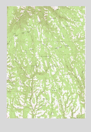
Billy Meadows, OR USGS Topographic Map
Click on map above to begin viewing in our Map Viewer.

This topographic map contains these locations and features:
Feature Name Type Latitude Longitude GNIS ID View Map
Alder SpringSpringN45.7979°W117.0127°1137109View Map
Aspen SpringSpringN45.7875°W117.1249°1137336View Map
Baldwin SpringSpringN45.8575°W117.0778°1137471View Map
Bear SpringSpringN45.8535°W117.0872°1137751View Map
Bed SpringSpringN45.7950°W117.1241°1137862View Map
Billy MeadowsFlatN45.8285°W117.0438°1138125View Map
Billy Meadows Guard StationLocaleN45.8296°W117.0424°1138126View Map
Coyote Recreation SiteLocaleN45.8424°W117.1132°1140345View Map
Coyote SpringSpringN45.8443°W117.1149°1152841View Map
Dougherty Recreation SiteLocaleN45.8524°W117.0332°1141209View Map
Dougherty SpringSpringN45.8513°W117.0329°1152840View Map
East Fork Broady CreekStreamN45.8749°W117.0690°1141536View Map
East Fork Peavine CreekStreamN45.7949°W117.0846°1141589View Map
Elk SpringSpringN45.8357°W117.0391°1141799View Map
Ellis CanyonValleyN45.7510°W117.0202°1141835View Map
French GulchValleyN45.7535°W117.0824°1142469View Map
Getchel MeadowsFlatN45.8318°W117.0949°1851696View Map
Getchel RidgeRidgeN45.8199°W117.0913°1142707View Map
Hay Pen CampLocaleN45.8321°W117.0643°1143398View Map
Hinton SpringSpringN45.7617°W117.1086°1152842View Map
Hollow Log Cow CampLocaleN45.7993°W117.0302°1143671View Map
Hollow Log SpringSpringN45.7790°W117.0510°1152839View Map
Kernan SpringSpringN45.8593°W117.0187°1144571View Map
Lone SpringSpringN45.8176°W117.1226°1145365View Map
Long RidgeRidgeN45.8493°W117.0404°1145445View Map
Long Ridge SpringSpringN45.8614°W117.0555°1145449View Map
McCarty ReservoirReservoirN45.7717°W117.0598°1145931View Map
Paris SpringSpringN45.7647°W117.0709°1147428View Map
Poker Bill SpringSpringN45.8463°W117.0885°1147829View Map
Quirk SpringSpringN45.8265°W117.0887°1148109View Map
Red HillSummitN45.7885°W117.1021°1148306View Map
Red Hill Recreation SiteLocaleN45.7893°W117.1032°1952992View Map
Snow SpringSpringN45.8305°W117.0323°1149823View Map
Teepee SpringSpringN45.8712°W117.0460°1150939View Map
Telephone GulchValleyN45.7596°W117.0829°1150946View Map
Trough SpringSpringN45.8313°W117.0337°1151430View Map
Volstead ReservoirReservoirN45.7812°W117.0537°1151786View Map
Warnock SpringSpringN45.7541°W117.0704°1153090View Map
West Fork Peavine CreekStreamN45.7949°W117.0846°1152101View Map
Yew Wood SpringSpringN45.8451°W117.1018°1152734View Map

Note: Coordinates in the location and feature list above are referenced to NAD83 datum.


Copyright (C) 2008-2024 Ryan Niemi / Sunset Dynamics ... All Rights Reserved