TopoQuest Logo
Do you find TopoQuest useful?
Help keep TopoQuest running and adding new maps/features by donating!
Bitcoin:  19c7KJd3qBynnjoSw5npx9KScwjBe4ifkT
Litecoin:  LXs6TkuXGGXo1vDsWCkWVdjQX94eUKd6ui
Home View Maps Find Maps Find Places Resources & Links


Pollock Pines, California Topographic Map

USGS Map Title: Pollock Pines, CA
USGS Map MRC: 38120G5
DRG (GeoTIFF) Download: o38120g5.tif


Neighboring USGS Topographic Map Quads:


  Tunnel Hill, CA  
38120H6
 

  Devil Peak, CA  
38120H5
 

  Robbs Peak, CA  
38120H4
 

  Slate Mountain, CA  
38120G6
 

  Pollock Pines, CA  
38120G5
 

  Riverton, CA  
38120G4
 

  Camino, CA  
38120F6
 

  Sly Park, CA  
38120F5
 

  Old Iron Mountain, CA  
38120F4


Map MRC Location:

N39°
W121°
N39°
W120°
H8 H7 H6 H5 H4 H3 H2 H1
G8 G7 G6 G5 G4 G3 G2 G1
F8 F7 F6 F5 F4 F3 F2 F1
E8 E7 E6 E5 E4 E3 E2 E1
D8 D7 D6 D5 D4 D3 D2 D1
C8 C7 C6 C5 C4 C3 C2 C1
B8 B7 B6 B5 B4 B3 B2 B1
A8 A7 A6 A5 A4 A3 A2 A1
N38°
W121°
N38°
W120°

Pollock Pines, CA USGS 1:24K Topographic Map Preview:
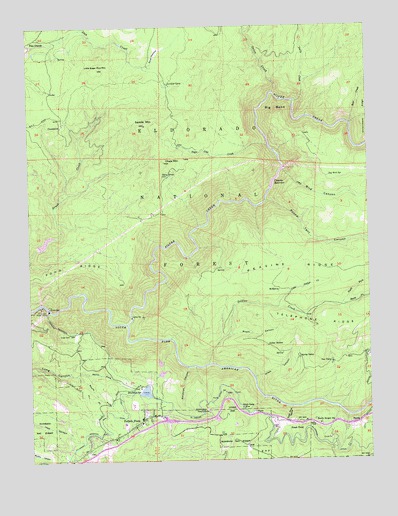
Pollock Pines, CA USGS Topographic Map
Click on map above to begin viewing in our Map Viewer.

This topographic map contains these locations and features:
Feature Name Type Latitude Longitude GNIS ID View Map
Bear CreekStreamN38.8468°W120.5071°256643View Map
Big BendSummitN38.8499°W120.5338°1658049View Map
Big Bend SchoolSchoolN38.7807°W120.5008°256890View Map
Brooks CreekStreamN38.8368°W120.6063°274942View Map
Brush CanyonValleyN38.7860°W120.5535°257523View Map
Brush Creek ReservoirReservoirN38.7957°W120.6219°274935View Map
Bullion Bend Historic MarkerParkN38.7641°W120.5608°257679View Map
Butcherknife JoeLocaleN38.8263°W120.5958°274940View Map
Camino 1009-004 DamDamN38.8282°W120.5371°1664132View Map
Camino PowerHouseLocaleN38.7957°W120.6219°274937View Map
Camino ReservoirReservoirN38.8282°W120.5371°257845View Map
Camp SevenLocaleN38.8318°W120.5749°257896View Map
Cement RavineValleyN38.8743°W120.6069°258166View Map
Chaix MountainSummitN38.8363°W120.5766°258178View Map
ClausseniusPopulated PlaceN38.8466°W120.6138°1658287View Map
Davis CreekStreamN38.8532°W120.5280°259083View Map
Deadman SpringSpringN38.7703°W120.5881°259141View Map
Ditch Camp FivePopulated PlaceN38.7652°W120.5483°1652967View Map
El Dorado CountyCivilN38.7787°W120.5246°277273View Map
El Dorado County Fire Protection District Station 17BuildingN38.7625°W120.5801°2624107View Map
El Dorado Forebay 97-053 DamDamN38.7699°W120.5860°1663629View Map
El Dorado Irrigation District Main CanalCanalN38.7599°W120.5996°266337View Map
El Dorado Power HouseLocaleN38.7935°W120.6191°1654241View Map
Fresh PondPopulated PlaceN38.7602°W120.5299°1658587View Map
Fresh Pond HeliportAirportN38.7599°W120.5371°1653834View Map
Fresh Pond RavineValleyN38.7652°W120.5305°260412View Map
Gasparni CreekStreamN38.8188°W120.6155°274939View Map
Ghost Mountain CampgroundLocaleN38.7660°W120.6144°1733833View Map
Ghost Mountain Ranch Recreation SiteLocaleN38.7957°W120.6219°274936View Map
Gold RidgePopulated PlaceN38.7532°W120.5683°1733904View Map
Grays CanyonValleyN38.7738°W120.5438°260835View Map
Harris Tree FarmLocaleN38.7735°W120.5774°1733841View Map
Incline CreekStreamN38.8252°W120.6144°274938View Map
Indian HattiesLocaleN38.7827°W120.5391°261749View Map
Jay Bird CanyonValleyN38.8338°W120.5327°261909View Map
Jay Bird SpringSpringN38.8315°W120.5153°261910View Map
Jaybird Power HouseLocaleN38.8343°W120.5319°275018View Map
Kings MeadowFlatN38.8666°W120.5794°262185View Map
Little Soldier CreekStreamN38.7941°W120.5346°262729View Map
Little Sugar Pine MountainSummitN38.8630°W120.6005°262733View Map
Long Canyon ForebayReservoirN38.7699°W120.5837°1733848View Map
Lovejoy CampLocaleN38.8585°W120.5752°262979View Map
McManusPopulated PlaceN38.7991°W120.5341°1659091View Map
North El Dorado DivisionCivilN38.8662°W120.5955°1935224View Map
North Fork Long CanyonValleyN38.7749°W120.6096°264181View Map
North Fork Soldier CreekStreamN38.7941°W120.5119°264214View Map
Onion CreekStreamN38.8557°W120.5360°264366View Map
PacificPopulated PlaceN38.7602°W120.5071°1659331View Map
Pacific Gas and Electric Company Camp 5 HeliportAirportN38.7682°W120.5496°1653826View Map
Pacific Ranger StationLocaleN38.7602°W120.5305°1655027View Map
Pacific Ranger StationLocaleN38.7605°W120.5196°264433View Map
Pines Shopping CenterLocaleN38.7624°W120.5769°1733932View Map
Pinewood Elementary SchoolSchoolN38.7655°W120.5885°1733864View Map
Poho RidgeRidgeN38.8030°W120.6213°264876View Map
Pollock PinesPopulated PlaceN38.7613°W120.5866°1659419View Map
Pollock Pines Branch El Dorado County LibraryBuildingN38.7599°W120.5880°1733933View Map
Pollock Pines Census Designated PlaceCensusN38.7564°W120.5904°2409086View Map
Pollock Pines Elementary SchoolSchoolN38.7610°W120.5855°1733934View Map
Pollock Pines Post OfficePost OfficeN38.7595°W120.5917°1733935View Map
Pollock Pines Recreation ParkParkN38.7716°W120.5810°1733936View Map
Pony Express Village Shopping CenterLocaleN38.7591°W120.5910°1733938View Map
Randolph CanyonValleyN38.7771°W120.5680°265182View Map
Rice CabinLocaleN38.8041°W120.5577°275019View Map
Round Tent CanyonValleyN38.8246°W120.5388°265617View Map
Saddle MountainSummitN38.8466°W120.5835°265710View Map
Silver CreekStreamN38.7896°W120.5910°266180View Map
Soldier CreekStreamN38.7777°W120.5610°267378View Map
South Fork Long CanyonValleyN38.7749°W120.6096°267471View Map
South Fork Soldier CreekStreamN38.7938°W120.5119°267507View Map
Spring ValleyPopulated PlaceN38.7793°W120.5277°1659847View Map
Sugar Pine CreekStreamN38.8407°W120.5380°267842View Map
Telephone RidgeRidgeN38.7893°W120.5030°268134View Map
Union HillSummitN38.7635°W120.5541°1660078View Map
Van VleckPopulated PlaceN38.7780°W120.5155°1660092View Map

Note: Coordinates in the location and feature list above are referenced to NAD83 datum.


Copyright (C) 2008-2025 Ryan Niemi / Sunset Dynamics ... All Rights Reserved