TopoQuest Logo
Do you find TopoQuest useful?
Help keep TopoQuest running and adding new maps/features by donating!
Bitcoin:  19c7KJd3qBynnjoSw5npx9KScwjBe4ifkT
Litecoin:  LXs6TkuXGGXo1vDsWCkWVdjQX94eUKd6ui
Home View Maps Find Maps Find Places Resources & Links


Ponderosa Park, Colorado Topographic Map

USGS Map Title: Ponderosa Park, CO
USGS Map MRC: 39104D6
DRG (GeoTIFF) Download: o39104d6.tif


Neighboring USGS Topographic Map Quads:


  Parker, CO  
39104E7
 

  Piney Creek, CO  
39104E6
 

  Watkins SE, CO  
39104E5
 

  Castle Rock North, CO  
39104D7
 

  Ponderosa Park, CO  
39104D6
 

  Cabin Gulch, CO  
39104D5
 

  Castle Rock South, CO  
39104C7
 

  Russellville Gulch, CO  
39104C6
 

  Elizabeth, CO  
39104C5


Map MRC Location:

N40°
W105°
N40°
W104°
H8 H7 H6 H5 H4 H3 H2 H1
G8 G7 G6 G5 G4 G3 G2 G1
F8 F7 F6 F5 F4 F3 F2 F1
E8 E7 E6 E5 E4 E3 E2 E1
D8 D7 D6 D5 D4 D3 D2 D1
C8 C7 C6 C5 C4 C3 C2 C1
B8 B7 B6 B5 B4 B3 B2 B1
A8 A7 A6 A5 A4 A3 A2 A1
N39°
W105°
N39°
W104°

Ponderosa Park, CO USGS 1:24K Topographic Map Preview:
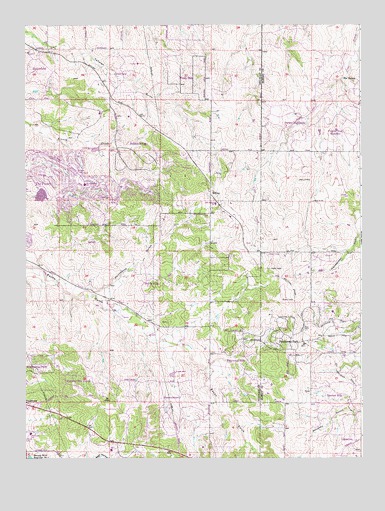
Ponderosa Park, CO USGS Topographic Map
Click on map above to begin viewing in our Map Viewer.

This topographic map contains these locations and features:
Feature Name Type Latitude Longitude GNIS ID View Map
Bayou HillsPopulated PlaceN39.4263°W104.7038°2085625View Map
Burning Tree RanchPopulated PlaceN39.3974°W104.7316°2085620View Map
Burning Tree Ranch Census Designated PlaceCensusN39.3959°W104.7285°2583217View Map
Cimarron Middle SchoolSchoolN39.4952°W104.7247°2730278View Map
Circle 2 Ranch Detention Dam Number 1DamN39.4650°W104.7272°198666View Map
Circle 2 Ranch Reservoir Number 1ReservoirN39.4650°W104.7272°198667View Map
Country AcresPopulated PlaceN39.3881°W104.6889°2120680View Map
Country Acres Census Designated PlaceCensusN39.3884°W104.7010°2583228View Map
CrestviewPopulated PlaceN39.4864°W104.7138°2085640View Map
Elizabeth Fire Rescue Station 72BuildingN39.4051°W104.6502°2368795View Map
Elizabeth Fire Rescue Station 73BuildingN39.4639°W104.6441°2368796View Map
Franktown Census Designated PlaceCensusN39.3905°W104.7487°2408255View Map
Franktown Elementary SchoolSchoolN39.3821°W104.7483°2085623View Map
Franktown Parker FPS-1 DamDamN39.4817°W104.7472°198716View Map
Franktown Parker FPS-1 ReservoirReservoirN39.4809°W104.7462°198717View Map
Franktown Post OfficePost OfficeN39.3910°W104.7493°2732400View Map
Hidden VilagePopulated PlaceN39.4634°W104.7074°2085644View Map
Hidden Village Census Designated PlaceCensusN39.4639°W104.7049°2583246View Map
HilltopPopulated PlaceN39.4517°W104.6814°185104View Map
Hilltop HeliportAirportN39.4292°W104.6591°204409View Map
KWHD-TV (Castle Rock)TowerN39.4328°W104.6555°204916View Map
Legend High SchoolSchoolN39.4909°W104.7307°2730301View Map
Moonshine GulchValleyN39.4226°W104.7291°185100View Map
Mountain View Elementary SchoolSchoolN39.4539°W104.7281°2085638View Map
Parker DivisionCivilN39.3834°W104.7471°1935543View Map
Parker HighlandsPopulated PlaceN39.4714°W104.6506°2088861View Map
Pawnee HillsPopulated PlaceN39.3931°W104.6383°2088862View Map
Pinery DamDamN39.4514°W104.7457°198736View Map
Pinery ReservoirReservoirN39.4509°W104.7441°198737View Map
Ponderosa ParkPopulated PlaceN39.4083°W104.6511°185105View Map
Ponderosa Park Census Designated PlaceCensusN39.3987°W104.6355°2409088View Map
Prairie Trail RanchesPopulated PlaceN39.4697°W104.6322°2088863View Map
Rattlesnake Fire Protection District Station 253BuildingN39.4989°W104.6556°2368669View Map
Sagewood Middle SchoolSchoolN39.4318°W104.7402°2439155View Map
Singing Hills Elementary SchoolSchoolN39.4644°W104.6492°2439171View Map
South Metro Fire Rescue Authority Station 43BuildingN39.4594°W104.7337°2368801View Map
The PineryPopulated PlaceN39.4553°W104.7344°1867091View Map
Village PinesPopulated PlaceN39.3800°W104.7239°2120681View Map
Walker PitMineN39.3819°W104.7103°1703884View Map
Windy HillsPopulated PlaceN39.4856°W104.6876°2085641View Map
Windy Hills Census Designated PlaceCensusN39.4927°W104.6898°2583317View Map

Note: Coordinates in the location and feature list above are referenced to NAD83 datum.


Copyright (C) 2008-2025 Ryan Niemi / Sunset Dynamics ... All Rights Reserved