TopoQuest Logo
Do you find TopoQuest useful?
Help keep TopoQuest running and adding new maps/features by donating!
Bitcoin:  19c7KJd3qBynnjoSw5npx9KScwjBe4ifkT
Litecoin:  LXs6TkuXGGXo1vDsWCkWVdjQX94eUKd6ui
Home View Maps Find Maps Find Places Resources & Links


Porcupine Creek, Wyoming Topographic Map

USGS Map Title: Porcupine Creek, WY
USGS Map MRC: 42110D7
DRG (GeoTIFF) Download: o42110d7.tif


Neighboring USGS Topographic Map Quads:


  Smoot, WY  
42110E8
 

  Mount Wagner, WY  
42110E7
 

  Poison Meadows, WY  
42110E6
 

  Salt Flat, WY  
42110D8
 

  Porcupine Creek, WY  
42110D7
 

  Graham Peak, WY  
42110D6
 

  Huff Lake, WY  
42110C8
 

  Big Park, WY  
42110C7
 

  Devils Hole Creek, WY  
42110C6


Map MRC Location:

N43°
W111°
N43°
W110°
H8 H7 H6 H5 H4 H3 H2 H1
G8 G7 G6 G5 G4 G3 G2 G1
F8 F7 F6 F5 F4 F3 F2 F1
E8 E7 E6 E5 E4 E3 E2 E1
D8 D7 D6 D5 D4 D3 D2 D1
C8 C7 C6 C5 C4 C3 C2 C1
B8 B7 B6 B5 B4 B3 B2 B1
A8 A7 A6 A5 A4 A3 A2 A1
N42°
W111°
N42°
W110°

Porcupine Creek, WY USGS 1:24K Topographic Map Preview:
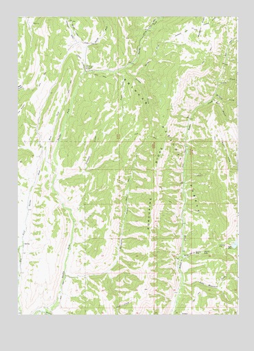
Porcupine Creek, WY USGS Topographic Map
Click on map above to begin viewing in our Map Viewer.

This topographic map contains these locations and features:
Feature Name Type Latitude Longitude GNIS ID View Map
Buckskin KnollRidgeN42.4922°W110.7699°1598460View Map
Bull GulchValleyN42.4655°W110.7638°1604370View Map
Coantag ProspectMineN42.3753°W110.7781°1746405View Map
Crystal LakeLakeN42.4011°W110.7701°1599065View Map
Griggs MineMineN42.4538°W110.7685°1746407View Map
Hobble CreekStreamN42.3758°W110.8602°1600351View Map
Hobble Creek Recreation SiteLocaleN42.3983°W110.7830°1608755View Map
Lake Mountain CreekStreamN42.3883°W110.7813°1600807View Map
Lander CreekStreamN42.4794°W110.8130°1600828View Map
Landslide DamDamN42.4035°W110.7543°1600835View Map
Murdock CreekStreamN42.4672°W110.7630°1601641View Map
North Fork Lander CreekStreamN42.4752°W110.8077°1601782View Map
North Fork Smiths ForkStreamN42.4766°W110.8366°1601814View Map
Oregon Trail - Lander CutoffTrailN42.4780°W110.8235°1608475View Map
Oregon Trail Lander CutoffBendN42.4780°W110.8235°1592470View Map
Porcupine CreekStreamN42.3908°W110.8485°1602259View Map
Porcupine RidgeRidgeN42.4208°W110.7969°1602272View Map
Scotty CreekStreamN42.4710°W110.7610°1602784View Map
Smiths Fork Greys River Stock DrivewayTrailN42.4805°W110.8091°1604756View Map
Smiths Fork Guard StationLocaleN42.4788°W110.8360°1603008View Map
Spring LakeLakeN42.4003°W110.7744°1603284View Map
Spring Lake CreekStreamN42.3994°W110.7807°1603285View Map
Spring Lake Creek ProspectMineN42.3983°W110.7775°1746406View Map
Trail CreekStreamN42.4766°W110.8182°1603724View Map
Trespass CreekStreamN42.4316°W110.8538°1603763View Map
West Fork Smiths ForkStreamN42.4297°W110.8555°1604075View Map

Note: Coordinates in the location and feature list above are referenced to NAD83 datum.


Copyright (C) 2008-2024 Ryan Niemi / Sunset Dynamics ... All Rights Reserved