TopoQuest Logo
Do you find TopoQuest useful?
Help keep TopoQuest running and adding new maps/features by donating!
Bitcoin:  19c7KJd3qBynnjoSw5npx9KScwjBe4ifkT
Litecoin:  LXs6TkuXGGXo1vDsWCkWVdjQX94eUKd6ui
Home View Maps Find Maps Find Places Resources & Links


Port Orange, Florida Topographic Map

USGS Map Title: Port Orange, FL
USGS Map MRC: 29080B8
DRG (GeoTIFF) Download: o29080b8.tif


Neighboring USGS Topographic Map Quads:


  Ormond Beach, FL  
29081C1


  Daytona Beach, FL  
29081B1
 

  Port Orange, FL  
29080B8


  Samsula, FL  
29081A1
 

  New Smyrna Beach, FL  
29080A8


Map MRC Location:

N30°
W81°
N30°
W80°
H8 H7 H6 H5 H4 H3 H2 H1
G8 G7 G6 G5 G4 G3 G2 G1
F8 F7 F6 F5 F4 F3 F2 F1
E8 E7 E6 E5 E4 E3 E2 E1
D8 D7 D6 D5 D4 D3 D2 D1
C8 C7 C6 C5 C4 C3 C2 C1
B8 B7 B6 B5 B4 B3 B2 B1
A8 A7 A6 A5 A4 A3 A2 A1
N29°
W81°
N29°
W80°

Port Orange, FL USGS 1:24K Topographic Map Preview:
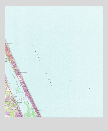
Port Orange, FL USGS Topographic Map
Click on map above to begin viewing in our Map Viewer.

This topographic map contains these locations and features:
Feature Name Type Latitude Longitude GNIS ID View Map
All Saints Lutheran ChurchChurchN29.1333°W80.9996°2451984View Map
Blue Skies Mobile Home VillagePopulated PlaceN29.1519°W80.9909°2452396View Map
Chapel in the GardenChurchN29.1284°W80.9790°2451985View Map
Church of the EpiphanyChurchN29.1334°W80.9824°2451986View Map
City of Daytona Beach ShoresCivilN29.1709°W80.9805°2404198View Map
Daytona Beach Fire Department Station 2BuildingN29.2028°W80.9985°2331181View Map
Daytona Beach ShoresPopulated PlaceN29.1761°W80.9828°281354View Map
Daytona Beach Shores Department of Public Safety Fire StationBuildingN29.1664°W80.9778°2644613View Map
Daytona Beach Shores Police DepartmentBuildingN29.1658°W80.9774°2756105View Map
Daytona Beach Shores Post OfficePost OfficeN29.1967°W80.9941°2767389View Map
Dunlawton (historical)LocaleN29.1336°W80.9831°294551View Map
Dunlawton SquareLocaleN29.1358°W80.9901°295990View Map
East-Port Orange Congregations of Jehovahs WitnessesChurchN29.1294°W80.9831°301721View Map
Epiphany Catholic Church ChurchChurchN29.1340°W80.9864°2451988View Map
First Baptist Church of Port OrangeChurchN29.1419°W80.9914°301720View Map
First United Methodist Church of Port OrangeChurchN29.1433°W80.9908°2451990View Map
Foursquare Gospel ChurchChurchN29.1433°W80.9734°301722View Map
Grace Episcopal ChurchChurchN29.1416°W80.9870°301723View Map
Halifax EstatesPopulated PlaceN29.1475°W80.9667°283617View Map
Halifax Trailer ParkPopulated PlaceN29.1486°W80.9888°2451970View Map
Pelican IslandIslandN29.1564°W80.9828°288672View Map
Port OrangePopulated PlaceN29.1383°W80.9956°295559View Map
Port Orange Elementary SchoolSchoolN29.1420°W80.9914°299385View Map
Port Orange Fire and Rescue Department Station 71BuildingN29.1407°W80.9864°2331231View Map
Port Orange PlazaLocaleN29.1419°W80.9881°295991View Map
Port Orange Post OfficePost OfficeN29.1382°W80.9985°2451966View Map
Port Orange Presbyterian ChurchChurchN29.1433°W80.9928°301719View Map
Port Orange Wastewater Treatment PlantLocaleN29.1374°W80.9944°2451960View Map
R J Longstreet Elementary SchoolSchoolN29.1770°W80.9857°299386View Map
South Peninsula DivisionCivilN29.1475°W80.9404°1935931View Map
Suwannee Mobile Home ParkPopulated PlaceN29.1577°W80.9967°2452402View Map
Tanglewood Mobile EstatesPopulated PlaceN29.1283°W80.9859°2451982View Map
Waters Edge Mobile Home ParkPopulated PlaceN29.1585°W80.9953°2452403View Map
Wilbur-by-the-SeaPopulated PlaceN29.1314°W80.9576°293276View Map
Wilbur-By-The-Sea Post Office (historical)Post OfficeN29.1314°W80.9576°2026978View Map
Woodland CemeteryCemeteryN29.1351°W80.9873°293502View Map

Note: Coordinates in the location and feature list above are referenced to NAD83 datum.


Copyright (C) 2008-2024 Ryan Niemi / Sunset Dynamics ... All Rights Reserved