TopoQuest Logo
Do you find TopoQuest useful?
Help keep TopoQuest running and adding new maps/features by donating!
Bitcoin:  19c7KJd3qBynnjoSw5npx9KScwjBe4ifkT
Litecoin:  LXs6TkuXGGXo1vDsWCkWVdjQX94eUKd6ui
Home View Maps Find Maps Find Places Resources & Links


Samsula, Florida Topographic Map

USGS Map Title: Samsula, FL
USGS Map MRC: 29081A1
DRG (GeoTIFF) Download: o29081a1.tif


Neighboring USGS Topographic Map Quads:


  Daytona Beach NW, FL  
29081B2
 

  Daytona Beach, FL  
29081B1
 

  Port Orange, FL  
29080B8
 

  Daytona Beach SW, FL  
29081A2
 

  Samsula, FL  
29081A1
 

  New Smyrna Beach, FL  
29080A8
 

  Lake Helen, FL  
28081H2
 

  Lake Ashby, FL  
28081H1
 

  Edgewater, FL  
28080H8


Map MRC Location:

N30°
W82°
N30°
W81°
H8 H7 H6 H5 H4 H3 H2 H1
G8 G7 G6 G5 G4 G3 G2 G1
F8 F7 F6 F5 F4 F3 F2 F1
E8 E7 E6 E5 E4 E3 E2 E1
D8 D7 D6 D5 D4 D3 D2 D1
C8 C7 C6 C5 C4 C3 C2 C1
B8 B7 B6 B5 B4 B3 B2 B1
A8 A7 A6 A5 A4 A3 A2 A1
N29°
W82°
N29°
W81°

Samsula, FL USGS 1:24K Topographic Map Preview:
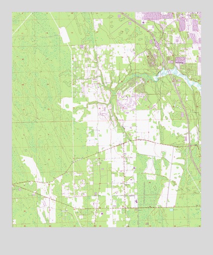
Samsula, FL USGS Topographic Map
Click on map above to begin viewing in our Map Viewer.

This topographic map contains these locations and features:
Feature Name Type Latitude Longitude GNIS ID View Map
Central Volusia DivisionCivilN29.0054°W81.0919°1935719View Map
City of Port OrangeCivilN29.1083°W81.0137°2404555View Map
Crane Lakes Mobile Home ParkPopulated PlaceN29.1027°W81.0502°2451976View Map
Double D Mobile RanchPopulated PlaceN29.0853°W81.0711°2448036View Map
Foursquare Gospel ChurchChurchN29.1060°W81.0220°2451991View Map
Friendship CemeteryCemeteryN29.0880°W81.0513°2581931View Map
Grace Baptist ChurchChurchN29.1010°W81.0398°2451992View Map
New Hope Baptist ChurchChurchN29.1013°W81.0355°2451995View Map
Our Savior's Lutheran ChurchChurchN29.0992°W81.0423°2451996View Map
Port Orange Christian ChurchChurchN29.1061°W81.0253°2451997View Map
Port Orange Church of the NazareneChurchN29.1059°W81.0199°2451998View Map
Port Orange Fire Rescue Department Station 74BuildingN29.0682°W81.0382°2331233View Map
Port Orange Fire Rescue Department Station 75BuildingN29.1114°W81.0527°2644349View Map
Port Orange United Church of ChristChurchN29.1074°W81.0059°2451999View Map
Saint Lukes Anglican ChurchChurchN29.1073°W81.0178°2452000View Map
SamsulaPopulated PlaceN29.0261°W81.0503°290466View Map
Samsula Elementary SchoolSchoolN29.0222°W81.0511°299390View Map
Samsula-Spruce Creek Census Designated PlaceCensusN29.0484°W81.0628°2402820View Map
South Tomoka Wildlife Management AreaParkN29.1044°W81.1242°308583View Map
Southern Dunes Golf and Country ClubLocaleN29.1005°W81.0496°2451963View Map
Southridge Golf CourseLocaleN29.0668°W81.0217°2451964View Map
Sovereign Grace ChurchChurchN29.0910°W81.0678°2448578View Map
Spruce Creek AirportAirportN29.0796°W81.0460°309357View Map
Spruce Creek CemeteryCemeteryN29.0795°W81.0434°2581932View Map
Spruce Creek Elementary SchoolSchoolN29.1053°W81.0052°299363View Map
Spruce Creek Presbyterian ChurchChurchN29.1003°W81.0395°2452001View Map
United Brethren in Christ Faith ChurchChurchN29.1243°W81.0239°2452002View Map
Volusia County Fire Services Station 12 Spruce CreekBuildingN29.0830°W81.0664°2331208View Map

Note: Coordinates in the location and feature list above are referenced to NAD83 datum.


Copyright (C) 2008-2024 Ryan Niemi / Sunset Dynamics ... All Rights Reserved