TopoQuest Logo
Do you find TopoQuest useful?
Help keep TopoQuest running and adding new maps/features by donating!
Bitcoin:  19c7KJd3qBynnjoSw5npx9KScwjBe4ifkT
Litecoin:  LXs6TkuXGGXo1vDsWCkWVdjQX94eUKd6ui
Home View Maps Find Maps Find Places Resources & Links


Port Sheldon, Michigan Topographic Map

USGS Map Title: Port Sheldon, MI
USGS Map MRC: 42086H2
DRG (GeoTIFF) Download: o42086h2.tif


Neighboring USGS Topographic Map Quads:


  Grand Haven, MI  
43086A2
 

  Nunica, MI  
43086A1


  Port Sheldon, MI  
42086H2
 

  Borculo, MI  
42086H1


  Holland West, MI  
42086G2
 

  Holland East, MI  
42086G1


Map MRC Location:

N43°
W87°
N43°
W86°
H8 H7 H6 H5 H4 H3 H2 H1
G8 G7 G6 G5 G4 G3 G2 G1
F8 F7 F6 F5 F4 F3 F2 F1
E8 E7 E6 E5 E4 E3 E2 E1
D8 D7 D6 D5 D4 D3 D2 D1
C8 C7 C6 C5 C4 C3 C2 C1
B8 B7 B6 B5 B4 B3 B2 B1
A8 A7 A6 A5 A4 A3 A2 A1
N42°
W87°
N42°
W86°

Port Sheldon, MI USGS 1:24K Topographic Map Preview:
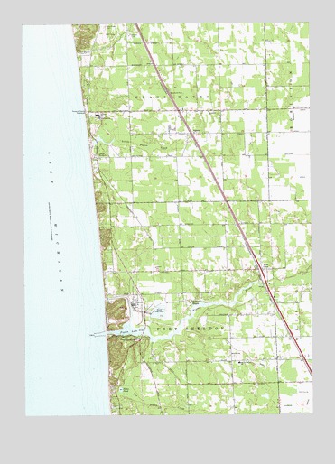
Port Sheldon, MI USGS Topographic Map
Click on map above to begin viewing in our Map Viewer.

This topographic map contains these locations and features:
Feature Name Type Latitude Longitude GNIS ID View Map
AgnewPopulated PlaceN42.9650°W86.1767°619868View Map
Agnew Post Office (historical)Post OfficeN42.9650°W86.1767°2572981View Map
Agnew StationLocaleN42.9650°W86.1769°2572847View Map
Camp BlodgettLocaleN42.9578°W86.2189°622543View Map
Charter Township of Grand HavenCivilN42.9962°W86.1870°1626370View Map
Cobmosay GraveCemeteryN42.9514°W86.2153°2571621View Map
Connell SchoolSchoolN42.9222°W86.1928°623705View Map
Grand Haven Golf ClubLocaleN42.9972°W86.2111°2573389View Map
Harlem ChurchChurchN42.8931°W86.1400°627801View Map
Haven Shores Community ChurchChurchN42.9431°W86.2056°2573344View Map
Historic CemeteryCemeteryN42.9972°W86.2031°1618696View Map
Indian CemeteryCemeteryN42.9430°W86.2128°2571619View Map
Kirk County ParkParkN42.9450°W86.2172°2573348View Map
Little Pigeon CreekStreamN42.9628°W86.2223°630726View Map
Mountain BeachBeachN42.9044°W86.2150°2573039View Map
Ottawa Reformed ChurchChurchN42.9361°W86.1450°2573343View Map
Pigeon LakeLakeN42.9022°W86.2045°634853View Map
Pigeon RiverStreamN42.9011°W86.2153°634856View Map
Port SheldonPopulated PlaceN42.8995°W86.1998°635268View Map
Port Sheldon Fire DepartmentBuildingN42.8853°W86.1806°2635941View Map
Port Sheldon ParkParkN42.9120°W86.2125°1618715View Map
Portsheldon Post Office (historical)Post OfficeN42.8994°W86.1997°2572862View Map
Post DrainCanalN42.8911°W86.1492°635323View Map
Robart SchoolSchoolN42.8945°W86.1600°636028View Map
Sheldon Woods SchoolSchoolN42.8914°W86.1567°637725View Map
Sloan PondLakeN42.8832°W86.2084°638111View Map
Spring BayouLakeN42.9107°W86.1775°638536View Map
Ten Hagen CreekStreamN42.8750°W86.1714°1614676View Map
Township of Port SheldonCivilN42.8996°W86.1779°1626936View Map
United Lutheran ChurchChurchN42.9720°W86.1692°628938View Map
West OlivePopulated PlaceN42.9214°W86.1464°1616155View Map
West Olive Christian Reformed ChurchChurchN42.9206°W86.1453°2573341View Map
West Olive Estates Mobile Home ParkPopulated PlaceN42.9306°W86.1472°2573340View Map
West Olive Post OfficePost OfficeN42.9239°W86.1469°2573342View Map
West Olive StationLocaleN42.9222°W86.1486°2573339View Map
West Ottawa Golf CourseLocaleN42.8833°W86.1278°2573349View Map
Wuskowhan Players ClubLocaleN42.8922°W86.1856°2573350View Map
Zwemer BeachBeachN42.9358°W86.2178°2573114View Map

Note: Coordinates in the location and feature list above are referenced to NAD83 datum.


Copyright (C) 2008-2025 Ryan Niemi / Sunset Dynamics ... All Rights Reserved