TopoQuest Logo
Do you find TopoQuest useful?
Help keep TopoQuest running and adding new maps/features by donating!
Bitcoin:  19c7KJd3qBynnjoSw5npx9KScwjBe4ifkT
Litecoin:  LXs6TkuXGGXo1vDsWCkWVdjQX94eUKd6ui
Home View Maps Find Maps Find Places Resources & Links


Biddle, Montana Topographic Map

USGS Map Title: Biddle, MT
USGS Map MRC: 45105A3
DRG (GeoTIFF) Download: o45105a3.tif


Neighboring USGS Topographic Map Quads:


  Bear Skull Mountain, MT  
45105B4
 

  Pine Creek, MT  
45105B3
 

  Sanburn Reservoir, MT  
45105B2
 

  Wild Bill Creek, MT  
45105A4
 

  Biddle, MT  
45105A3
 

  Belle Creek SW, MT  
45105A2
 

  Rocky Butte, WY  
44105H4
 

  Nipple Butte, WY  
44105H3
 

  Mitten Butte, WY  
44105H2


Map MRC Location:

N46°
W106°
N46°
W105°
H8 H7 H6 H5 H4 H3 H2 H1
G8 G7 G6 G5 G4 G3 G2 G1
F8 F7 F6 F5 F4 F3 F2 F1
E8 E7 E6 E5 E4 E3 E2 E1
D8 D7 D6 D5 D4 D3 D2 D1
C8 C7 C6 C5 C4 C3 C2 C1
B8 B7 B6 B5 B4 B3 B2 B1
A8 A7 A6 A5 A4 A3 A2 A1
N45°
W106°
N45°
W105°

Biddle, MT USGS 1:24K Topographic Map Preview:
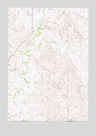
Biddle, MT USGS Topographic Map
Click on map above to begin viewing in our Map Viewer.

This topographic map contains these locations and features:
Feature Name Type Latitude Longitude GNIS ID View Map
08S52E20ADA_01 WellWellN45.0378°W105.3658°807465View Map
08S52E27CC__01 WellWellN45.0155°W105.3397°807334View Map
08S52E27DD__01 WellWellN45.1036°W105.3333°807924View Map
08S53E29BCBB01 WellWellN45.1161°W105.2617°807988View Map
09S52E13DC__01 WellWellN45.0453°W105.2903°807520View Map
09S52E16CCCB01 WellWellN45.0442°W105.3628°807514View Map
Badger CreekStreamN45.0964°W105.3350°768430View Map
BiddlePopulated PlaceN45.0994°W105.3383°802029View Map
Biddle Census Designated PlaceCensusN45.1051°W105.3115°2583790View Map
Biddle Post OfficePost OfficeN45.0994°W105.3387°2738321View Map
Biddle Volunteer Fire DepartmentBuildingN45.1002°W105.3378°2546555View Map
Blacktail CreekStreamN45.0753°W105.3530°769002View Map
Bobcat CreekStreamN45.1119°W105.3178°769066View Map
Bowers CreekStreamN45.0455°W105.3497°769138View Map
Deep CreekStreamN45.1192°W105.3147°1690017View Map
Deer Trail CreekStreamN45.0030°W105.3397°770591View Map
Fuller GulchValleyN45.0125°W105.3528°771654View Map
Hay CreekStreamN45.1194°W105.3280°772243View Map
Kendricknumber 1 DamDamN45.0717°W105.2522°796920View Map
Little Hay CreekStreamN45.1242°W105.3619°1690012View Map
Myrtle CreekStreamN45.1136°W105.3147°1690018View Map
Prairie Dog CreekStreamN45.0403°W105.3480°775438View Map
Rambo GulchValleyN45.0769°W105.2853°1690016View Map
Ranch CreekStreamN45.0972°W105.3258°775544View Map
Wild Bill CreekStreamN45.0422°W105.3742°778462View Map
Williams CreekStreamN45.0722°W105.3422°778517View Map
Wilson GulchValleyN45.0897°W105.3047°1690019View Map

Note: Coordinates in the location and feature list above are referenced to NAD83 datum.


Copyright (C) 2008-2025 Ryan Niemi / Sunset Dynamics ... All Rights Reserved