TopoQuest Logo
Do you find TopoQuest useful?
Help keep TopoQuest running and adding new maps/features by donating!
Bitcoin:  19c7KJd3qBynnjoSw5npx9KScwjBe4ifkT
Litecoin:  LXs6TkuXGGXo1vDsWCkWVdjQX94eUKd6ui
Home View Maps Find Maps Find Places Resources & Links


Pine Creek, Montana Topographic Map

USGS Map Title: Pine Creek, MT
USGS Map MRC: 45105B3
DRG (GeoTIFF) Download: o45105b3.tif


Neighboring USGS Topographic Map Quads:


  Eldon Mountain, MT  
45105C4
 

  Fighting Butte, MT  
45105C3
 

  Dry Creek Butte, MT  
45105C2
 

  Bear Skull Mountain, MT  
45105B4
 

  Pine Creek, MT  
45105B3
 

  Sanburn Reservoir, MT  
45105B2
 

  Wild Bill Creek, MT  
45105A4
 

  Biddle, MT  
45105A3
 

  Belle Creek SW, MT  
45105A2


Map MRC Location:

N46°
W106°
N46°
W105°
H8 H7 H6 H5 H4 H3 H2 H1
G8 G7 G6 G5 G4 G3 G2 G1
F8 F7 F6 F5 F4 F3 F2 F1
E8 E7 E6 E5 E4 E3 E2 E1
D8 D7 D6 D5 D4 D3 D2 D1
C8 C7 C6 C5 C4 C3 C2 C1
B8 B7 B6 B5 B4 B3 B2 B1
A8 A7 A6 A5 A4 A3 A2 A1
N45°
W106°
N45°
W105°

Pine Creek, MT USGS 1:24K Topographic Map Preview:
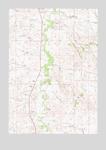
Pine Creek, MT USGS Topographic Map
Click on map above to begin viewing in our Map Viewer.

This topographic map contains these locations and features:
Feature Name Type Latitude Longitude GNIS ID View Map
07S52E02ACDC01 WellWellN45.1672°W105.3086°808268View Map
07S52E10DBDC01 WellWellN45.2367°W105.3319°808534View Map
07S52E11BBBB01 WellWellN45.2461°W105.3242°808569View Map
07S52E21DC__01 WellWellN45.2044°W105.3514°808413View Map
07S52E26BACB01 WellWellN45.2011°W105.3194°808402View Map
07S52E27ABBB01 WellWellN45.2028°W105.3347°808409View Map
07S52E34BB__01 WellWellN45.1855°W105.3400°808351View Map
08S52E15CCAD01 WellWellN45.1358°W105.3386°808117View Map
Allison CreekStreamN45.2372°W105.3205°768215View Map
Bear Skull CreekStreamN45.1883°W105.3225°768606View Map
Bell TowerSummitN45.1503°W105.3186°768683View Map
Belle CreekStreamN45.1939°W105.3158°768684View Map
Big GulchValleyN45.1844°W105.3178°768791View Map
Bobcat CreekStreamN45.1258°W105.3158°1690020View Map
Gumbo CreekStreamN45.2097°W105.3130°1690027View Map
Home CreekStreamN45.2292°W105.3422°1690024View Map
Horse CreekStreamN45.2469°W105.3083°772538View Map
Little Bear Skull CreekStreamN45.1883°W105.3214°773398View Map
North Fork Little Bear Skull CreekStreamN45.1972°W105.3669°1690023View Map
Pease DrawValleyN45.1683°W105.3172°775133View Map
Pine CreekStreamN45.2364°W105.3133°775236View Map
Plum CreekStreamN45.2394°W105.3105°1690025View Map
Preacher DrawValleyN45.1683°W105.3297°775450View Map
Rocky ButteSummitN45.1775°W105.3378°775876View Map
Rue CreekStreamN45.1550°W105.3378°776007View Map
South Fork Wright CreekStreamN45.1300°W105.2714°776892View Map
Spring CreekStreamN45.2258°W105.3186°1690026View Map
Spring CreekStreamN45.2169°W105.3272°776993View Map
Watt CreekStreamN45.2019°W105.3261°778155View Map
Wolf RavineValleyN45.1439°W105.3361°1690021View Map
Wright CreekStreamN45.1353°W105.3194°778702View Map

Note: Coordinates in the location and feature list above are referenced to NAD83 datum.


Copyright (C) 2008-2025 Ryan Niemi / Sunset Dynamics ... All Rights Reserved