TopoQuest Logo
Do you find TopoQuest useful?
Help keep TopoQuest running and adding new maps/features by donating!
Bitcoin:  19c7KJd3qBynnjoSw5npx9KScwjBe4ifkT
Litecoin:  LXs6TkuXGGXo1vDsWCkWVdjQX94eUKd6ui
Home View Maps Find Maps Find Places Resources & Links


Portage Entry, Michigan Topographic Map

USGS Map Title: Portage Entry, MI
USGS Map MRC: 46088H4
DRG (GeoTIFF) Download: o46088h4.tif


Neighboring USGS Topographic Map Quads:


  Chassell, MI  
47088A5
 

  Point Mills, MI  
47088A4
 

  Traverse Island, MI  
47088A3
 

  Otter Lake, MI  
46088H5
 

  Portage Entry, MI  
46088H4
 

  Keweenaw Bay NE, MI  
46088H3
 

  Bear Town, MI  
46088G5
 

  L'Anse, MI  
46088G4
 

  Aura, MI  
46088G3


Map MRC Location:

N47°
W89°
N47°
W88°
H8 H7 H6 H5 H4 H3 H2 H1
G8 G7 G6 G5 G4 G3 G2 G1
F8 F7 F6 F5 F4 F3 F2 F1
E8 E7 E6 E5 E4 E3 E2 E1
D8 D7 D6 D5 D4 D3 D2 D1
C8 C7 C6 C5 C4 C3 C2 C1
B8 B7 B6 B5 B4 B3 B2 B1
A8 A7 A6 A5 A4 A3 A2 A1
N46°
W89°
N46°
W88°

Portage Entry, MI USGS 1:24K Topographic Map Preview:
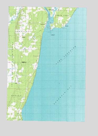
Portage Entry, MI USGS Topographic Map
Click on map above to begin viewing in our Map Viewer.

This topographic map contains these locations and features:
Feature Name Type Latitude Longitude GNIS ID View Map
ArnheimPopulated PlaceN46.9169°W88.4826°1617421View Map
Arnheim Post Office (historical)Post OfficeN46.9169°W88.4825°2129325View Map
Arnheim Station (historical)LocaleN46.9167°W88.4825°2129326View Map
Craig Post Office (historical)Post OfficeN46.9867°W88.4375°2124150View Map
Finnish Lutheran Church Historical MarkerParkN46.9797°W88.4119°2123803View Map
JacobsvillePopulated PlaceN46.9808°W88.4101°629192View Map
Jacobsville Historical MarkerParkN46.9797°W88.4119°2123802View Map
Jacobsville Post Office (historical)Post OfficeN46.9808°W88.4100°2124046View Map
Jarvi CreekStreamN46.9722°W88.4446°629213View Map
Kelsey CreekStreamN46.8797°W88.4748°629559View Map
KlingvillePopulated PlaceN46.9677°W88.4779°629794View Map
Newtonville Post Office (historical)Post OfficeN46.8842°W88.4800°2129283View Map
Newtonville Station (historical)LocaleN46.8842°W88.4800°2129282View Map
Portage EntryPopulated PlaceN46.9822°W88.4407°635277View Map
Portage Entry LighthouseLocaleN46.9669°W88.4307°1618741View Map
Portage Entry Post Office (historical)Post OfficeN46.9822°W88.4406°2124031View Map
Portage River Harbor of RefugeBayN46.9869°W88.4382°1618739View Map
Rasce Marine Hoist RampLocaleN46.9838°W88.4379°1618392View Map
Redrock Post Office (historical)Post OfficeN46.9972°W88.3875°2124027View Map
White CityPopulated PlaceN46.9822°W88.4251°1616300View Map

Note: Coordinates in the location and feature list above are referenced to NAD83 datum.


Copyright (C) 2008-2025 Ryan Niemi / Sunset Dynamics ... All Rights Reserved