TopoQuest Logo
Do you find TopoQuest useful?
Help keep TopoQuest running and adding new maps/features by donating!
Bitcoin:  19c7KJd3qBynnjoSw5npx9KScwjBe4ifkT
Litecoin:  LXs6TkuXGGXo1vDsWCkWVdjQX94eUKd6ui
Home View Maps Find Maps Find Places Resources & Links


Posey, California Topographic Map

USGS Map Title: Posey, CA
USGS Map MRC: 35118G6
DRG (GeoTIFF) Download: o35118g6.tif


Neighboring USGS Topographic Map Quads:


  Gibbon Peak, CA  
35118H7
 

  California Hot Springs, CA  
35118H6
 

  Johnsondale, CA  
35118H5
 

  White River, CA  
35118G7
 

  Posey, CA  
35118G6
 

  Tobias Peak, CA  
35118G5
 

  Woody, CA  
35118F7
 

  Glennville, CA  
35118F6
 

  Alta Sierra, CA  
35118F5


Map MRC Location:

N36°
W119°
N36°
W118°
H8 H7 H6 H5 H4 H3 H2 H1
G8 G7 G6 G5 G4 G3 G2 G1
F8 F7 F6 F5 F4 F3 F2 F1
E8 E7 E6 E5 E4 E3 E2 E1
D8 D7 D6 D5 D4 D3 D2 D1
C8 C7 C6 C5 C4 C3 C2 C1
B8 B7 B6 B5 B4 B3 B2 B1
A8 A7 A6 A5 A4 A3 A2 A1
N35°
W119°
N35°
W118°

Posey, CA USGS 1:24K Topographic Map Preview:
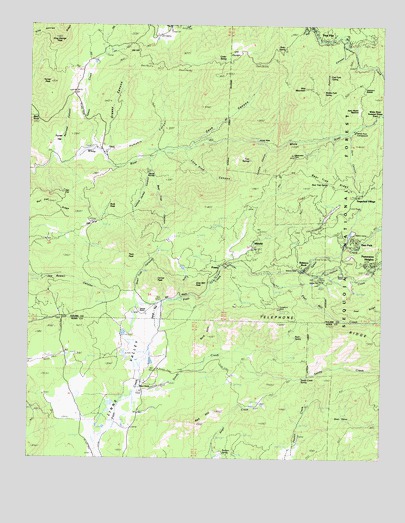
Posey, CA USGS Topographic Map
Click on map above to begin viewing in our Map Viewer.

This topographic map contains these locations and features:
Feature Name Type Latitude Longitude GNIS ID View Map
Ames HoleValleyN35.8429°W118.6719°269516View Map
Balance RockPopulated PlaceN35.8061°W118.6520°1660292View Map
Balance RockPillarN35.8050°W118.6562°269635View Map
Balance Rock Post Office (historical)Post OfficeN35.8061°W118.6520°2026837View Map
Bald HillsRidgeN35.7850°W118.6876°269640View Map
Bald KnobSummitN35.8469°W118.7498°269641View Map
Bear DensBasinN35.7619°W118.6401°269736View Map
Bear Trap CanyonValleyN35.8361°W118.7076°269752View Map
Bear Trap RidgeRidgeN35.8319°W118.6501°269756View Map
Bear Trap SpringSpringN35.8228°W118.6430°269758View Map
Betty SpringSpringN35.8684°W118.6609°269802View Map
Betty Waller MeadowFlatN35.8505°W118.6340°269803View Map
Bowen RanchLocaleN35.7702°W118.7115°1667544View Map
Buck PeakSummitN35.8225°W118.7195°1660387View Map
Burton RanchLocaleN35.8027°W118.6387°1667561View Map
California Hot Springs AmbulanceBuildingN35.8624°W118.6251°2662275View Map
Capinero SaddleGapN35.8577°W118.6320°270294View Map
Carver and Bowen RanchLocaleN35.7594°W118.7145°270323View Map
Carver PeakSummitN35.8013°W118.7051°270324View Map
Cedar SpringSpringN35.8646°W118.6821°270372View Map
Cedar Trough Landmark ObjectLocaleN35.8227°W118.6343°275564View Map
Cooksie CanyonValleyN35.8394°W118.6659°270590View Map
Cove CanyonValleyN35.8402°W118.6937°270639View Map
Dark CanyonValleyN35.8441°W118.6370°270754View Map
Devils KitchenFlatN35.8325°W118.7073°270862View Map
Durkas FlatFlatN35.8005°W118.6509°270944View Map
East Fork SpringSpringN35.8601°W118.6448°271002View Map
Grassy CanyonValleyN35.8388°W118.7248°271413View Map
Grist Mill PeakSummitN35.8002°W118.6906°1660701View Map
IdlewildPopulated PlaceN35.8108°W118.6720°1660785View Map
Idlewild Census Designated PlaceCensusN35.8096°W118.6705°2585425View Map
Jack RanchLocaleN35.8088°W118.6845°274910View Map
King George PeakSummitN35.8713°W118.7409°271897View Map
King George RidgeRidgeN35.8722°W118.7476°271898View Map
Lone Pine CanyonValleyN35.8388°W118.6965°272170View Map
McClenney Tract Census Designated PlaceCensusN35.8220°W118.6478°2585431View Map
Middle Fork SpringSpringN35.8562°W118.6472°272444View Map
Oak FlatFlatN35.8163°W118.7304°272733View Map
Old Sled TrailTrailN35.8352°W118.6423°272788View Map
Panorama HeightsPopulated PlaceN35.8050°W118.6293°1661189View Map
Panorama Heights Census Designated PlaceCensusN35.8068°W118.6271°2585435View Map
Peel Mill CreekStreamN35.8038°W118.6651°272916View Map
Pine Flat Census Designated PlaceCensusN35.8736°W118.6425°2585438View Map
Pine MountainSummitN35.8572°W118.6531°272996View Map
Pipeline CanyonValleyN35.8702°W118.6395°273024View Map
Pleasant ViewPopulated PlaceN35.8055°W118.6409°1661242View Map
PoseyPopulated PlaceN35.8047°W118.6829°1661254View Map
Posey Census Designated PlaceCensusN35.8056°W118.6756°2585441View Map
Posey Post OfficePost OfficeN35.8061°W118.6814°2780982View Map
Poso Forest Service StationLocaleN35.8075°W118.6443°274911View Map
Poso ParkPopulated PlaceN35.8108°W118.6348°1661255View Map
Poso Park Census Designated PlaceCensusN35.8113°W118.6365°2585442View Map
Pumpkin CanyonValleyN35.8380°W118.7220°273133View Map
Quail Trap CanyonValleyN35.7975°W118.7126°273150View Map
Rail FlatFlatN35.8266°W118.7359°273164View Map
Rail Flat RidgeRidgeN35.8222°W118.7454°273165View Map
Railroad CanyonValleyN35.8369°W118.7415°273169View Map
Red HillSummitN35.7605°W118.6906°273239View Map
Rock SpringSpringN35.7851°W118.6564°273316View Map
Runyon SpringSpringN35.7515°W118.6815°273384View Map
Sand FlatFlatN35.7902°W118.7048°273529View Map
Sandy CreekStreamN35.7688°W118.7123°273533View Map
Sandy Creek SpringSpringN35.7736°W118.6526°273534View Map
Sierra Christian CampLocaleN35.8002°W118.6484°1667614View Map
Spear CreekStreamN35.8044°W118.6534°273858View Map
Speas CreekStreamN35.8394°W118.7293°273859View Map
Sugarloaf VillagePopulated PlaceN35.8258°W118.6343°1667621View Map
Sugarloaf Village Census Designated PlaceCensusN35.8269°W118.6354°2585452View Map
Telephone RidgeRidgeN35.7863°W118.6340°274057View Map
Tulare County Fire Department Battalion 2 California Hot Springs Fire Station 6BuildingN35.8624°W118.6251°274904View Map
Tulare County Fire Department Battalion 2 Posey Fire Station 5BuildingN35.8066°W118.6334°2624198View Map
Turner FlatFlatN35.8400°W118.7415°274239View Map
Turner PeakSummitN35.8583°W118.7437°274240View Map
Twin PeakSummitN35.8094°W118.7140°274247View Map
Twin SpringsSpringN35.8360°W118.6725°274254View Map
Uhi PocketBasinN35.8658°W118.6809°274263View Map
Uhl HillSummitN35.8672°W118.7140°1661598View Map
Vincent RanchLocaleN35.7930°W118.7115°274346View Map
Von Hellum CreekStreamN35.8027°W118.6540°274357View Map
White River CampgroundLocaleN35.8444°W118.6359°1667628View Map
White River Summer Home TractPopulated PlaceN35.8494°W118.6270°1661684View Map
Yellow Jacket CanyonValleyN35.8361°W118.7076°274590View Map

Note: Coordinates in the location and feature list above are referenced to NAD83 datum.


Copyright (C) 2008-2024 Ryan Niemi / Sunset Dynamics ... All Rights Reserved