TopoQuest Logo
Do you find TopoQuest useful?
Help keep TopoQuest running and adding new maps/features by donating!
Bitcoin:  19c7KJd3qBynnjoSw5npx9KScwjBe4ifkT
Litecoin:  LXs6TkuXGGXo1vDsWCkWVdjQX94eUKd6ui
Home View Maps Find Maps Find Places Resources & Links


California Hot Springs, California Topographic Map

USGS Map Title: California Hot Springs, CA
USGS Map MRC: 35118H6
DRG (GeoTIFF) Download: o35118h6.tif


Neighboring USGS Topographic Map Quads:


  Globe, CA  
36118A7
 

  Solo Peak, CA  
36118A6
 

  Sentinel Peak, CA  
36118A5
 

  Gibbon Peak, CA  
35118H7
 

  California Hot Springs, CA  
35118H6
 

  Johnsondale, CA  
35118H5
 

  White River, CA  
35118G7
 

  Posey, CA  
35118G6
 

  Tobias Peak, CA  
35118G5


Map MRC Location:

N36°
W119°
N36°
W118°
H8 H7 H6 H5 H4 H3 H2 H1
G8 G7 G6 G5 G4 G3 G2 G1
F8 F7 F6 F5 F4 F3 F2 F1
E8 E7 E6 E5 E4 E3 E2 E1
D8 D7 D6 D5 D4 D3 D2 D1
C8 C7 C6 C5 C4 C3 C2 C1
B8 B7 B6 B5 B4 B3 B2 B1
A8 A7 A6 A5 A4 A3 A2 A1
N35°
W119°
N35°
W118°

California Hot Springs, CA USGS 1:24K Topographic Map Preview:
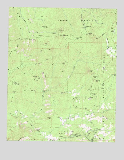
California Hot Springs, CA USGS Topographic Map
Click on map above to begin viewing in our Map Viewer.

This topographic map contains these locations and features:
Feature Name Type Latitude Longitude GNIS ID View Map
Alder CreekStreamN35.9025°W118.6523°269469View Map
Buck SlideSlopeN35.9663°W118.6865°270058View Map
Bull Point MineMineN35.8855°W118.7143°270077View Map
Cain SpringSpringN35.9278°W118.7395°270147View Map
Cain Spring GapGapN35.9188°W118.7415°270148View Map
California Hot SpringsPopulated PlaceN35.8813°W118.6644°1660419View Map
California Hot Springs Census Designated PlaceCensusN35.8863°W118.6561°2585404View Map
California Hot Springs Post OfficePost OfficeN35.8809°W118.6682°2780944View Map
Capinero CreekStreamN35.8802°W118.6590°270293View Map
Chute SpringSpringN35.9192°W118.6513°240617View Map
Cold Springs CreekStreamN35.8983°W118.7315°270545View Map
Cold Springs PeakSummitN35.9322°W118.6487°1660500View Map
Cold Springs SaddleGapN35.9349°W118.6484°270546View Map
Corral HillSummitN35.9227°W118.7212°1660515View Map
Cougar CampLocaleN35.9702°W118.6848°270632View Map
Dead Mule SaddleGapN35.9172°W118.6548°270780View Map
Devils DenBendN35.9644°W118.7076°270853View Map
Devils ThumbRidgeN35.9474°W118.7126°270867View Map
Eagle HotelLocaleN35.9097°W118.6434°270965View Map
Frankum RanchLocaleN35.9472°W118.7334°271206View Map
Gordon HillsRidgeN35.9705°W118.7231°271367View Map
Hatchet PeakSummitN35.9405°W118.6562°271513View Map
Hot Springs Elementary SchoolSchoolN35.8808°W118.6773°1835759View Map
Hot Springs Ranger StationLocaleN35.8869°W118.6462°1667591View Map
Jon HillRidgeN35.9130°W118.7448°271819View Map
Leavis Flat CampgroundLocaleN35.8794°W118.6765°272009View Map
Lone Pine MountainSummitN35.9702°W118.7365°1660939View Map
McDermott CampLocaleN35.9822°W118.7123°272386View Map
Merry CampLocaleN35.9172°W118.6693°272415View Map
Merry CreekStreamN35.8980°W118.6787°272416View Map
Millard CorralLocaleN35.9727°W118.7170°272473View Map
Mud SpringSpringN35.9287°W118.6430°272593View Map
North Cold SpringSummitN35.9733°W118.6881°272666View Map
North Cold Spring GroveWoodsN35.9794°W118.6943°272667View Map
North Cold Spring PeakSummitN35.9752°W118.6951°1661114View Map
North Fork Gordon CreekStreamN35.9438°W118.7356°272686View Map
Parker MeadowFlatN35.9605°W118.6306°272878View Map
Parker Meadow Stock DrivewayTrailN35.9194°W118.6426°272879View Map
Parker PassGapN35.9572°W118.6309°272880View Map
Parker PeakSummitN35.9722°W118.6465°272881View Map
Parker Peak GroveWoodsN35.9861°W118.6562°272882View Map
Pine FlatPopulated PlaceN35.8780°W118.6515°1661222View Map
Pinnell Camp RidgeRidgeN35.9222°W118.7273°273010View Map
Poison Oak SpringSpringN35.9116°W118.7229°273067View Map
Rattlesnake RidgeRidgeN35.9611°W118.7401°273226View Map
Redwood CorralPopulated PlaceN35.9824°W118.6626°1661297View Map
Redwood CreekStreamN35.9974°W118.6659°273256View Map
Rube CreekStreamN35.8986°W118.7315°274659View Map
Skunk SpringSpringN35.9341°W118.7141°273737View Map
Skunk Spring SaddleGapN35.9344°W118.7173°273738View Map
Soldier MeadowFlatN35.9794°W118.6351°273801View Map
South Fork Gordon CreekStreamN35.9436°W118.7354°273823View Map
Starvation CreekStreamN35.9027°W118.6465°273893View Map
Stone PlacePopulated PlaceN35.9025°W118.7343°1661507View Map
Sycamore GapGapN35.8933°W118.7220°274009View Map
Sycamore SpringSpringN35.9060°W118.6615°274015View Map
Thompson CampLocaleN35.9208°W118.7098°274111View Map
Thompson PeakSummitN35.9383°W118.7084°274117View Map
Thompson RidgeRidgeN35.9383°W118.7079°274119View Map
Tyler CreekStreamN35.8838°W118.7073°274258View Map
Tyler Creek Fire Control StationLocaleN35.8816°W118.6995°274259View Map
Tyler PeakSummitN35.8963°W118.7015°274260View Map
Uhi StationLocaleN35.8858°W118.6465°274264View Map
Upper Parker MeadowFlatN35.9666°W118.6356°274295View Map

Note: Coordinates in the location and feature list above are referenced to NAD83 datum.


Copyright (C) 2008-2025 Ryan Niemi / Sunset Dynamics ... All Rights Reserved