TopoQuest Logo
Do you find TopoQuest useful?
Help keep TopoQuest running and adding new maps/features by donating!
Bitcoin:  19c7KJd3qBynnjoSw5npx9KScwjBe4ifkT
Litecoin:  LXs6TkuXGGXo1vDsWCkWVdjQX94eUKd6ui
Home View Maps Find Maps Find Places Resources & Links


Potter, Kansas Topographic Map

USGS Map Title: Potter, KS
USGS Map MRC: 39095D2
DRG (GeoTIFF) Download: o39095d2.tif


Neighboring USGS Topographic Map Quads:


  Lancaster, KS  
39095E3
 

  Atchison West, KS  
39095E2
 

  Atchison East, KS  
39095E1
 

  Nortonville, KS  
39095D3
 

  Potter, KS  
39095D2
 

  Oak Mills, KS  
39095D1
 

  Winchester, KS  
39095C3
 

  Easton SW, KS  
39095C2
 

  Easton, KS  
39095C1


Map MRC Location:

N40°
W96°
N40°
W95°
H8 H7 H6 H5 H4 H3 H2 H1
G8 G7 G6 G5 G4 G3 G2 G1
F8 F7 F6 F5 F4 F3 F2 F1
E8 E7 E6 E5 E4 E3 E2 E1
D8 D7 D6 D5 D4 D3 D2 D1
C8 C7 C6 C5 C4 C3 C2 C1
B8 B7 B6 B5 B4 B3 B2 B1
A8 A7 A6 A5 A4 A3 A2 A1
N39°
W96°
N39°
W95°

Potter, KS USGS 1:24K Topographic Map Preview:
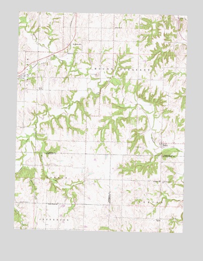
Potter, KS USGS Topographic Map
Click on map above to begin viewing in our Map Viewer.

This topographic map contains these locations and features:
Feature Name Type Latitude Longitude GNIS ID View Map
Ashcraft CemeteryCemeteryN39.4694°W95.1479°2673185View Map
Atchison County Rural Fire District 4 - Mount PleasantBuildingN39.4869°W95.1605°2111115View Map
Camp CreekStreamN39.4792°W95.2305°473481View Map
Corpus Christi CemeteryCemeteryN39.3907°W95.2397°478250View Map
Corpus Christi SchoolSchoolN39.3906°W95.2183°478251View Map
Crooked CreekStreamN39.4586°W95.1902°478244View Map
CummingsPopulated PlaceN39.4628°W95.2475°478259View Map
Cummings CemeteryCemeteryN39.4599°W95.2414°2673189View Map
Cummings Christian ChurchChurchN39.4636°W95.2446°2689817View Map
Cummings Post OfficePost OfficeN39.4629°W95.2455°2693682View Map
Cummings United Methodist ChurchChurchN39.4629°W95.2451°2690222View Map
Evergreen CemeteryCemeteryN39.3832°W95.1335°478254View Map
Fairview CemeteryCemeteryN39.4239°W95.1616°478255View Map
HawthornePopulated PlaceN39.4764°W95.2141°484843View Map
Hawthorne Elementary SchoolSchoolN39.4819°W95.2033°478258View Map
Howard CreekStreamN39.4114°W95.2444°478249View Map
Locust Grove (historical)LocaleN39.4264°W95.1980°482150View Map
Mooney CreekStreamN39.4292°W95.2369°478248View Map
Mount Pleasant (historical)LocaleN39.4478°W95.1377°482151View Map
PotterPopulated PlaceN39.4258°W95.1419°478256View Map
Potter Community ChurchChurchN39.4257°W95.1408°2688750View Map
Round Mound CemeteryCemeteryN39.4647°W95.1911°478257View Map
Saint John's Lutheran ChurchChurchN39.4044°W95.1428°478252View Map
Saint Johns CemeteryCemeteryN39.4043°W95.1390°478253View Map
Spring CreekStreamN39.4736°W95.2261°478246View Map
Springhill CemeteryCemeteryN39.4303°W95.2025°2673187View Map
Township of Mount PleasantCivilN39.4771°W95.1794°473489View Map

Note: Coordinates in the location and feature list above are referenced to NAD83 datum.


Copyright (C) 2008-2025 Ryan Niemi / Sunset Dynamics ... All Rights Reserved