TopoQuest Logo
Do you find TopoQuest useful?
Help keep TopoQuest running and adding new maps/features by donating!
Bitcoin:  19c7KJd3qBynnjoSw5npx9KScwjBe4ifkT
Litecoin:  LXs6TkuXGGXo1vDsWCkWVdjQX94eUKd6ui
Home View Maps Find Maps Find Places Resources & Links


Lancaster, Kansas Topographic Map

USGS Map Title: Lancaster, KS
USGS Map MRC: 39095E3
DRG (GeoTIFF) Download: o39095e3.tif


Neighboring USGS Topographic Map Quads:


  Everest, KS  
39095F4
 

  Denton, KS  
39095F3
 

  Bendena, KS  
39095F2
 

  Effingham, KS  
39095E4
 

  Lancaster, KS  
39095E3
 

  Atchison West, KS  
39095E2
 

  Half Mound, KS  
39095D4
 

  Nortonville, KS  
39095D3
 

  Potter, KS  
39095D2


Map MRC Location:

N40°
W96°
N40°
W95°
H8 H7 H6 H5 H4 H3 H2 H1
G8 G7 G6 G5 G4 G3 G2 G1
F8 F7 F6 F5 F4 F3 F2 F1
E8 E7 E6 E5 E4 E3 E2 E1
D8 D7 D6 D5 D4 D3 D2 D1
C8 C7 C6 C5 C4 C3 C2 C1
B8 B7 B6 B5 B4 B3 B2 B1
A8 A7 A6 A5 A4 A3 A2 A1
N39°
W96°
N39°
W95°

Lancaster, KS USGS 1:24K Topographic Map Preview:
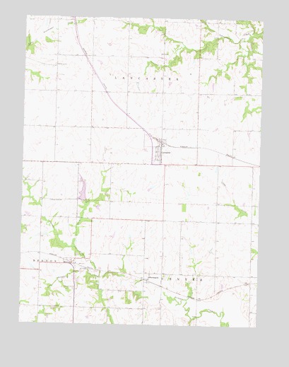
Lancaster, KS USGS Topographic Map
Click on map above to begin viewing in our Map Viewer.

This topographic map contains these locations and features:
Feature Name Type Latitude Longitude GNIS ID View Map
Atchison CountyCivilN39.5317°W95.3134°484972View Map
Atchison County Fire District 5 - LancasterBuildingN39.5748°W95.3042°2111113View Map
City of LancasterCivilN39.5712°W95.3037°2395625View Map
FarmingtonPopulated PlaceN39.5186°W95.3097°473485View Map
Jackson Farmers Grain Elevator Number 4LocaleN39.5757°W95.3048°2695300View Map
LancasterPopulated PlaceN39.5728°W95.3028°473483View Map
Lancaster CemeteryCemeteryN39.5665°W95.3063°2673191View Map
Lancaster Elementary SchoolSchoolN39.5687°W95.3039°2506531View Map
Lancaster Post OfficePost OfficeN39.5731°W95.3024°2693811View Map
Lancaster Sewage Treatment PlantLocaleN39.5713°W95.3115°2691908View Map
Little Stranger CreekStreamN39.5192°W95.3330°473479View Map
Maple Grove CemeteryCemeteryN39.5503°W95.3600°484346View Map
MonroviaPopulated PlaceN39.5242°W95.3461°473486View Map
Monrovia CemeteryCemeteryN39.5149°W95.3470°473487View Map
North Fork Stranger CreekStreamN39.5311°W95.3472°473480View Map
Old Huron CemeteryCemeteryN39.6056°W95.3588°473482View Map
Shannon School (historical)SchoolN39.5658°W95.2558°473484View Map
Township of LancasterCivilN39.6041°W95.3097°473252View Map

Note: Coordinates in the location and feature list above are referenced to NAD83 datum.


Copyright (C) 2008-2024 Ryan Niemi / Sunset Dynamics ... All Rights Reserved