TopoQuest Logo
Do you find TopoQuest useful?
Help keep TopoQuest running and adding new maps/features by donating!
Bitcoin:  19c7KJd3qBynnjoSw5npx9KScwjBe4ifkT
Litecoin:  LXs6TkuXGGXo1vDsWCkWVdjQX94eUKd6ui
Home View Maps Find Maps Find Places Resources & Links


Powderville, Montana Topographic Map

USGS Map Title: Powderville, MT
USGS Map MRC: 45105G1
DRG (GeoTIFF) Download: o45105g1.tif


Neighboring USGS Topographic Map Quads:


  Mills Creek West, MT  
45105H2
 

  Mills Creek East, MT  
45105H1
 

  Blacktail Creek NW, MT  
45104H8
 

  Snake Butte, MT  
45105G2
 

  Powderville, MT  
45105G1
 

  Blacktail Creek SW, MT  
45104G8
 

  Oliphant Butte, MT  
45105F2
 

  Rattlesnake Ridge, MT  
45105F1
 

  Davis Creek West, MT  
45104F8


Map MRC Location:

N46°
W106°
N46°
W105°
H8 H7 H6 H5 H4 H3 H2 H1
G8 G7 G6 G5 G4 G3 G2 G1
F8 F7 F6 F5 F4 F3 F2 F1
E8 E7 E6 E5 E4 E3 E2 E1
D8 D7 D6 D5 D4 D3 D2 D1
C8 C7 C6 C5 C4 C3 C2 C1
B8 B7 B6 B5 B4 B3 B2 B1
A8 A7 A6 A5 A4 A3 A2 A1
N45°
W106°
N45°
W105°

Powderville, MT USGS 1:24K Topographic Map Preview:
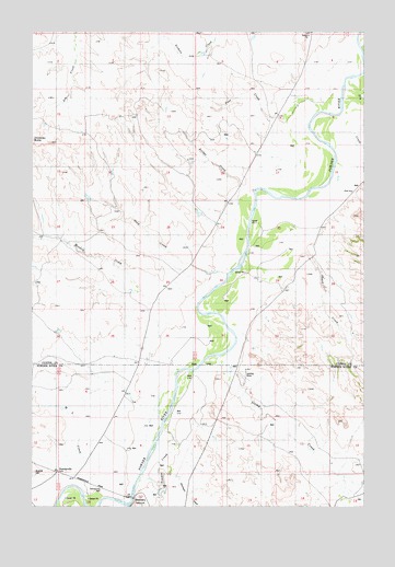
Powderville, MT USGS Topographic Map
Click on map above to begin viewing in our Map Viewer.

This topographic map contains these locations and features:
Feature Name Type Latitude Longitude GNIS ID View Map
01N53E01ADDA01 WellWellN45.8686°W105.0647°812905View Map
01N53E24DDBD01 WellWellN45.8175°W105.0680°812389View Map
01N53E35DCBC01 WellWellN45.7897°W105.0947°812055View Map
01N54E09BBDA01 WellWellN45.8603°W105.0177°812823View Map
01N54E18DDAC01 WellWellN45.8336°W105.0458°812578View Map
01N54E18DDBA01 WellWellN45.8344°W105.0458°812585View Map
01S54E04BADD01 WellWellN45.7842°W105.0653°811992View Map
01S54E17ACD_01 WellWellN45.7528°W105.0628°811666View Map
01S54E17BDC_01 WellWellN45.7522°W105.0883°811662View Map
01S54E18ABD_01 WellWellN45.7564°W105.1016°811707View Map
03S54E04DCDA01 WellWellN45.7700°W105.0422°811838View Map
03S54E10DDBD01 WellWellN45.7569°W105.0253°811726View Map
Boothill CemeteryCemeteryN45.7593°W105.1243°769104View Map
Bridge CreekStreamN45.8294°W105.0478°769219View Map
Deep CreekStreamN45.8111°W105.0519°770547View Map
Dry CreekStreamN45.8628°W105.0050°770788View Map
Flintheart DrawValleyN45.7581°W105.0705°771471View Map
Hunt School (historical)SchoolN45.8331°W105.0047°772626View Map
Meadow CreekStreamN45.7989°W105.0730°774058View Map
Peas CreekStreamN45.8439°W105.0305°775131View Map
PowdervillePopulated PlaceN45.7589°W105.1153°775415View Map
Powderville Community HallLocaleN45.7544°W105.0994°775416View Map
Skunk CreekStreamN45.8181°W105.0239°776625View Map
Soldiers MountSummitN45.7506°W105.0858°776736View Map
Stump CreekStreamN45.7897°W105.0544°777275View Map
Timber CreekStreamN45.7706°W105.0761°777659View Map
W L CreekStreamN45.7608°W105.1058°778048View Map

Note: Coordinates in the location and feature list above are referenced to NAD83 datum.


Copyright (C) 2008-2024 Ryan Niemi / Sunset Dynamics ... All Rights Reserved